Heavy rain & strong to severe storms possible Thursday afternoon
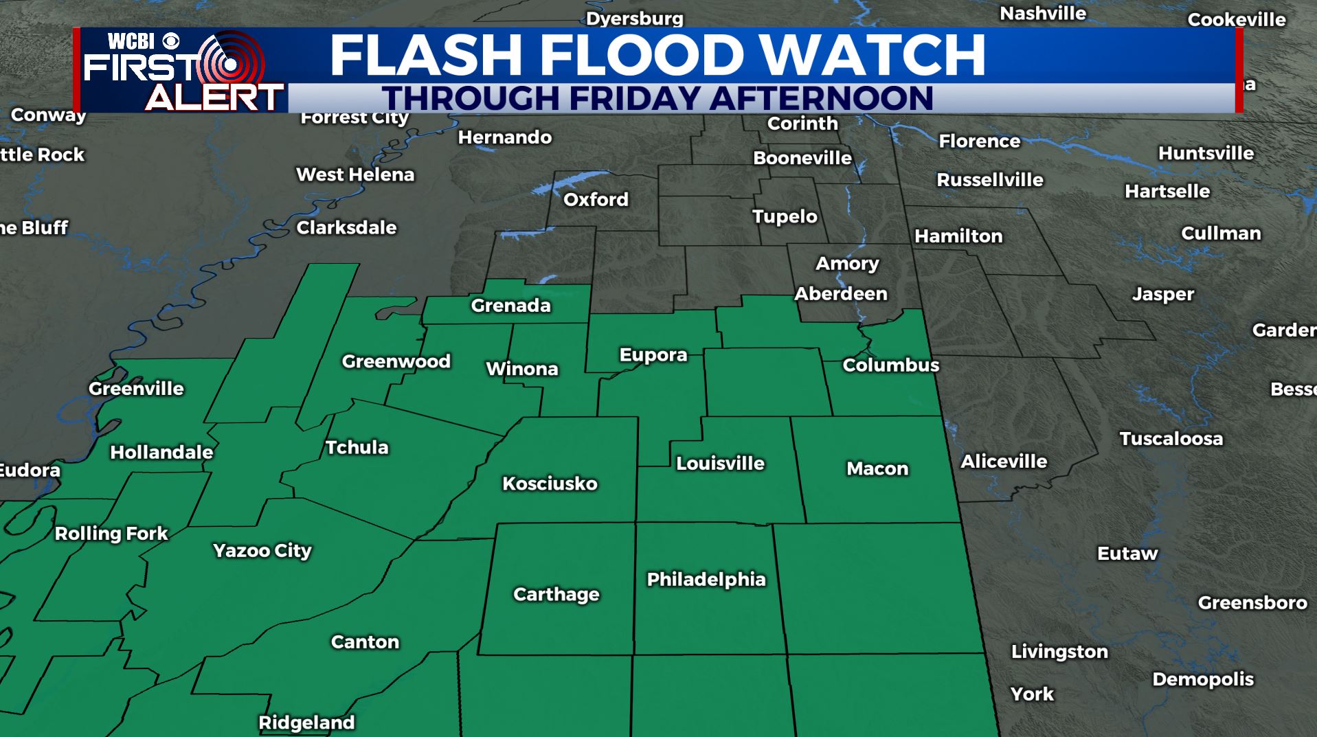
SUMMARY: A Flash Flood Watch is in effect Thursday through Friday afternoon. Widespread rain is moving in for our Thursday. Some rounds can still be heavy at times. Total rainfall amounts Thursday and Friday may range from 1-5″. Soil is pretty wet from recent rains and additional excessive rainfall will cause more flooding around the region. There is still also the chance of some strong storms from Columbus and south of US-82 Thursday afternoon and evening but it’s still very much in doubt how unstable air can get. Some gusty winds and an isolated tornado can’t be ruled out.
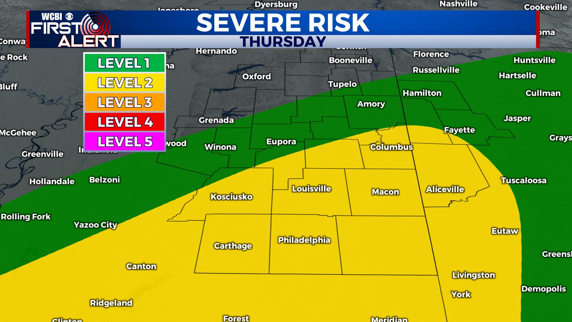
THURSDAY: Widespread rain and possible thunderstorms. Rain may become heavy at times and cause flooding concerns. Flash Flood Watch is in effect. Temperatures will range from the 50s in Tupelo to the 60s south of US-82. Will be a bit breezy as well with winds SE 10-20 mph, gusts up to near 25 at times. Some storms are POSSIBLE mainly Columbus and south during the afternoon and evening but it’s still iffy if our coverage area will get in on the action. Stay tuned for updates.
THURSDAY NIGHT: Cloudy skies with areas of showers. Overnight lows in the mid 50s.
FRIDAY: Cloudy skies with lingering showers. Mild with highs in the low 60s.
FRIDAY NIGHT: Mostly cloudy skies. Lows near 40.
THIS WEEKEND: Clouds will start to break up on Saturday and we should be mostly sunny for Sunday. Highs will be a few degrees below average Saturday in the upper 40s with a brisk NW wind before going back up into the mid to upper 50s on Sunday. Overnight lows chilly in the 30s.
MONDAY: A sunny start to the new work week as many of us return back to work & school from holiday break. Highs in the upper 50s.
TUESDAY: A mix of sun and clouds with possible rain chances. Still a few days out to look at this. Highs in the lower 50s. Overnight lows in the lower 30s.
WEDNESDAY: Mostly sunny skies. Highs in the mid 50s.
STAY WITH @WCBIWEATHER ON FACEBOOK, INSTAGRAM, TWITTER AND ON THE WCBI MOBILE APP.


Leave a Reply