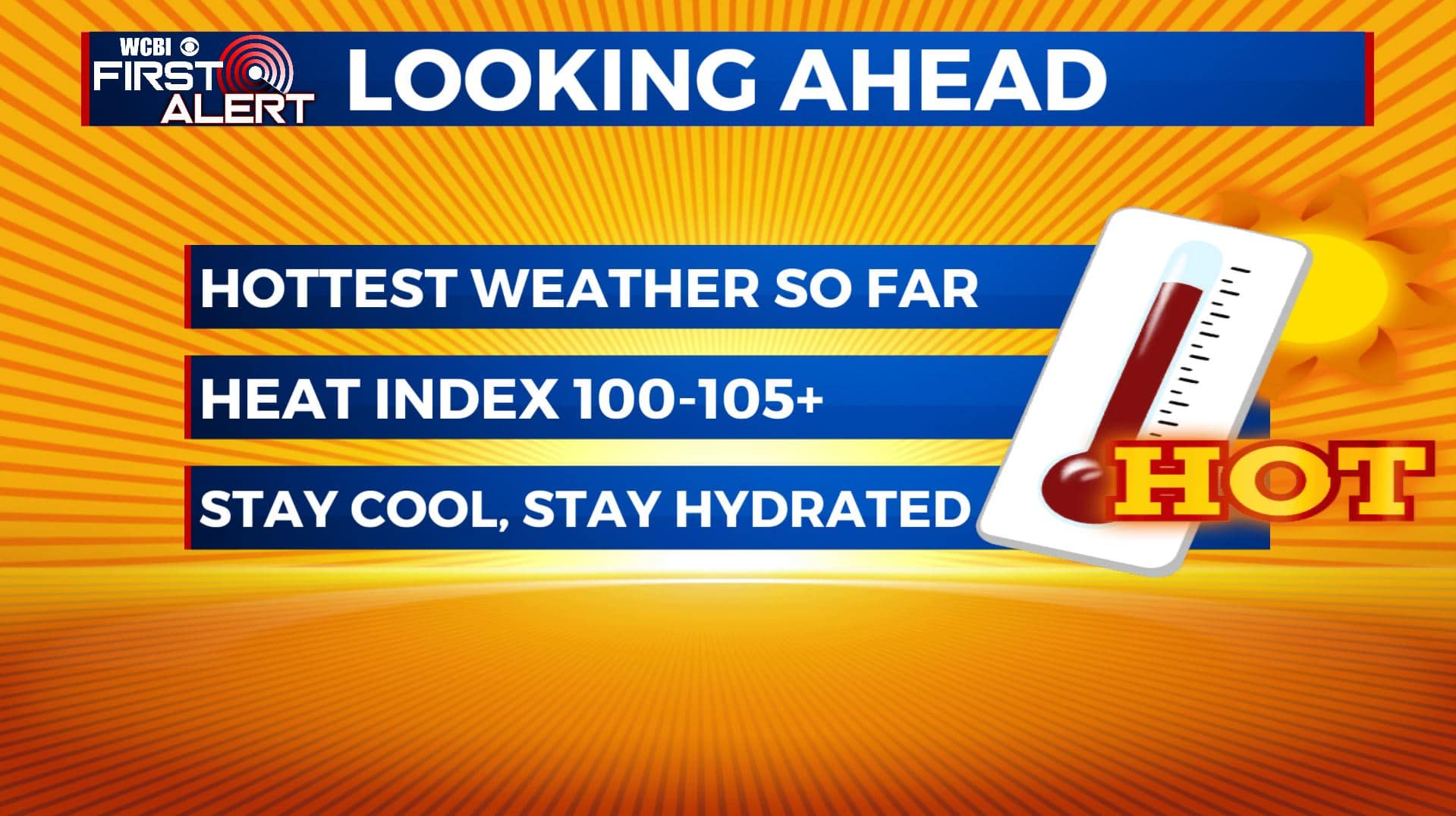
The hottest weather of 2020 so far moves in this weekend
SUMMARY: Our top weather story heading into the weekend and early next week will be the hottest weather we’ll be dealing so far in 2020. Hot, humid, and occasionally showers & storms chances will hang around through the weekend. Highs will be in the 90s but heat indices maybe at 100-105+ at times. Rain chances drop dramatically next week but the heat and humidity will only intensify as a big ridge of high pressure sets up over the Deep South. Plan on staying in air conditioning to help stay cool and drink lots of water to help stay hydrated as much as possible for the considerable future.
FRIDAY: Another very warm & humid day is expected for our Friday. Highs in the lower to mid 90s with triple digit heat indices. There is a chance of scattered showers and storms during the day. Just the beginning of a very hot summer weekend ahead.
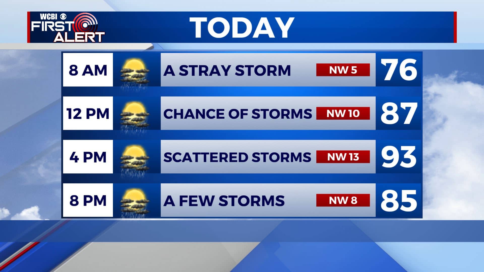
FRIDAY NIGHT: A few clouds and muggy overnight. Lows in the 70s. A stray shower or storm remains possible by early Saturday morning.
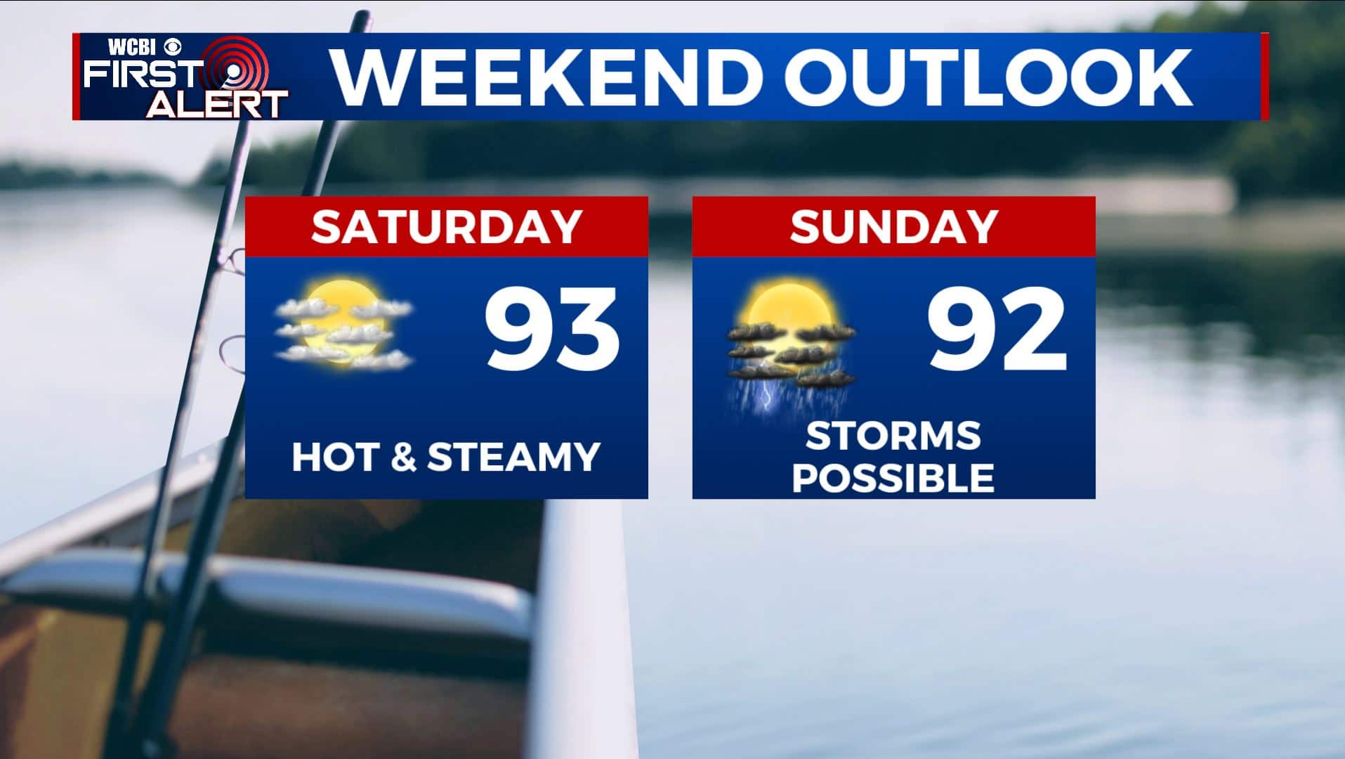
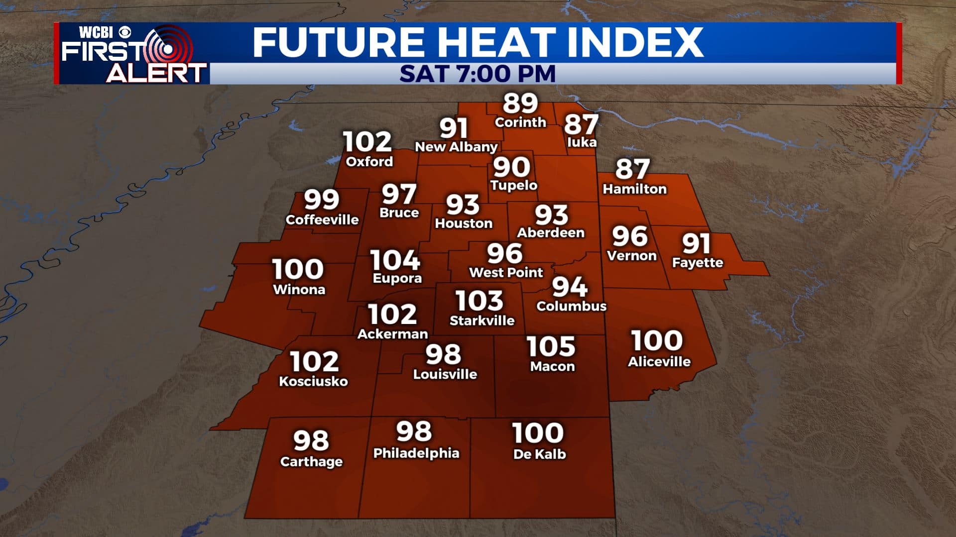
WEEKEND: Looking ahead to the weekend, we’ll see a mix of sun & clouds with on/off again chances of showers and storms both days as a cold front rolls down a few storm complexes from the Central Plains from time to time. Those could be wind and rain producers if they do pan out. Highs will be in the lower to mid 90s with maximum heat indices 100-105+ at times. Make sure you stay cool & hydrated!
NEXT WEEK: Staying mostly sunny, hot and humid. Rain chances drop to an isolated chance each day. Highs will stay in the lower to mid 90s everyday with heat indices well into the 100s. Overnight lows stay in the 70s.
Stay connected with @WCBIWEATHER on Facebook, Twitter, Instagram, and the WCBI News App


Leave a Reply