Rain chances scale back a bit into the holiday weekend
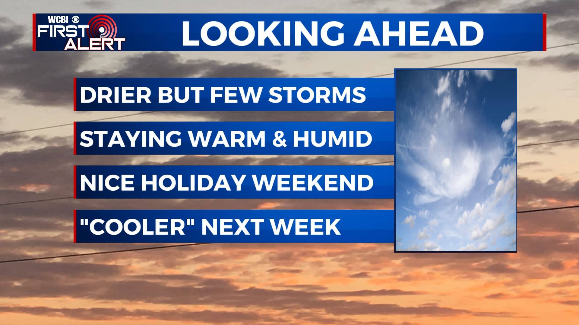
SUMMARY: The summer heat & humidity is set to continue during the first week of September. The highest odds of rain through Friday will stay to the northwest of us, but some showers and storm chances are still possible. Drier & less humid air will move in for the long Labor Day holiday weekend. Additional rain & storm chances are possible early next week.
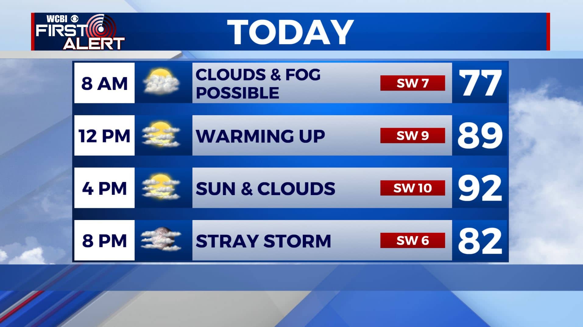
WEDNESDAY: Expect a mix of cloud & sun overall with high humidity levels for your Wednesday. Just a slight chance of a few showers or isolated storms. Highs in the lower to mid 90s with heat indices in the low 100s. Winds SW 5-10 mph.
WEDNESDAY NIGHT: A few clouds, but looking to be mostly clear and quiet overnight. While a storm is possible most of the activity should remain just to our northwest. Overnight lows in the 70s.
THURSDAY: A mix of sun & clouds, just a chance of some scattered showers & storms. Staying very warm and humid. Highs in the lower to mid 90s with heat indices around 100. Overnight lows stay in the 70s.
FRIDAY: Scattered storms are possible with a cold front moving through the region. Highs near 90 degrees.
SATURDAY-SUNDAY: More sunshine for the long holiday weekend. Maybe a few clouds with an isolated shower or two, but we’ll take it. Still warm but a little less humid. Highs in the upper 80s. Overnight lows dipping back into the mid to upper 60s.
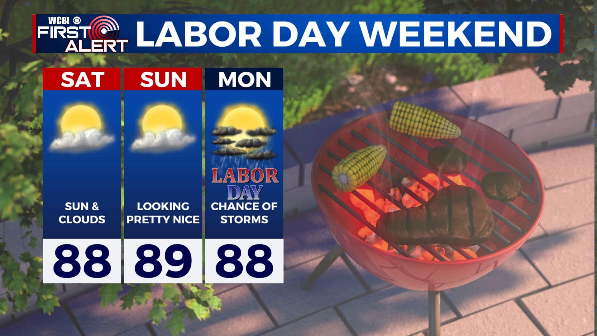
LABOR DAY: Partly sunny with scattered chances of showers and storms. High temperatures still in the 80s.
EARLY NEXT WEEK: A few more showers and storms likely. Highs in the mid to upper 80s with overnight lows in the the 60s.
Stay connected with @WCBIWEATHER on Facebook, Twitter, Instagram, and the WCBI News App


Leave a Reply