Zeta moves out; Cooler & nicer weather moving in
SUMMARY: Zeta is now a tropical storm with winds at 60 mph as of 8am this morning as it continues to push through Alabama and now moving into Georgia with gusty winds, heavy rain & the tropical tornado threat. As Zeta continues to move away from us, we are seeing the rain and winds decrease here. A cold front has also pushed through the region Thursday morning. Drier, sunny and cooler weather weather builds back in by Friday. It will continue through Halloween weekend and into early next week.
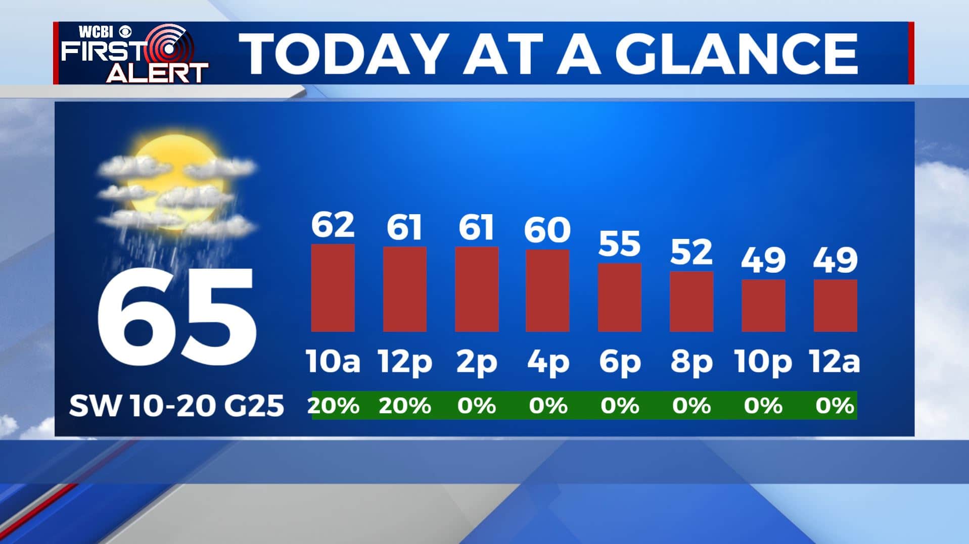
THURSDAY: Now with Zeta out of here, a cold front has moved through. Temperatures will be dropping from the 70s into the 60s then the 50s as the sunshine tries to return by early afternoon. Still breezy as those winds switch from the SW to NW at 10-25 mph.
THURSDAY NIGHT: Mostly cloudy skies. Cooler with overnight lows in the mid 40s.
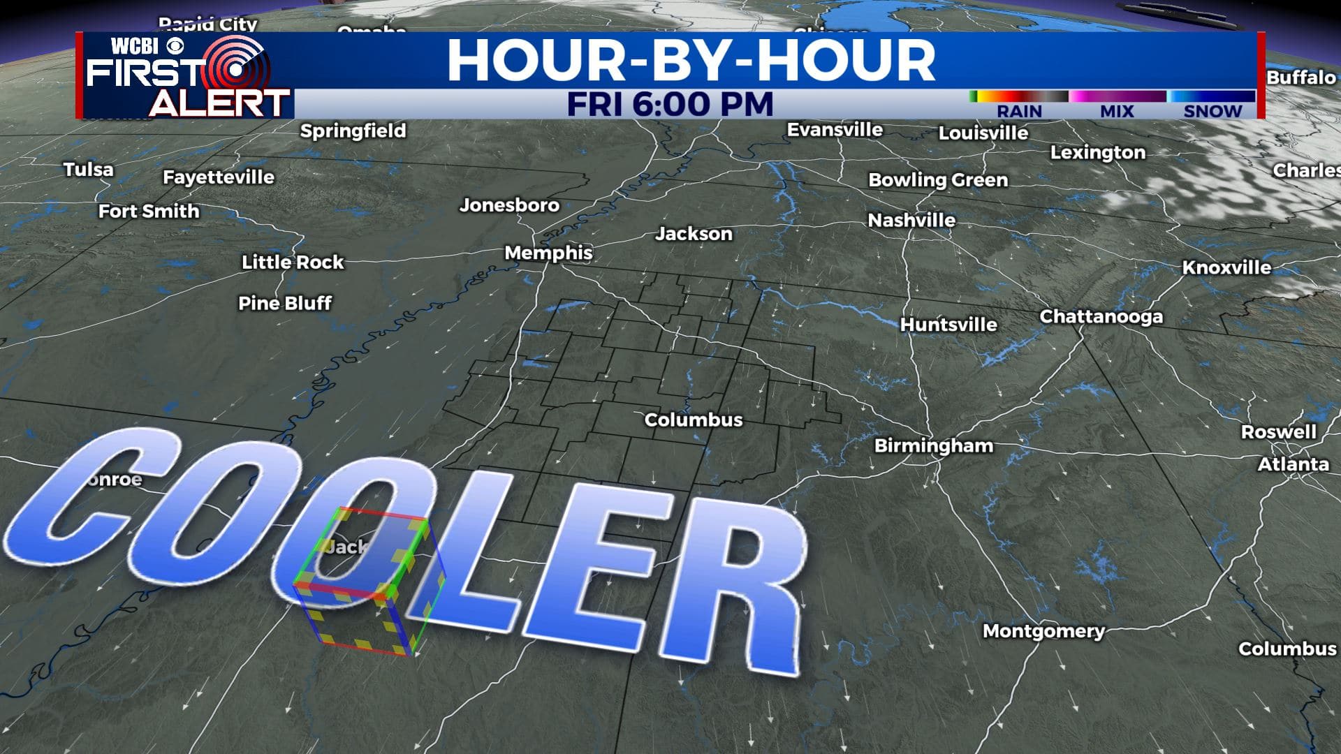
FRIDAY: Skies clear up and we’ll see lots of sunshine. Feeling cooler but more like fall with highs only in the lower 60s.
FRIDAY NIGHT: Clear skies, cool, and quiet. Overnight lows near 40.
HALLOWEEN: No tricks, just treats. It will be boo-tiful which is good news for any Halloween plans you may have. Mostly sunny skies with highs in the upper 60s, some spots could hit 70. Early evening temperatures around 60 can be expected for those little ghosts and goblins that may venture out. Overnight lows around 50 Saturday night. Reminder that we fall back one hour 2am Sunday.
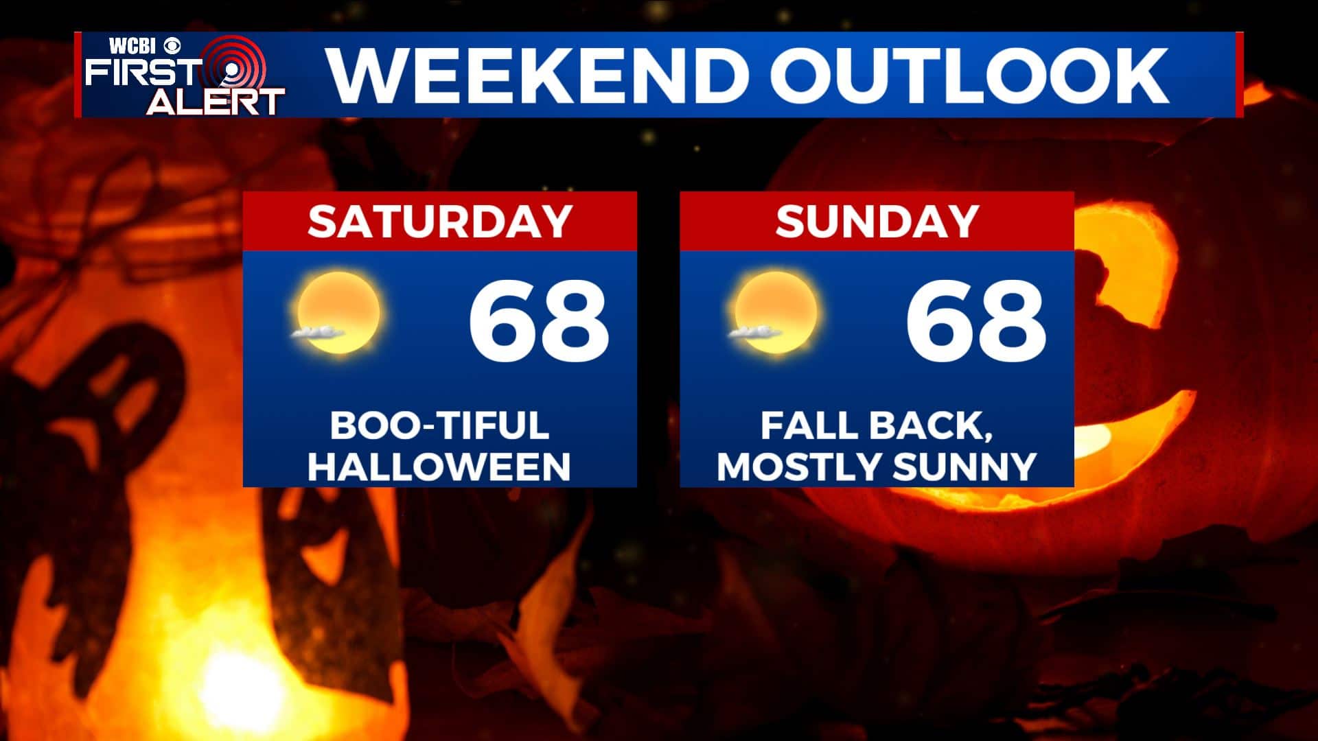

SUNDAY: Mostly sunny skies. Highs in the upper 60s. Another cold front is set to push through here Sunday evening, bringing us another shot of cooler fall-like air. Chilly overnight lows in the mid 30s Sunday night.
MONDAY: Sunny & cool. Highs in the mid to upper 50s. Overnight lows in the mid 30s again Monday night.
ELECTION DAY: Sunny skies as you head to the polls. Highs in the mid 60s.
Stay connected with @WCBIWEATHER on Facebook, Twitter, Instagram, and the WCBI News App


Leave a Reply