A Very Cold But Merry Christmas Eve & Christmas Day
SUMMARY: Our strong cold front has pushed through and now the arctic is moving in. Expect blustery, cold but sunny weather for our Christmas Eve and Christmas Day. Temperatures only into the 30s and 40s for highs while overnight lows will be in the 20s. Wind chill temperatures look to be the 20s and 10s into Christmas morning. Stay warm! Temperatures will moderate back up to the 50s this weekend.
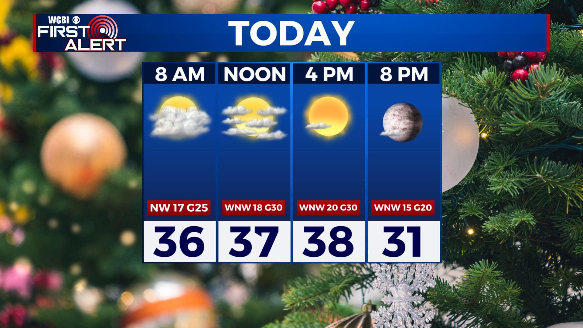
CHRISTMAS EVE: Cloudy skies in the morning will give way to more sunshine by the afternoon. It will be blustery and much colder as temperatures will be struggling to get up into the upper 30s. Winds WNW 10-25 mph, gusts 30-35. Wind chill values into the 30s and 20s.
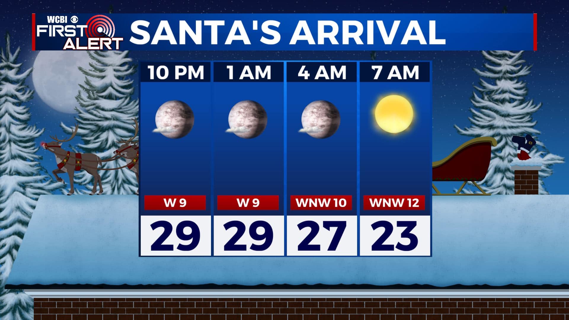
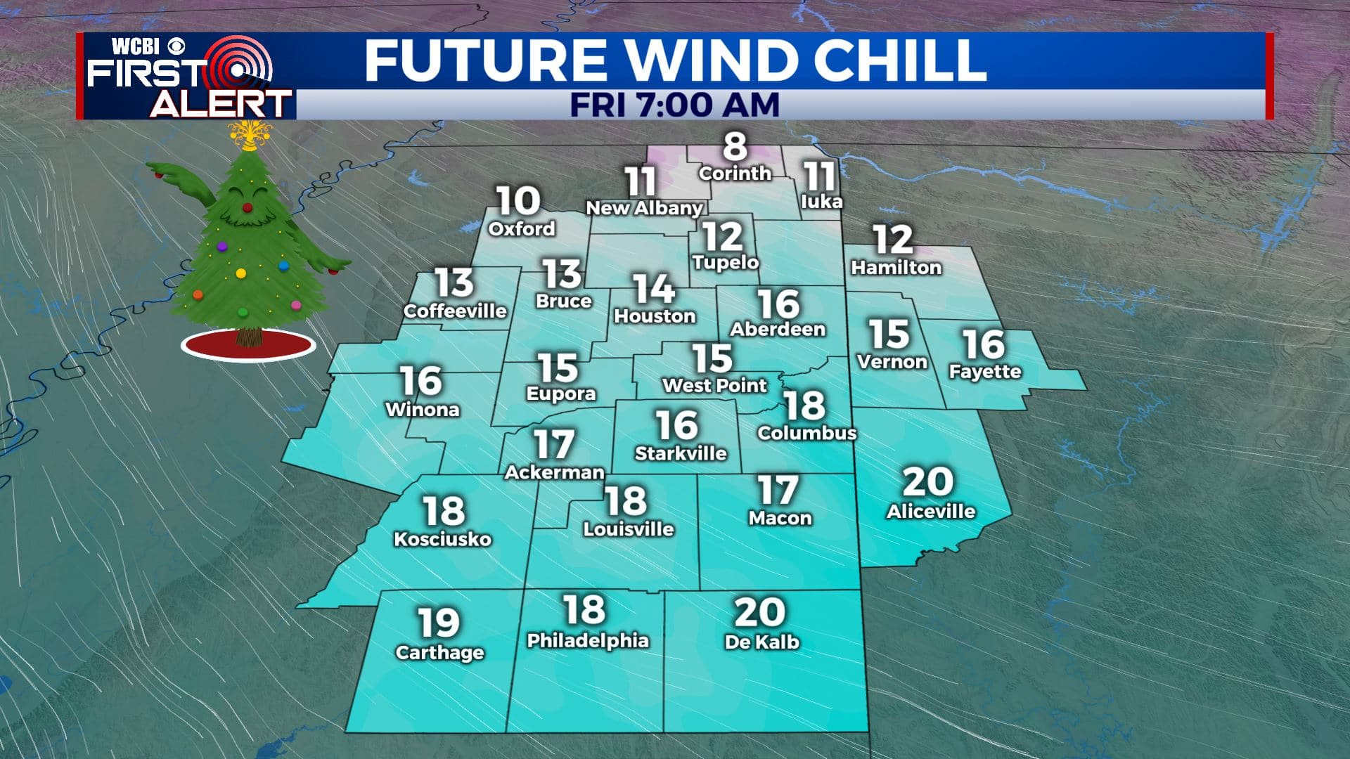
THURSDAY NIGHT: Santa should have now weather issues as he makes his way into our region Christmas Eve night. We’re expecting mostly clear skies, but it will be a cold one. Overnight lows near 20 with colder wind chill values in the 10s to single digits by Christmas Day morning.
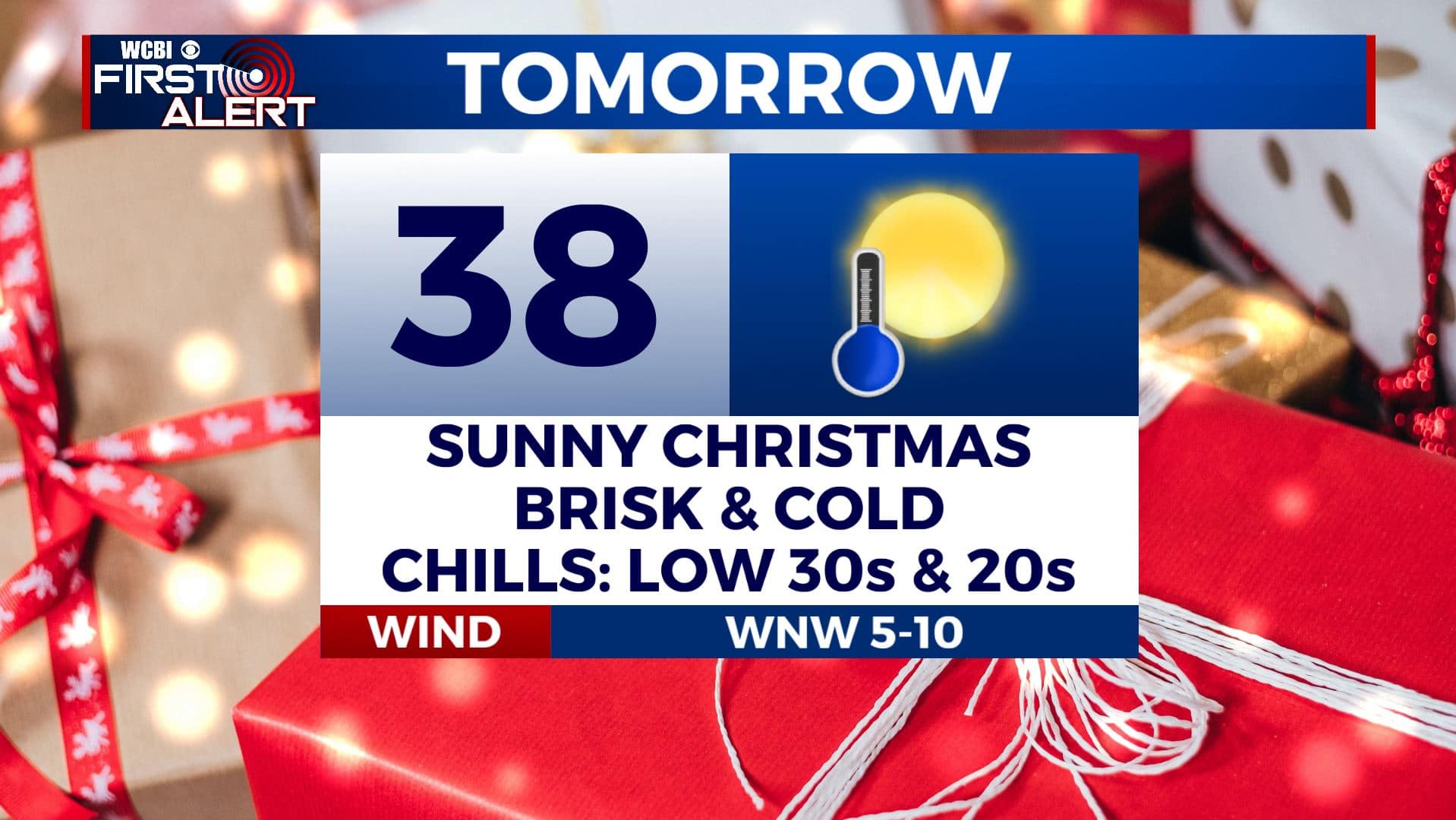
CHRISTMAS DAY: Merry Christmas! Lots of sunshine and cold. High temperatures in the upper 30s to 40 degrees. Wind chills in the 30s & 20s.
FRIDAY NIGHT: Clear skies and cold. Overnight lows in the low 20s.
SATURDAY: Sunny skies continue. Temperatures begin to rebound back up to the lower 50s.
SATURDAY NIGHT: Mostly clear. Lows near 30.
SUNDAY: Increasing clouds with another chance of evening rain showers. Highs in the mid 50s.
MONDAY: A mix of sun & clouds after some morning showers. Cool with highs in the upper 40s to lower 50s.
MIDWEEK: Mostly cloudy skies on Tuesday before another storm system moves through here on Wednesday bringing us another chance of rain. Highs in the upper 50s to lower 60s.
Stay connected with @WCBIWEATHER on Facebook, Twitter, Instagram, and the WCBI News App


Leave a Reply