Showers Today, Storms Late Tonight and Tomorrow.
Storm Threats
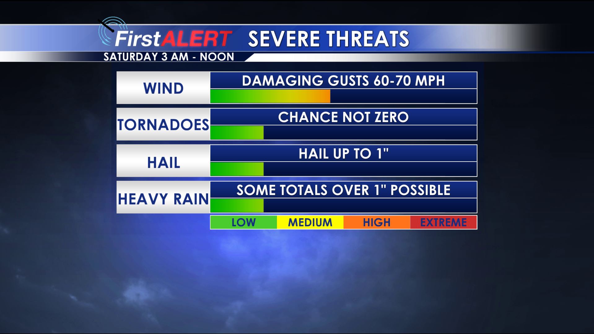
TODAY/SATURDAY: Showers off and on through the day, with high temperatures reaching the upper 60s. There will likely be a brief lull in the rain this evening, with more showers and storms developing late overnight into Saturday morning. While there are some significant limiting factors, some of these storms could become strong to briefly severe from around 2 AM to around Noon Saturday. The main threat these storms would pose would be damaging straight line winds, although hail up to the size of quarters and even an isolated tornado cannot be ruled out. After storms exit our area, we may see some peeks of sun in the afternoon Saturday. High temperatures climb into the low to mid 70s. Continued clearing overnight Saturday with lows in the upper 40s and low 50s.
SUN/MON: A mix of clouds and sun to kick off next week, with no mention-able rain chances. Highs around 70° Sunday, with an overnight low in the upper 40s. Appreciably cooler Monday with highs in the low 60s, and an overnight low in the upper 30s.
TUE/WED/THU: The middle of the work-week next week looks quite cool, with high temperatures struggling to escape the 40s despite ample sunshine. Overnight lows Tuesday and Wednesday night will drop well below freezing, so a widespread frost certainly seems like a strong possibility.


Leave a Reply