Wet Wednesday
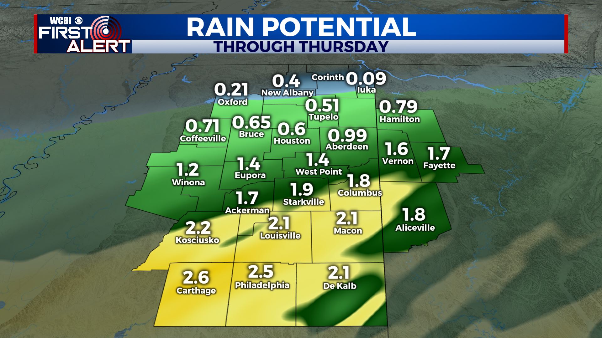
SUMMARY: More rain will move through the region Wednesday and Thursday. Anywhere from 1/4″ to over 2″ of additional rain will fall. The heavier amounts could lead to more flooding. Some thunder is also possible but odds of severe weather north of I-20 are pretty slim. Bright sunshine returns Friday and it’ll stick around through the weekend.
TUESDAY NIGHT: Cloudy with areas of rain developing. Some thunder can’t be ruled out late. Look for lows in the 50s.
WEDNESDAY: Areas of rain. Perhaps some thunder as well. Highs in the upper 50s.
WEDNESDAY NIGHT: Additional rain is likely. Lows in the upper 40s.
THURSDAY: Morning clouds and rain with some clearing during the afternoon. Highs may top out in the low 60s if we skies clear out.
THURSDAY NIGHT: Clear and much cooler. Lows around 40.
FRIDAY: Sunny. Highs near 60. Lows in the low 30s Friday night under clear skies.
SATURDAY: Sunny. Highs in the low 60s. Staying clear Saturday night with lows in the mid 30s.
SUNDAY: Mostly sunny. Highs in the mid 60s.
MONDAY & TUESDAY: Areas of rain and thunder return to the region. Temperatures moderate back to around 70 by Tuesday.
Follow @WCBIWEATHER on Facebook, Twitter, Instagram and the WCBI News app


Leave a Reply