Dry thru Sunday
SUMMARY: Bright sunshine and no rain will be the themes heading into the weekend. Aside from a possible frost Saturday morning things look pretty good for the next few days. Rain and thunder chances return next week but temperatures will be moderating back into the 70s by Tuesday.
THURSDAY NIGHT: Clear and cooler. Lows around 40. Winds NW 5-10 mph.
FRIDAY: Bright sunshine. Highs in the upper 50s. Breezy NW winds 10-20 mph with gusts to 25 mph.
FRIDAY NIGHT: Clear, quiet, and cold. Lows around 30. Cover up any tender foliage that may have already emerged.
SATURDAY: Mostly sunny. Highs around 60.
SATURDAY NIGHT: Mostly clear to party cloudy. Lows in the mid 30s.
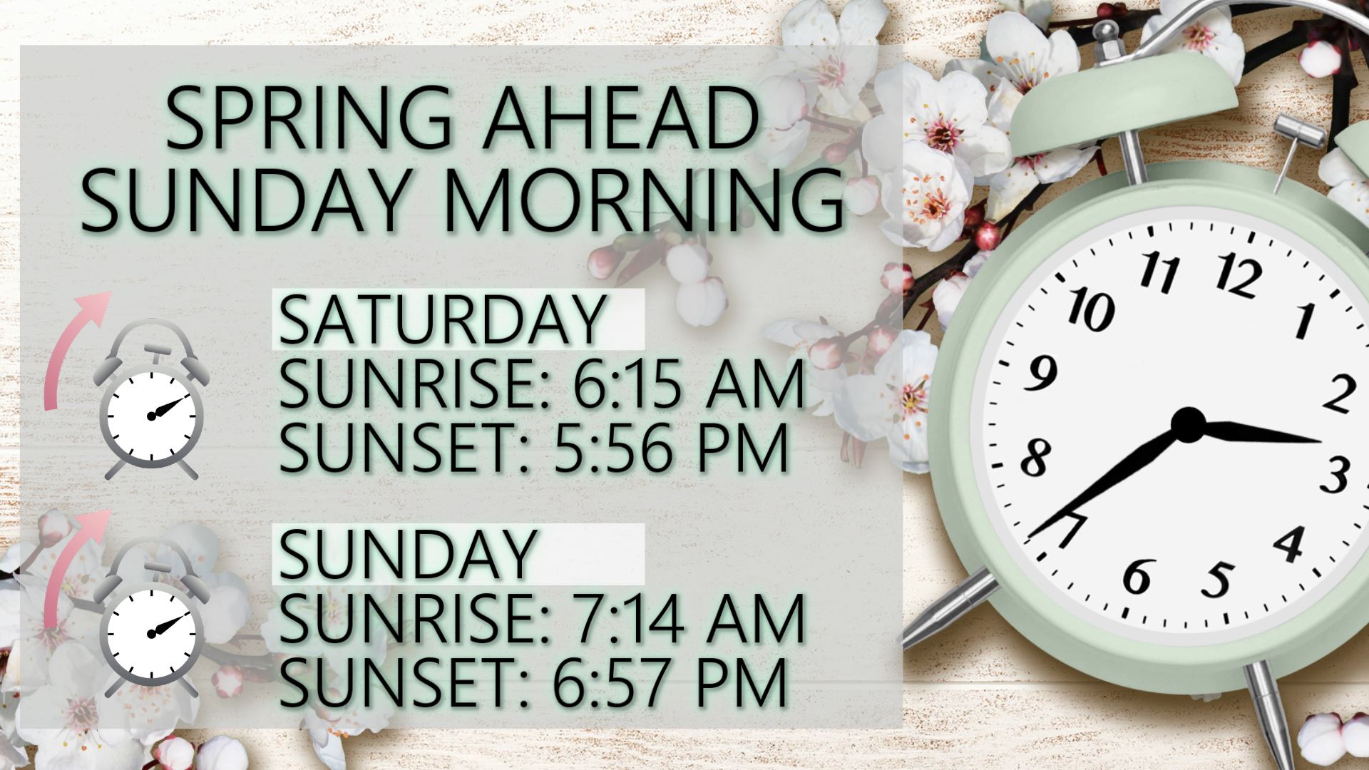
SUNDAY: Partly cloudy. Highs in the mid 60s. Don’t forget to set your clocks ahead 1 hour due to the start of daylight saving time.
NEXT WEEK: Rain and storm chances look to return Monday continuing through at least Thursday. We’ll start off the week in the 60s but highs in the 70s are more likely starting Tuesday.
Stay connected with @WCBIWEATHER on Facebook, Twitter, Instagram, and the WCBI News App


Leave a Reply