Rain chances make a comeback this work week
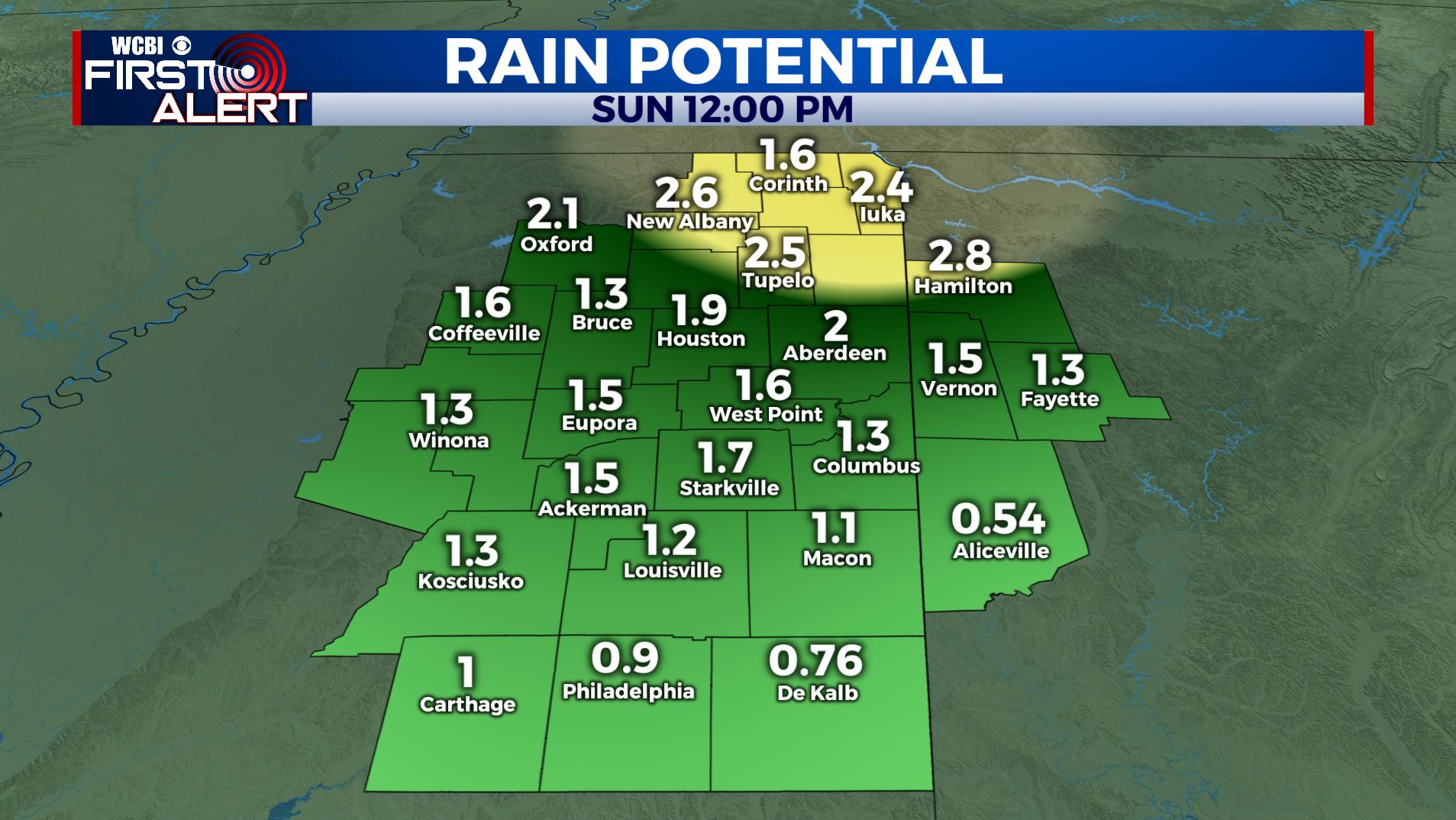
SUMMARY: After a beautiful weekend, an unsettled weather pattern is moving back in for the new work week and it’s looking to stick around for a while with a stalled front and a few weak disturbances moving through. We’ll continue to watch for any strong storm possibilities but it’s just a bit too early tell if any will occur in our area. As of right now, 1-3 inches of rain is expected over the next seven days.
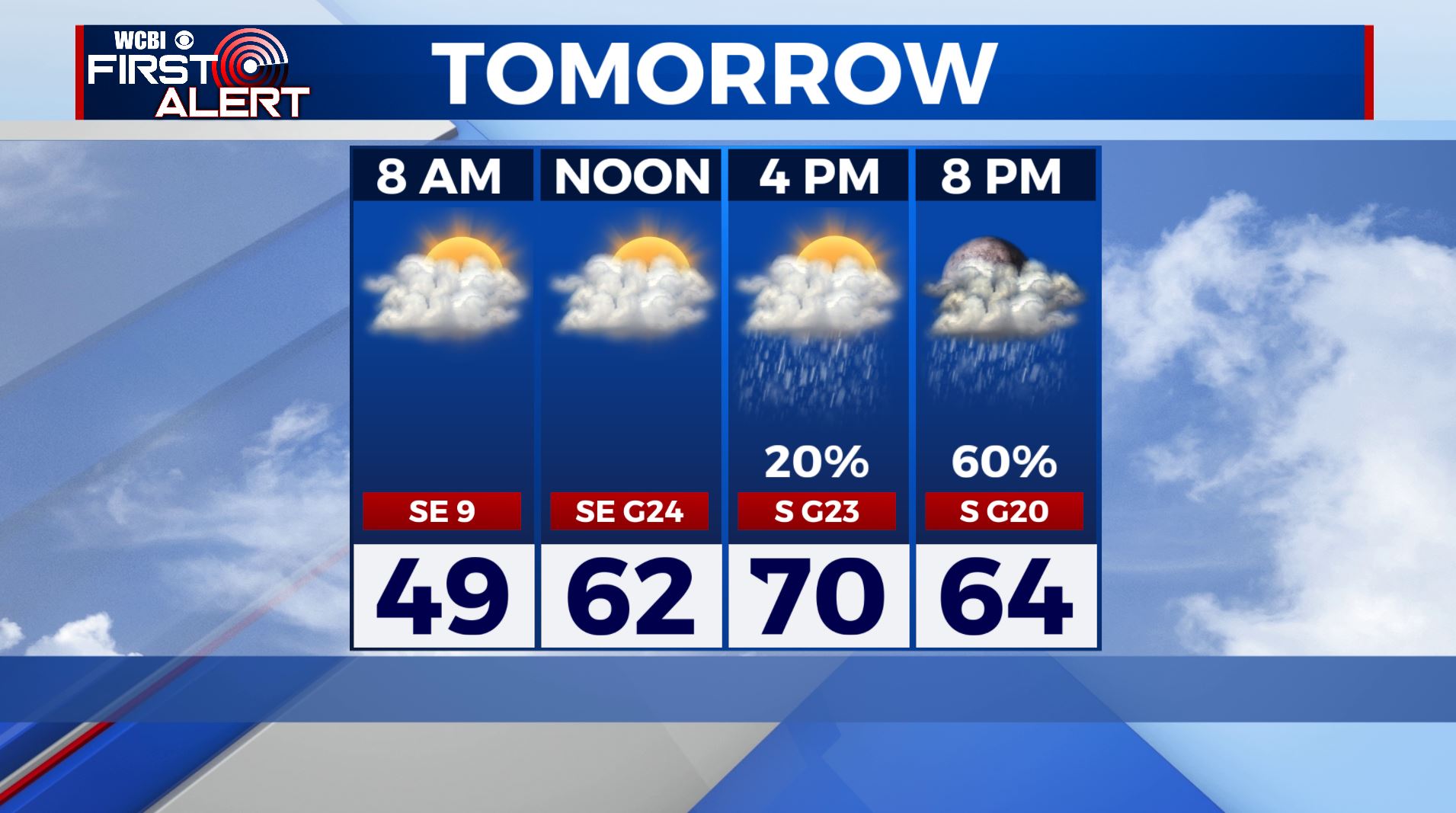
MONDAY: Mostly cloudy and breezy for most of the day. Areas of showers will be possible during the late afternoon and evening. Highs in the upper 60s to around 70. SE to south winds 10-20 mph with gusts perhaps over 25 mph.
MONDAY NIGHT: Areas of rain, maybe a storm. Lows in the upper 50s.
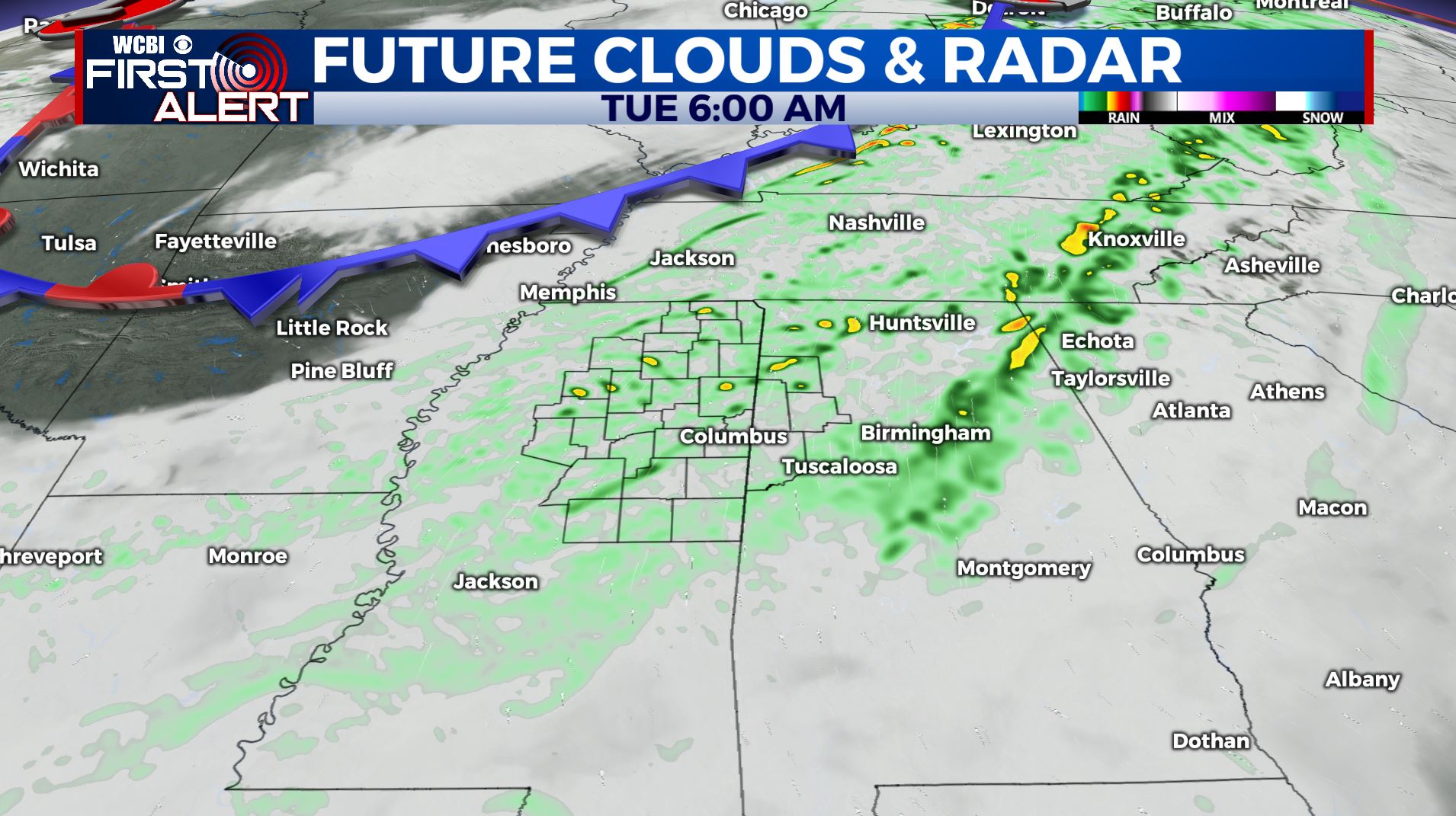
TUESDAY: Some widespread showers throughout the day with cloudy overcast skies. An isolated storm is also possible. Highs in the lower 70s.
WEDNESDAY: Warmer with highs in the mid 70s. Afternoon and evening showers and storms are possible.
THURSDAY: Scattered showers & clouds. Highs in the lower to mid 70s.
FRIDAY: Mostly cloudy with areas of rain. Highs in the upper 60s.
THE WEEKEND: Another round of showers and storms is possible. Temperatures in the upper 60s to lower 70s.
Stay connected with @WCBIWEATHER on Facebook, Twitter, Instagram, and on the WCBI News App


Leave a Reply