Mild & unsettled
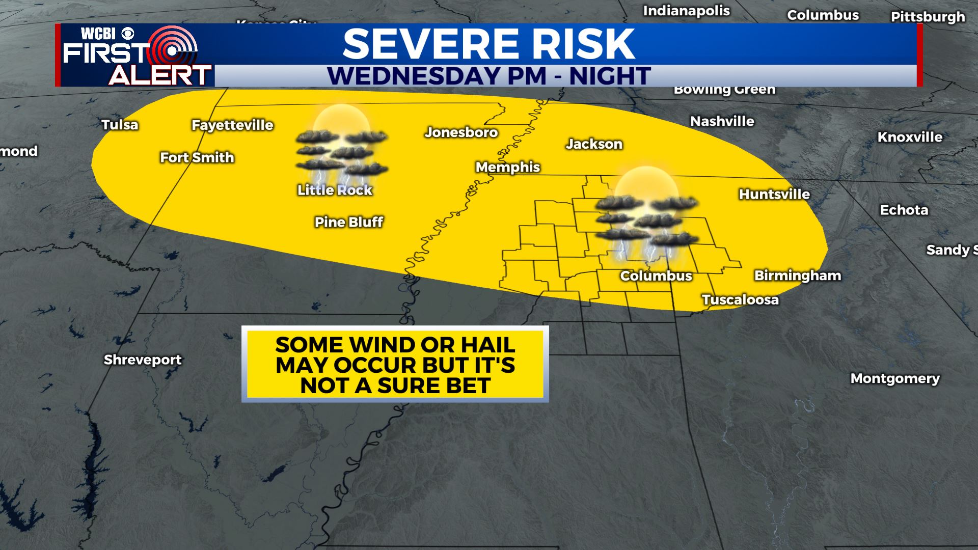
SUMMARY: A stalled front and a few weak disturbances moving through the region will keep things unsettled all week long. A few stronger storms are possible Wednesday afternoon and evening but things remain unclear if they’ll pan out or not. Rainfall projections over the next week suggest another 1-3” may fall across the area.
MONDAY NIGHT: Areas of rain or showers. Lows in the upper 50s to around 60. Winds SSW 10-15 mph.
TUESDAY: Sun & clouds with a 30% chance of showers, especially during the first half of the day. Highs in the lower 70s. Winds W 5-15 mph.
TUESDAY NIGHT: Mostly cloudy. Lows mainly in the 50s.
WEDNESDAY: Warmer highs in the mid 70s. Afternoon and evening showers and storms are possible. It’s still iffy whether any become strong but if they do some gusty wind and hail can’t be ruled out. The chance of rain is 50%.
THURSDAY: Sun & clouds with a 30% chance of showers and storms. Highs in the mid 70s.
FRIDAY: Mostly cloudy with a 50% chance of rain. Highs in the 60s.
SATURDAY: Variably cloudy with a 50% chance of rain and thunder. Highs in the mid 70s.
SUNDAY: A 30% chance of showers. Variably cloudy. Highs in the mid 60s.
MONDAY: A few more showers are possible. Highs in the upper 60s.
Follow @WCBIWEATHER on Facebook, Twitter, Instagram, and on the WCBI News App


Leave a Reply