A little bit of sunshine before more rain moves back in for Thursday
SUMMARY: Daily chances of showers and storms continue for at least the next week. Even though we’ll see a brief break from our unsettled weather pattern Thursday, storms & rain will move back in tonight. A bit cooler on Friday but warm, above average temperatures look to continue for the most part through next week.
THURSDAY: We’ll see a mix of sun & clouds for your Thursday with warm & breezy conditions. Look for highs well into the upper 70s. Some spots could get into the lower 80s. Winds SW 10-20 mph.
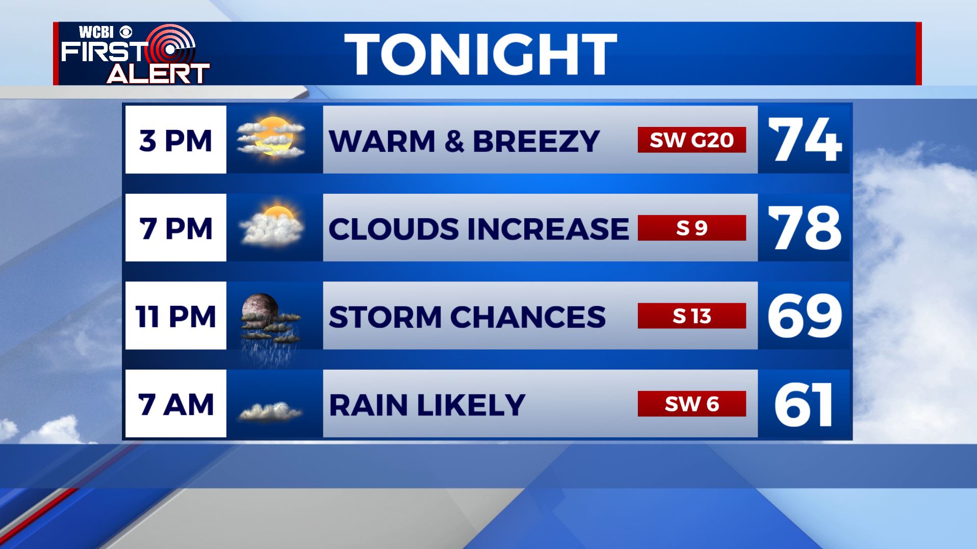
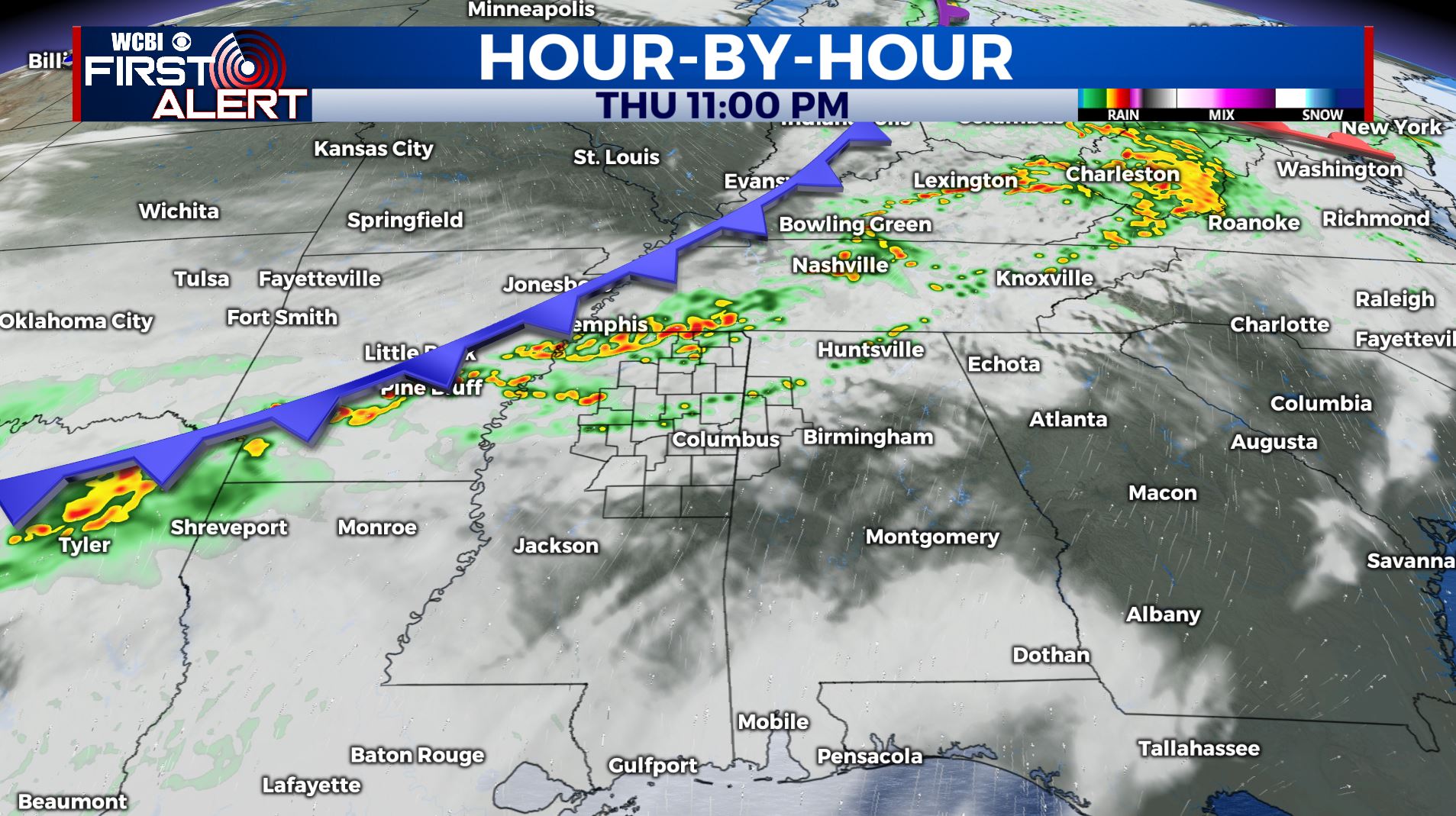
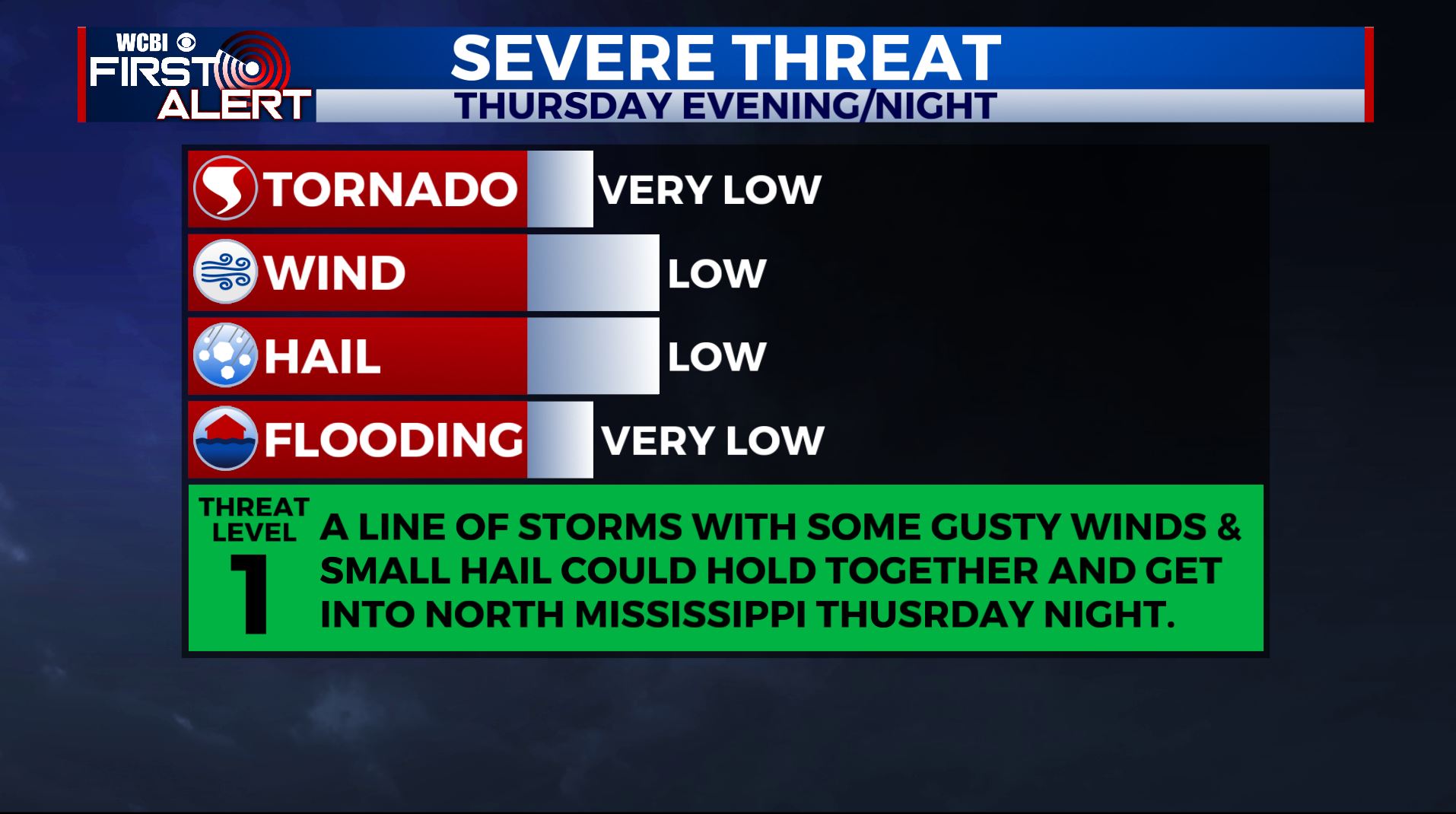
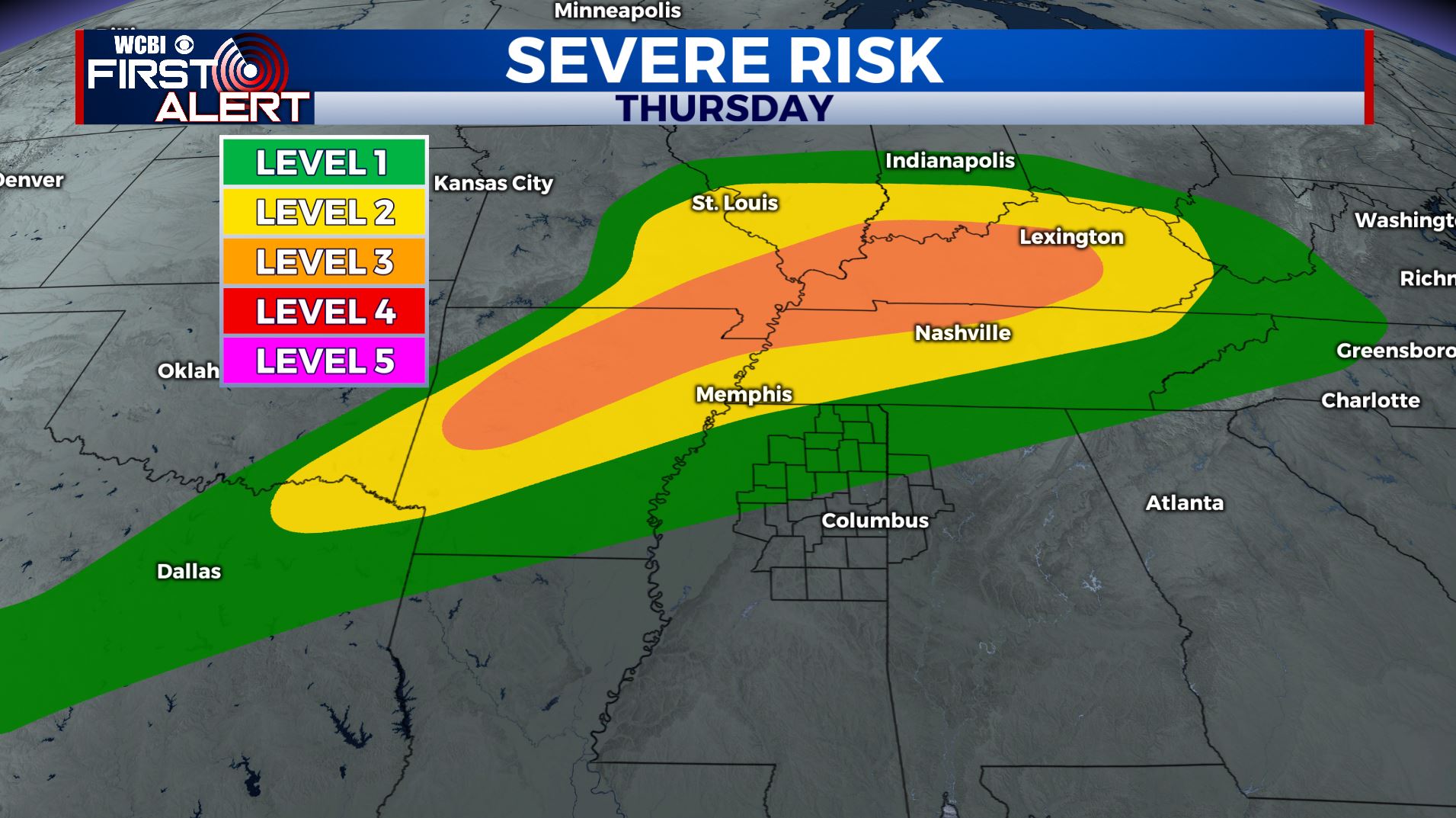
THURSDAY NIGHT: Mostly cloudy. More showers and thunderstorms move back in tonight into Friday as a cold front pushes through. Severe storms will occur to our north in the Tennessee Valley region. Wind and hail would be the primary threats if storms manage to stay strong as the enter north MS. Lows near 60.
FRIDAY: Mostly cloudy with areas of rain or showers. Cooler with highs in the mid 60s.
SATURDAY: Variably cloudy with a chance of a few storms. Highs back up into the mid 70s.
SUNDAY: Mostly cloudy with rain and showers likely. Highs in the upper 60s to lower 70s.
MONDAY: A few more showers are possible. Highs in the lower to middle 70s.
TUESDAY-WEDNESDAY: Daily opportunities for rain and storms continues. Highs in the mid to upper 70s. Lows around 60.
Stay connected with @WCBIWEATHER on Facebook, Twitter, Instagram, and the WCBI News App


Leave a Reply