Getting warmer, staying unsettled
SUMMARY: Unseasonably mild air settles in for the next 2 days with highs expected to surpass 80 degrees in many spots. Rain chances will remain low Wednesday & Thursday. We’ll have more rain and storms in the region on Friday as a cold front presses into north Mississippi and Alabama.
TUESDAY NIGHT: Variably cloudy evening with clouds filling back in a bit overnight. Lows in the upper 50s. Light and variable winds.
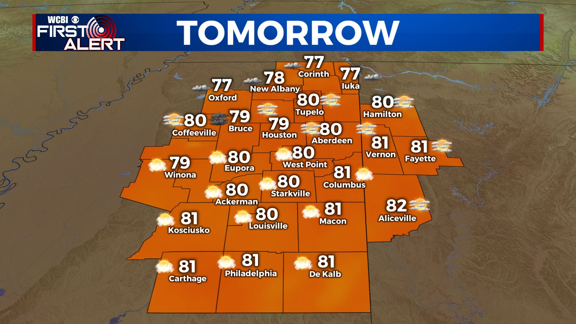
WEDNESDAY & THURSDAY: Partly to mostly cloudy and warmer. Highs ranging from the upper 70s to lower 80s. Overnight lows in the 60s. Rain chances are going to be reasonably low but we can’t rule out a few isolated showers and storms.
FRIDAY: Staying mild with highs in the lower 70s. A cold front moving through the region will produce a good chance for showers and storms. A few strong storms can’t be totally ruled out but it doesn’t appear to be a major severe weather producer at this point. We’ll keep watching.

WEEKEND: Some showers may linger Saturday with another batch possible on Sunday. It’s still unclear how wet the weekend may be but at first glance it doesn’t appear to be a washout. Cooler 60s and 50s return.
Follow @WCBIWEATHER on Facebook, Twitter, Instagram, and on the WCBI News App


Leave a Reply