Stormy Thursday, Warm Weekend Coming
Severe Threat Thursday
WEDNESDAY NIGHT: Increasing clouds but quiet during the evening. Some rain and storms are possible by sunrise. Lows will be in the upper 40s to around 50.
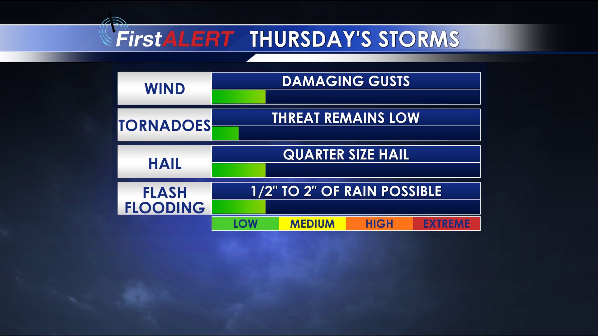
THURSDAY: We expect lots of cloud cover and numerous showers and storms during the day. The overall chance of rain is 70%. A few of the storms may be strong to severe with damaging wind gusts and hail up to 1″ in diameter; however, most locations will probably not experience any severe weather. Anywhere between 1/4″ and 2″ of rain may fall with the storms during the day. Highs top out mainly in the 60s.
THURSDAY NIGHT: Mostly cloudy and pretty quiet overall with just a few lingering showers possible. Lows fall into the upper 50s.
FRIDAY: There will be lots of clouds in the morning but we’re hopeful they’ll thin out as the day wears on. Highs should top out in the mid to upper 70s.
WEEKEND: Warm highs in the low 80s remain in the forecast for both Saturday and Sunday. Some showers and storms may develop Saturday afternoon and evening. Additional storms are possible Sunday. There is also the potential for some more strong to severe storms but it’s too early to tell exactly where and when they’ll form. It’s just something we’ll be watching.
EARLY NEXT WEEK: Showers and storms may continue into Monday but drier, more stable air is slated to return by Tuesday. Seasonable temperatures continue.
Follow @WCBIWEATHER on Facebook, Twitter, and Instagram


Leave a Reply