Rain and Storms Through Much of Today
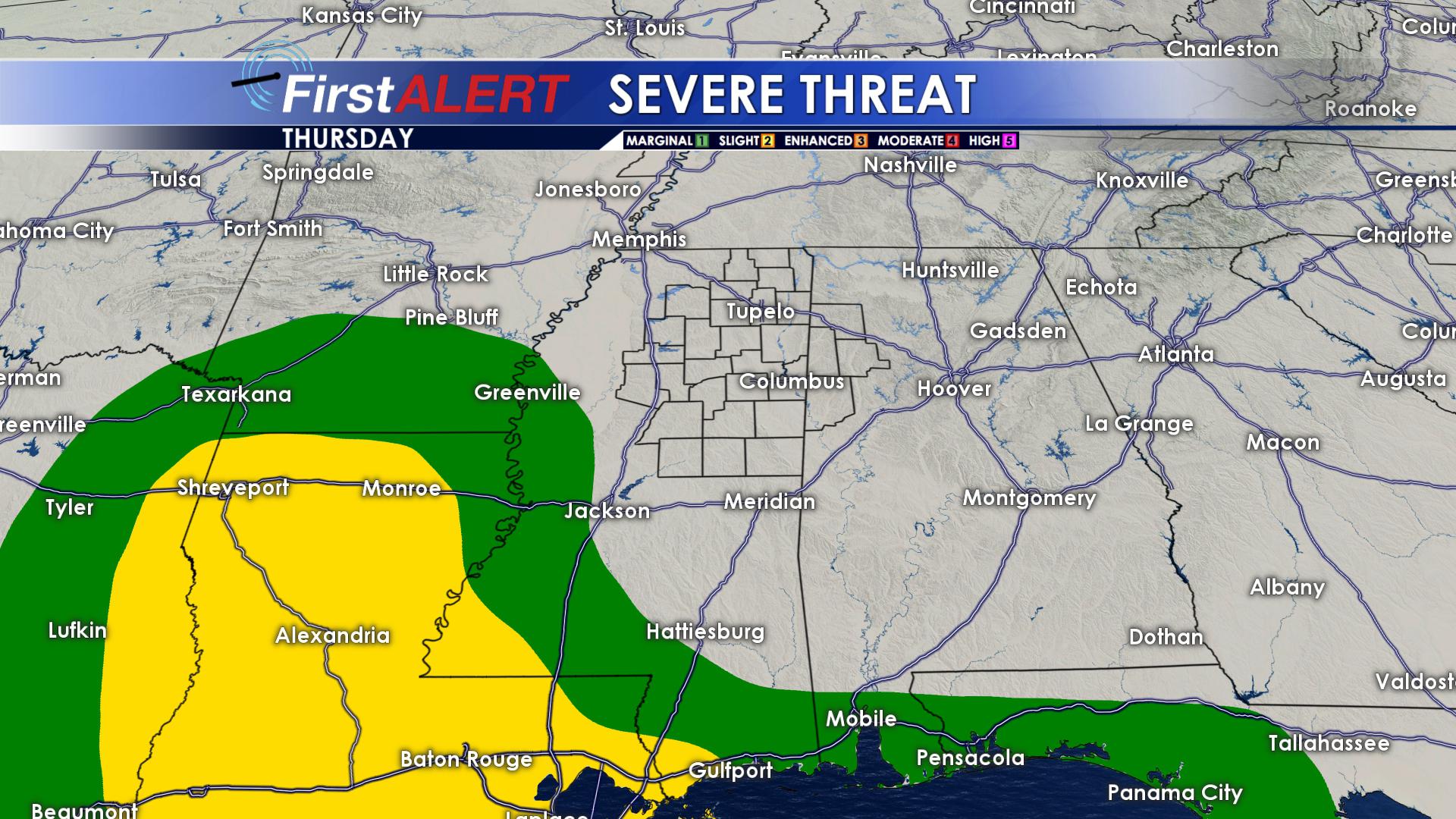
THURSDAY: We’re anticipating widespread rain and storms through the day. Rainfall amounts may approach 1″-2″ with locally higher amounts across the region. Some breezy gusts of wind and small hail are also possible, but the latest mid-morning update from the Storm Prediction Center pushes the severe threat to our south and west. Look for highs generally in the upper 60s with a few of us in the low 70s.
TIMING: Rain and storms approach by the mid-morning hours and fill in from west to east by the lunch hour. Through the afternoon, numerous to widespread storms continue area wide. By the evening hours, a line of storms should form and push through the area into the late evening hours. This line of storms may bring the better chance for a stronger storm, but the chance to see wind and hail remains very low the rest of the day.
SEE THE LATEST WEBCAST WITH FUTURECAST TIMING OUT THE STORMS HERE.
THURSDAY NIGHT: Mostly cloudy and pretty decent overall. We’ll have rain and storms ending early with dry conditions by morning Lows fall into the upper 50s and low 60s.
FRIDAY: There will be lots of clouds in the morning but we’re expecting them to thin out as the day wears on. Highs climb into in the mid to upper 70s.
THIS WEEKEND: Warm highs in the low 80s remain in the forecast for both Saturday and Sunday. Some showers and storms may develop Saturday afternoon and evening. Additional storms are possible Sunday. There is also the potential for some more strong to severe storms but it’s too early to tell exactly where and when they’ll form. It’s just something we’ll be watching.
EARLY NEXT WEEK: Showers and storms may continue into Monday but drier, more stable air is slated to return by Tuesday. Temperatures continue in the upper 70s and even a few low 80s.
Follow @WCBIWEATHER on Facebook, Twitter, and Instagram


Leave a Reply