Another day of showers & storms for your Tuesday
SUMMARY: Scattered to widespread chances of showers and thunderstorms will stick around the rest of the workweek as a stationary front stays put across the Deep South. Some of you may get a daily soaking while others may miss out. We look to dry out a bit as we head into the weekend. We’re staying below average in the 80s the rest of the week, but the humidity and the 90s will be making a comeback.
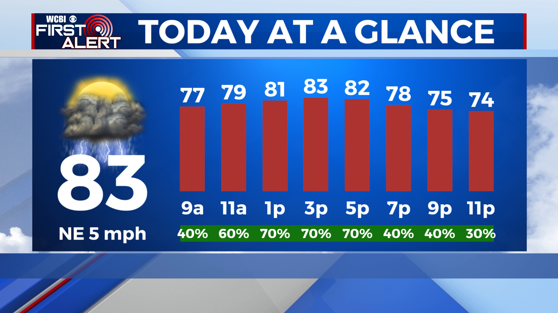
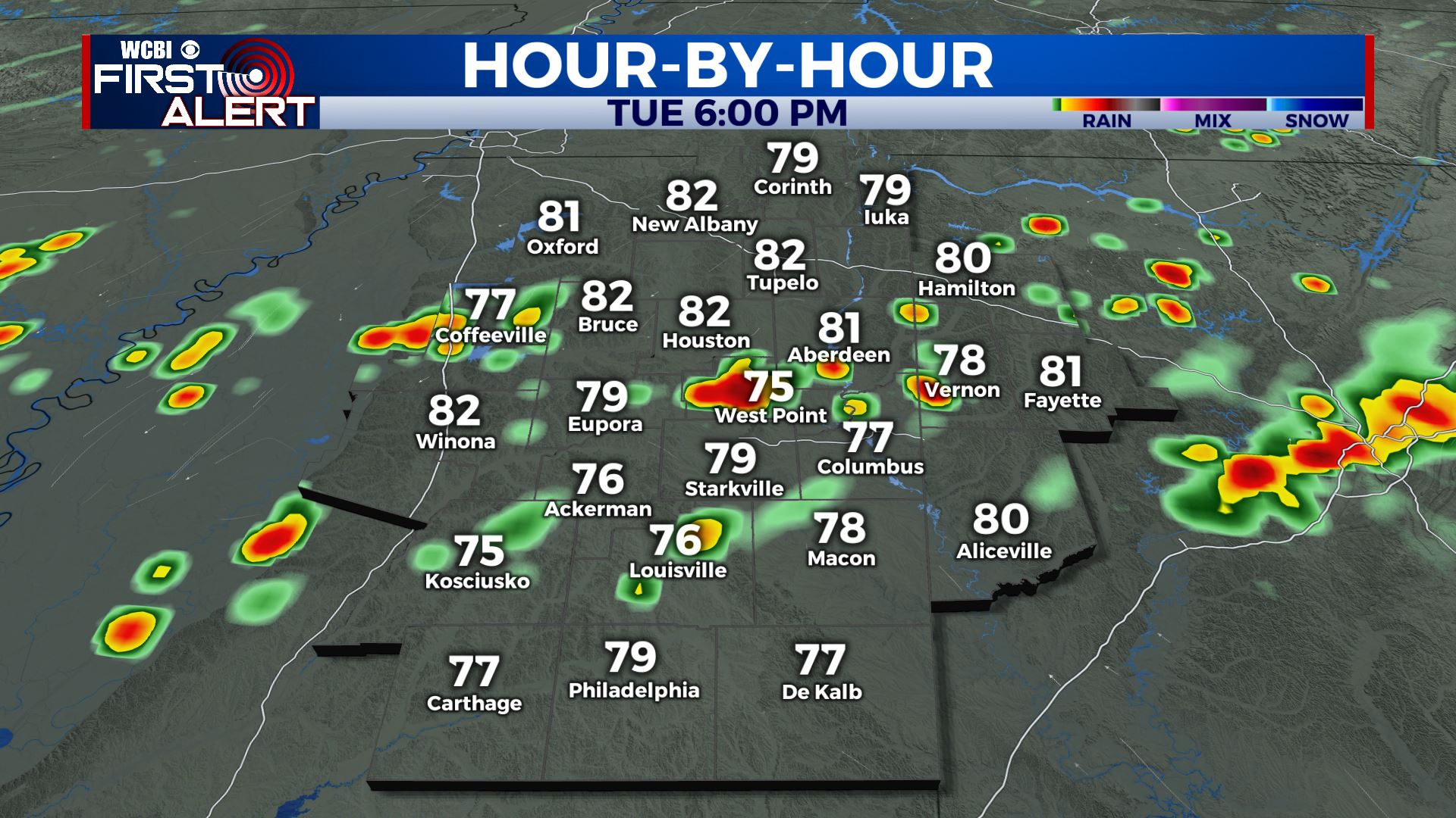
TUESDAY: We’re pretty much hitting the repeat button for our Tuesday. Cloudy skies with a chance of scattered rain and storms. Locally heavy rainfall may occur at times. Highs once again below average in the lower 80s. Winds NE 5-10 mph.
TUESDAY NIGHT: Mostly cloudy. A few showers are possible. Lows around 70.
WEDNESDAY: Scattered showers and thunderstorms chances will continue through midweek. Temperatures in the mid to upper 80s. Overnight will be fairly humid thanks to the clouds that will stick around. Lows in the 70s.
THURSDAY-SUNDAY: We’ll dry out a bit with more sunshine with a few clouds heading into the weekend but afternoon rain & storm chances will be possible every day. Highs in the upper 80s to close out the workweek with the lower 90s returning Saturday and Sunday.
MONDAY: A few isolated showers or storms remain possible. Temperatures back up to near average with highs in the lower to mid 90s.
Stay connected with @WCBIWEATHER on Facebook, Twitter, Instagram and the WCBI News App


Leave a Reply