Stormy Friday Then Warmer Next Week
SUMMARY: Showers and thunderstorms are possible the rest of the evening, with localized flooding in the strongest storms. Rain chances will decrease as we reach the weekend, but temperatures will be on the increase to start the work week.
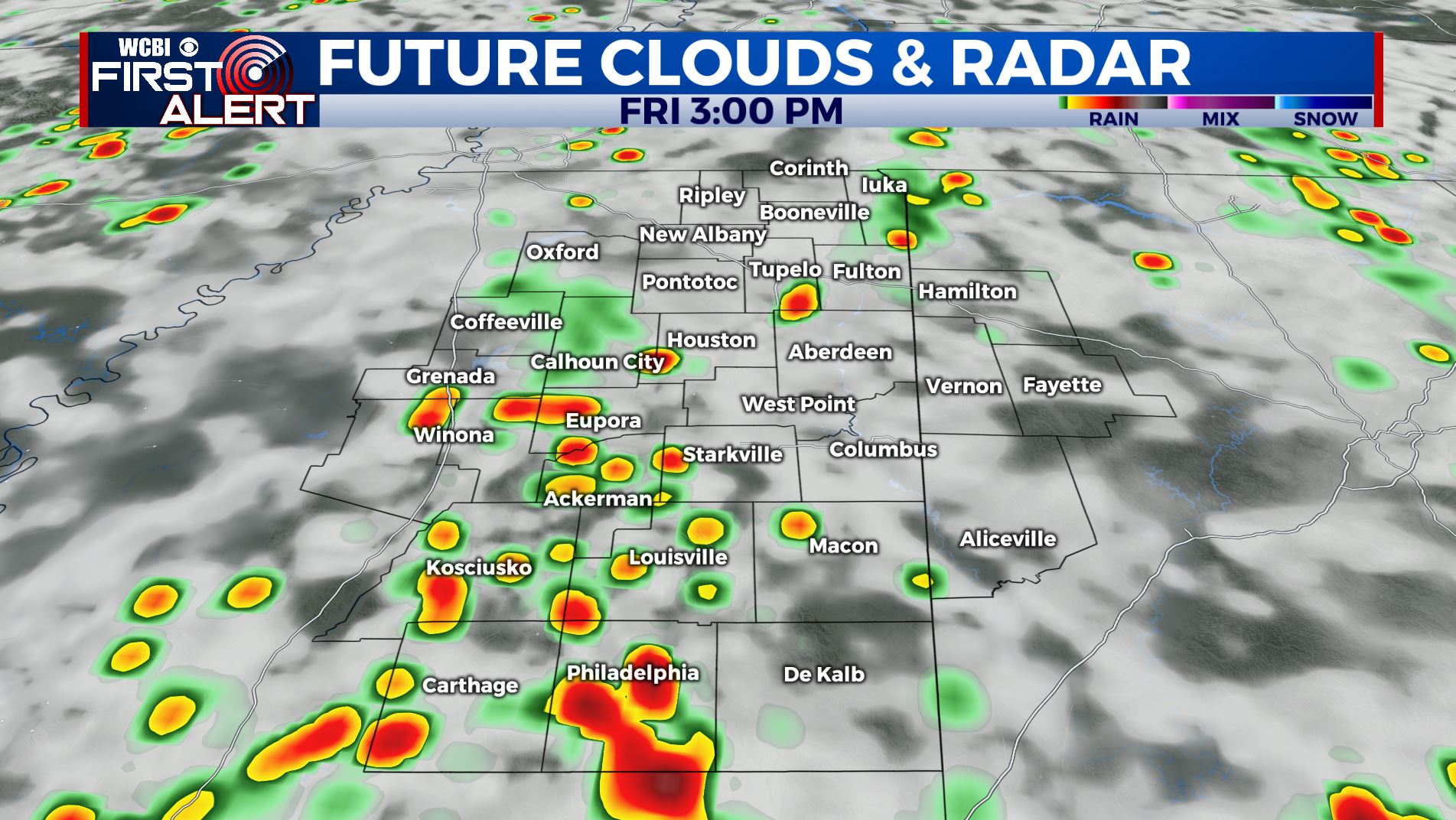
FRIDAY: Isolated showers and thunderstorms will become more numerous through the afternoon. Rain may be heavy at times with localized flooding possible. Highs will range from the middle-80s to to low-90s.
FRIDAY NIGHT: Showers and thunderstorms will end by the late evening with a mostly cloudy sky overnight. Overnight lows in the mid-70s.
WEEKEND: A few isolated showers and thunderstorms will be possible Saturday, but a ridge of high pressure will build into our region which will end rain chances by Sunday. High temperatures will range from the upper-80s to low-90s both days.
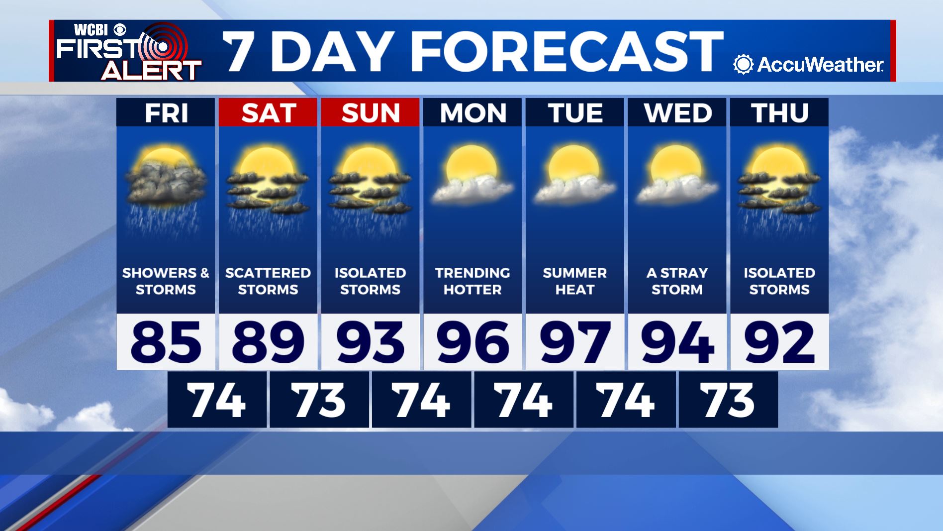
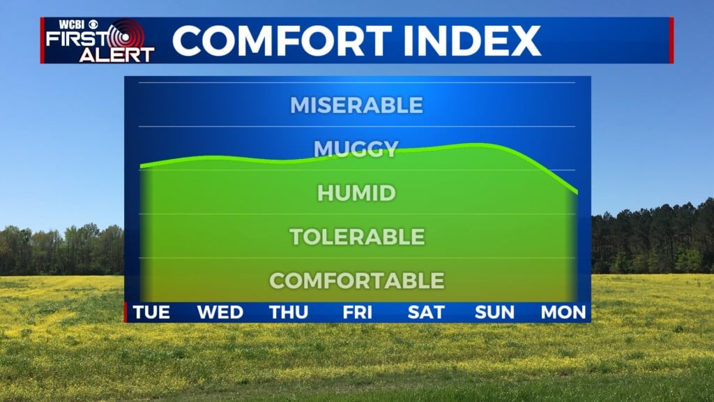
NEXT WEEK: High pressure will dominate the region to start the week and temperatures will respond accordingly. Afternoon highs will reach the middle-90s Monday through Wednesday with heat indices in the low-100s. Take precautions to stay cool and hydrated! Rain chances will hold off until a few isolated storms return to the region Thursday.
Follow Meteorologist Lance Blocker on Facebook and Twitter or via reach out via e-mail at LBlocker@WCBI.com!
Stay connected with @WCBIWEATHER on Facebook, Twitter, Instagram and the WCBI News App