Chilly tonight, more sun Friday & Saturday
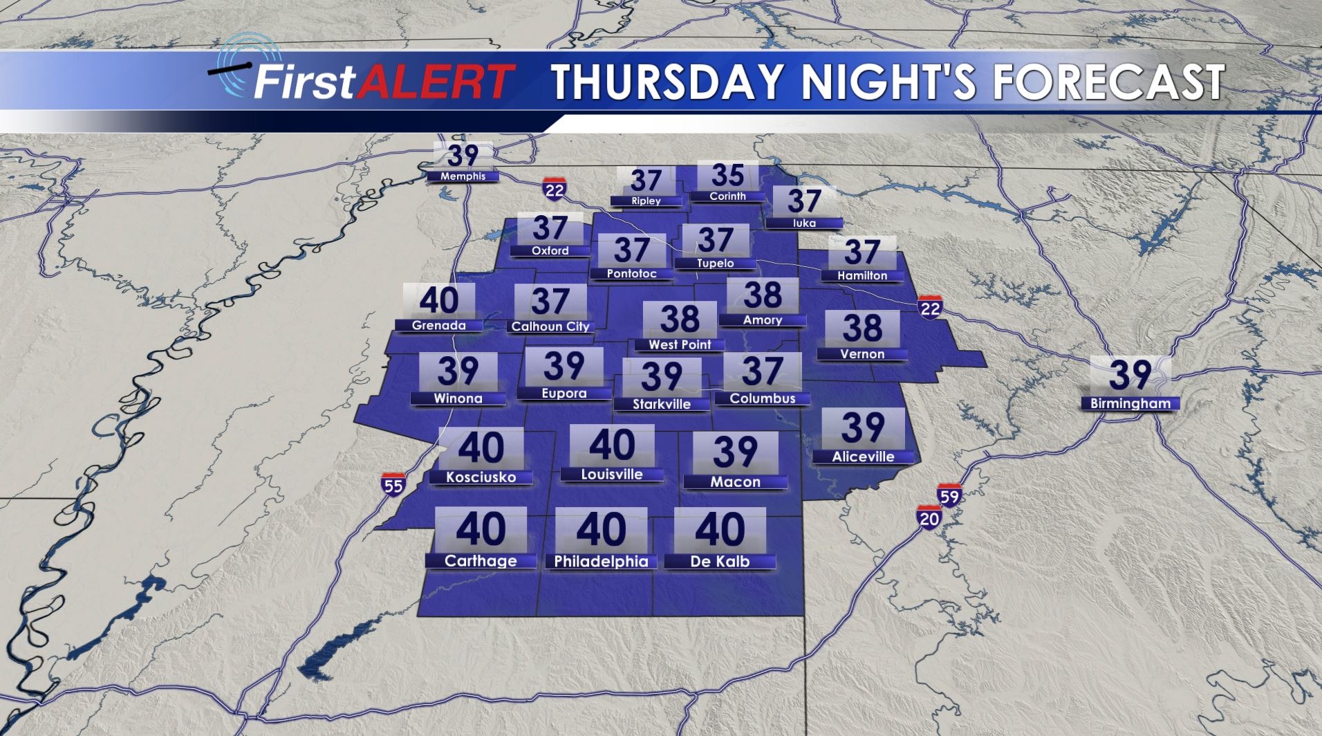
Thursday Night’s Lows
THURSDAY NIGHT: Clear and chilly with lows mainly in the mid to upper 30s. Some frost is possible, especially across northeast Mississippi. Any low lying, sheltered spot could have a brief bout of frost if the wind can taper off but at this point it doesn’t look like a widespread event at this time.
FRIDAY: Mainly sunny skies look to continue. Milder highs in the upper 60s to around 70 will be enjoyed area wide. Winds from the NE between 10 and 15 mph are going to be noticeably but not as gusty.
SATURDAY: Pretty good weather is in the forecast and that bodes well for all of the outdoor events that are scheduled. Highs will be in the low 70s with increasing clouds. A few evening showers can’t be ruled out but most if not all of the daylight hours should remain dry.
SUNDAY: A 90% chance of rain continues and a few embedded storms are also possible. While the chance of a strong storm or two isn’t zero it still looks like the most unstable air is going to remain across central and southern Mississippi and Alabama during this evening. Of course it bears watching. If nothing else there may be some locally heavy rain during the day. Plan on highs in the 60s.
NEXT WEEK: Below average temperatures along with daily shower chances hold on through at least Wednesday.
Follow @WCBIWEATHER on Facebook, Twitter, Instagram, and Snapchat


Leave a Reply