Heavy Rain Tonight, Cooler Wednesday
Severe Threat Index
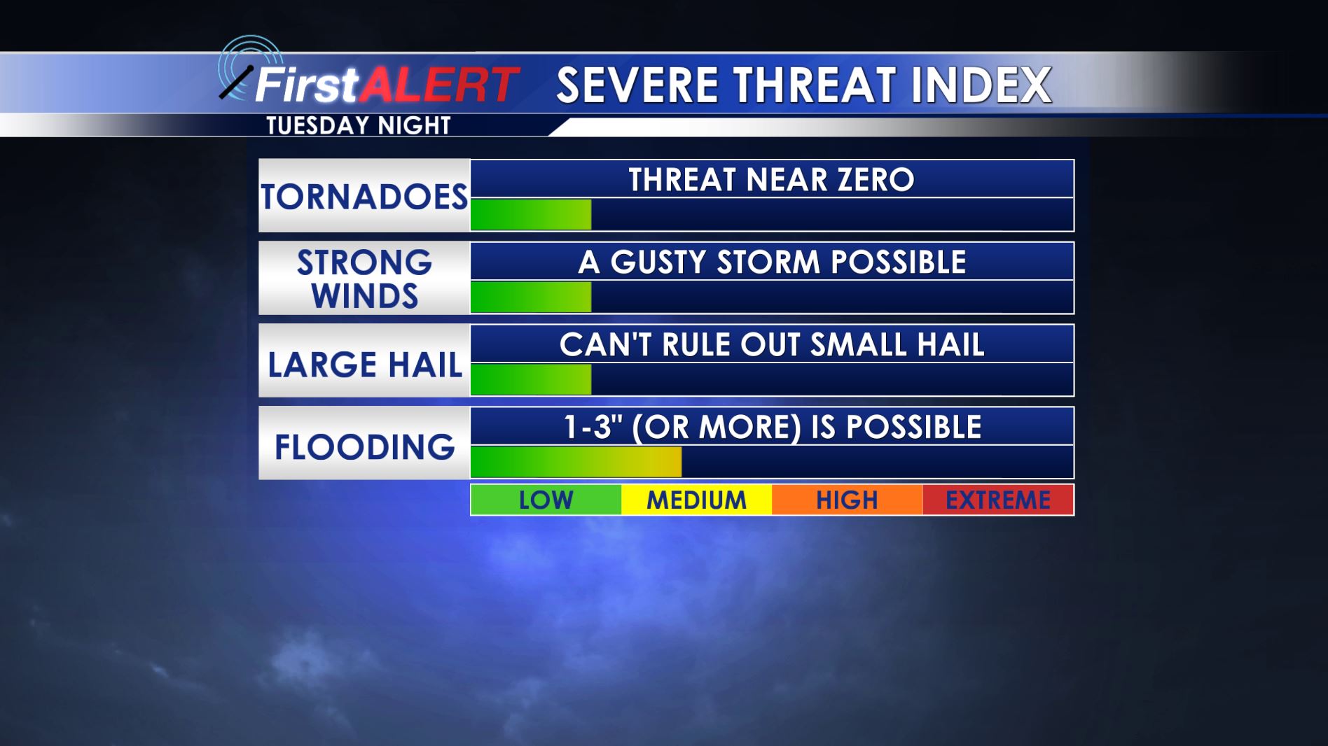
TONIGHT: Widespread heavy rain is expected to develop along with some embedded thunderstorms. Total rainfall between 1” and 3” is possible. While we can’t rule out some small hail or a gusty storm no widespread severe weather is likely. Temperatures may actually rise close to 60 during the night.
WEDNESDAY: Rain showers will end from NW to SE during the morning hours but clouds will hold tough all day long. Blustery and colder conditions return with afternoon temperatures only in the 40s. Winds from the NW between 10 and 20 mph will make it feel cold all day long.
WEDNESDAY NIGHT: Clear, calm, and cold weather returns. Look for lows in the mid to upper 20s.
THURSDAY: A bright and sunny day is on tap. Seasonable highs in the 50s are likely along with fairly light wind.
FRIDAY: Clouds increase and there will be a chance for a few afternoon and evening showers. Highs should be around 60.
WEEKEND: Additional showers and storms are possible. At this point we’re forecasting highs in the 60s but that is subject to change as well. We hope to have a clearer picture later in the week.
Follow @wcbiweather on Facebook, Twitter, Instagram, and Snapchat


Leave a Reply