Where Did Spring Go?
We might as well call Spring dead and gone as near record warm temperatures locks in place over the area. After the third coldest April for the State of Mississippi since records began, May is starting off on fire with high temperatures averaging 10 degree above normal through next week.
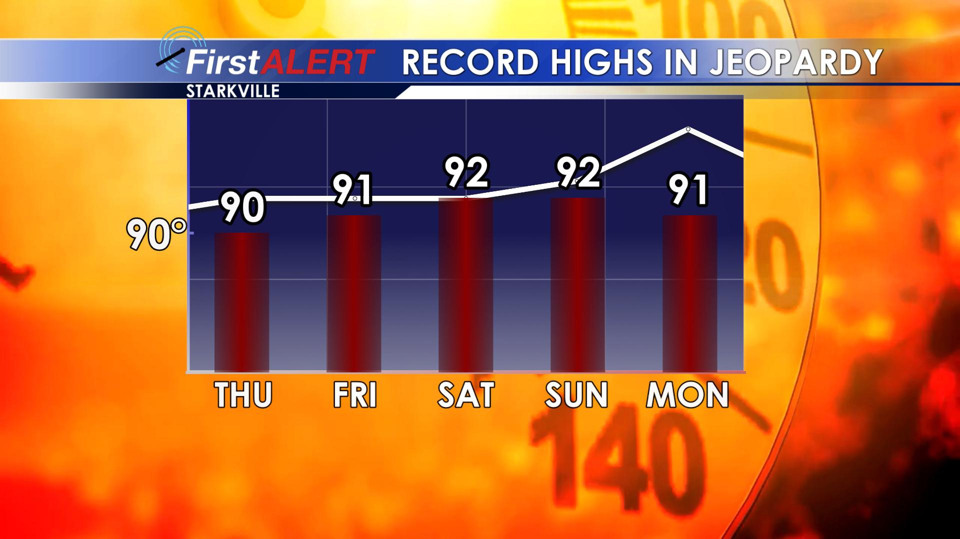
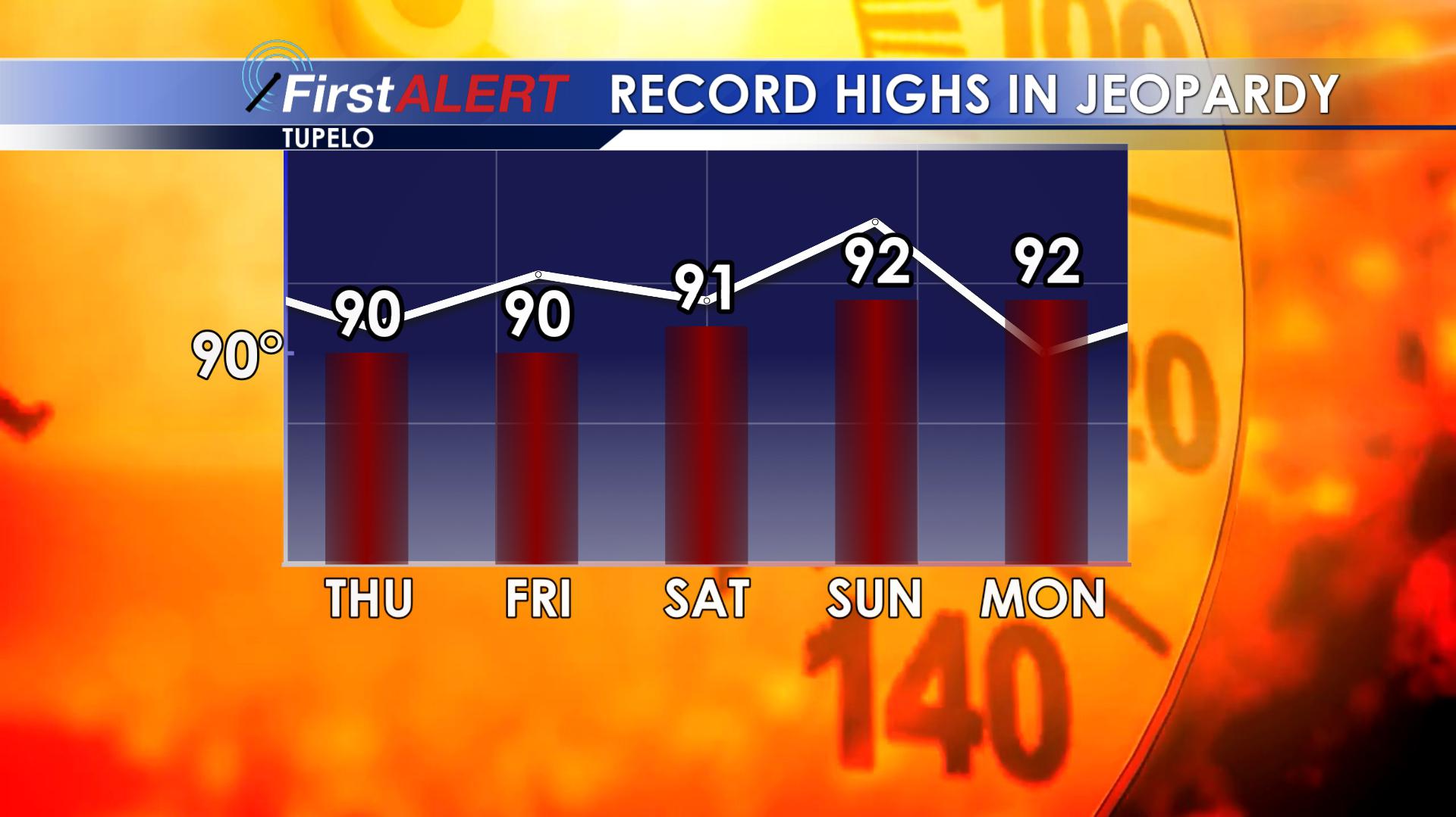
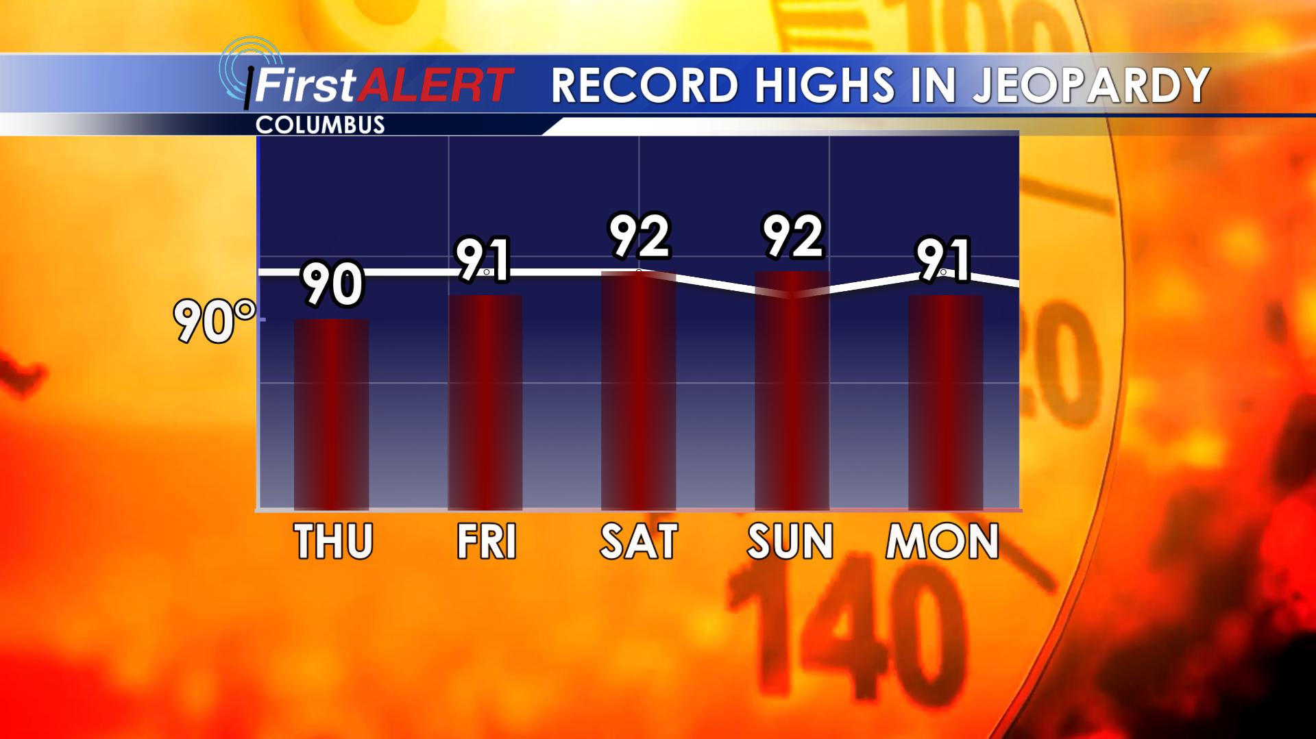
Here’s a look at some records that are in jeopardy in Starkville, Columbus and Tupelo. The white line is the record high for that day while the red bar is our forecast. Every day comes close or matches, if not exceeds the record high for the day, and some of these records go all the way back to the 1910s!
The extended range doesn’t show much in the way of relief and the official Climate Prediction Center places above odds for warmer temperatures through the end of the month in the Southeast US. That means the upper 80s and low 90s look to stick around through Memorial Day Weekend and beyond. This also means our classic summertime pop-up showers and storms look to stick in the forecast most days this month as a more tropical air mass locks in and summer kicks spring out.
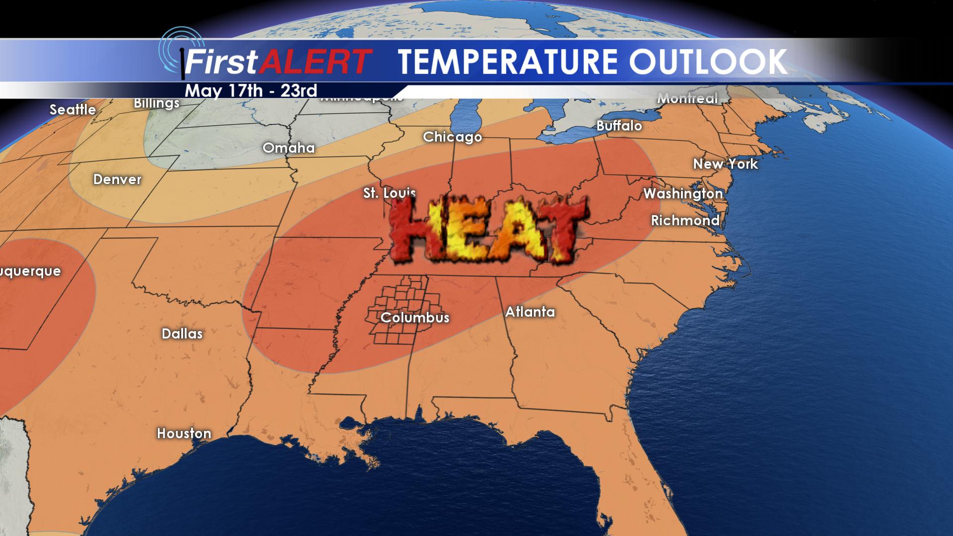
Below is the official Climate Prediction Center forecast from May 17th through 23rd. The brighter the orange, the higher the odds of above normal temperatures. We’ll be staying firmly in the above average area for high temperatures, which should be in the low 80s this time of year.
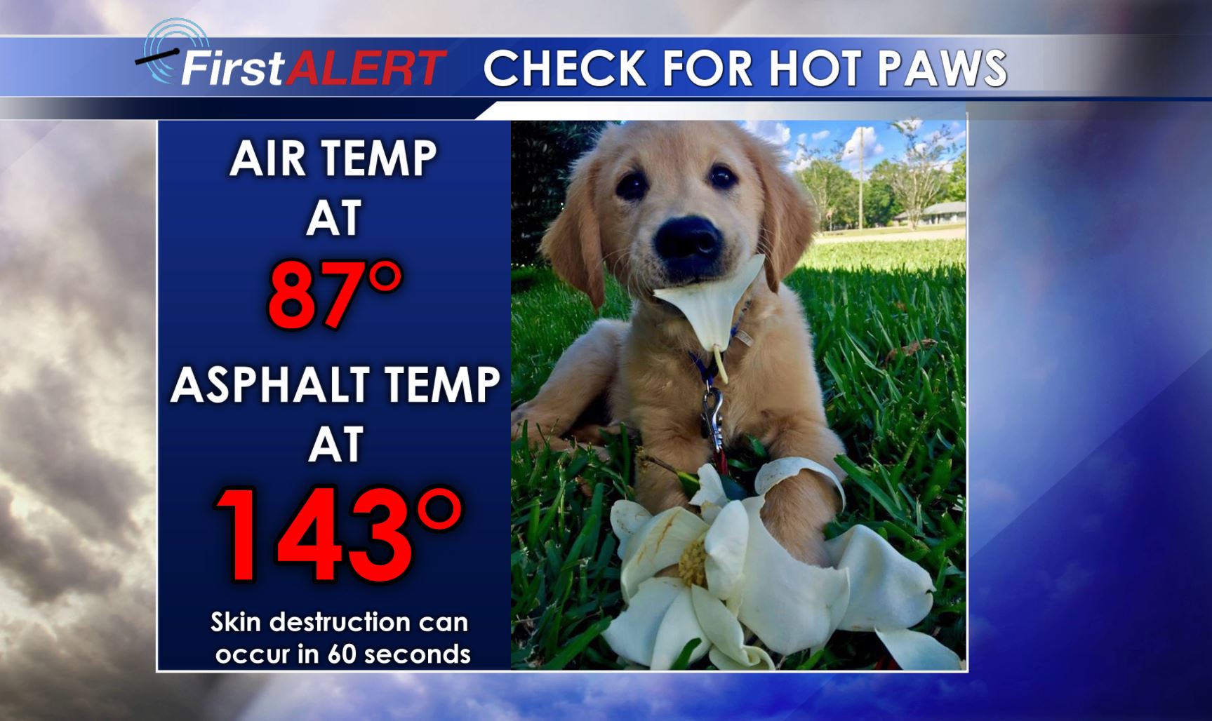
As a final reminder, with the weather warming up, be sure to think about your pets as you walk them. With temperatures only in the upper 80s, it is more than enough to burn their paws on the asphalt if you take them out for a walk. Remember to also check your vehicles to avoid leaving someone behind inside, and take appropriate measures if you are out in the hot sun.


Leave a Reply