Wet Weather Continues. Strong Storms Possible This Weekend.
TODAY: A cold front will stall and then lift northwest across the area this morning. Rain chances will drop significantly once that happens. Highs will again climb into the 70s and 80s. Rain chance in the morning around 50%, dropping to around 20% in the afternoon. Overnight, lows will drop into the 60s.
FRIDAY: Highs reach the 70s and 80s yet again. A few widely scattered showers and thunderstorms will be possible in the afternoon and evening. Chance of rain around 30%. Overnight lows in the 60s.
WEEKEND: A few scattered showers and storms during the day Saturday, with highs around 80. A cold front moves through overnight, increasing the rain chance. Storms along and ahead of the front could be strong or severe. At this point, all modes of severe weather, including a few tornadoes, looks to be possible. This looks to be a late night event, so ensure you have multiple ways to receive warnings, especially while asleep. Showers and a few storms may linger into Sunday, especially Sunday morning. Sunday will be much cooler behind the front. Highs in the 60s, with lows in the 40s.
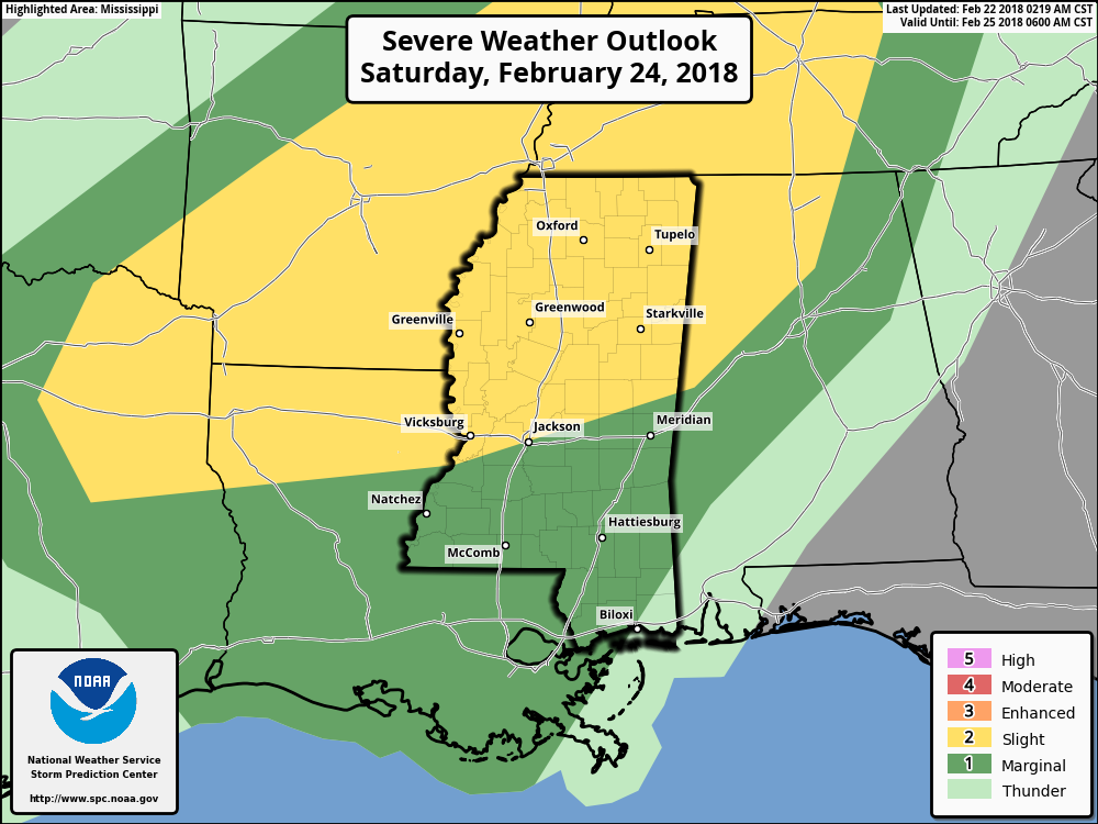
SPC OUTLOOK FOR SATURDAY
MONDAY: A few scattered showers possible. Highs in the upper 60s with lows in the 40s. Chance of rain around 30%.
TUESDAY: Dry and partly sunny. Highs in the upper 60s, with lows in the low 50s.
WEDNESDAY: Scattered showers and thunderstorms, especially overnight. Highs in the 60s and 70s, with lows in the 50s.


Leave a Reply