Strong Storms Possible Late Saturday
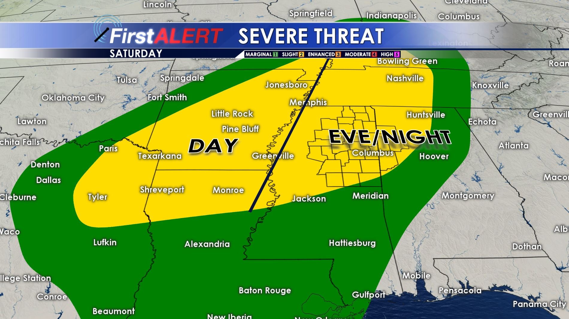
Severe Threat Saturday
TONIGHT: A fairly quiet night is anticipated but low clouds are going to fill back in by sunrise. Look for lows mainly in the 60s.
FRIDAY: There is a 30% chance of passing showers and storms during the day. Highs will be in the 70s and lower 80s.
FRIDAY NIGHT: Scattered showers and storms are possible. Lows will be in the 60s.
SATURDAY: Most of the day will be tame with only a few passing showers. Highs are going to be in the upper 70s to lower 80s. Southerly winds will pick up in the 10 to 20 mph range.
SATURDAY NIGHT: A line of strong to severe storms may accompany a cold front as it moves through during the evening and overnight hours. Damaging wind gusts are the primary threats but we can’t rule out isolated tornadoes somewhere in the region. It definitely bears watching. Temperatures are going to fall back into the 50s behind the front.
SUNDAY: Showers may linger during the morning and a few more showers are possible during the afternoon and evening. Rain chances are 30%. Highs are only going to be in the 60s.
Follow @WCBIWEATHER on Facebook, Twitter, Instagram, and Snapchat


Leave a Reply