Midweek Rain, Late Week Sun
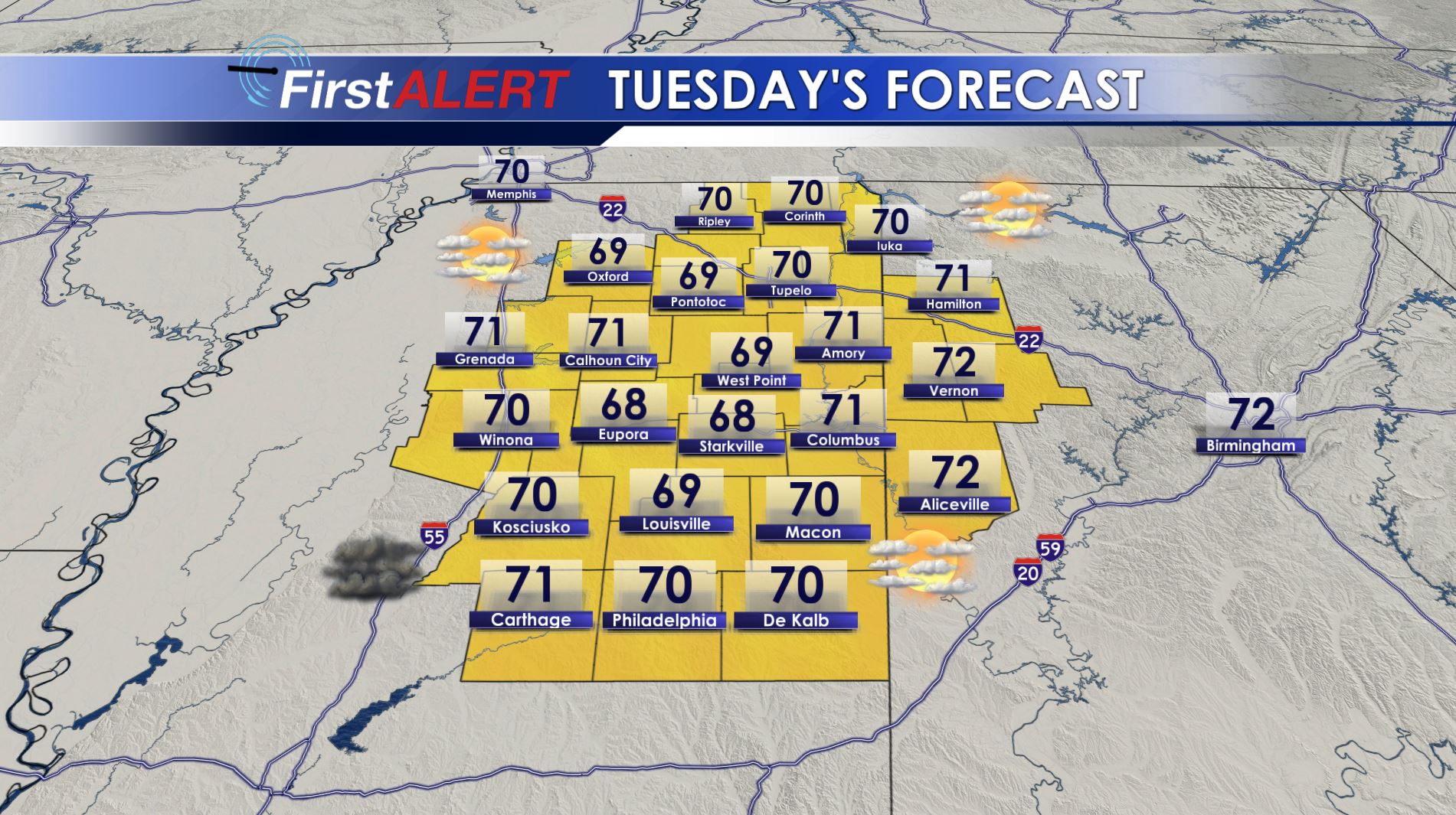
Tuesday’s Forecast
MONDAY NIGHT: Mainly clear conditions are in store for a change but areas of fog are possible. Look for lows in the upper 30s.
TUESDAY: We’ll start out the day on a fair note but clouds are going to increase during the afternoon. Highs should be around 70.
TUESDAY EVENING/NIGHT: Areas of showers and t-showers return. Lows will be in the mid to upper 50s.
WEDNESDAY: There is an 80% chance of showers and storms during the day and evening. It may not be an all day washout but the chance of a shower or storm exists at all times. Highs should top out in the low 70s.
WEDNESDAY NIGHT: Widespread rain and storms are likely. A few of them may be locally strong to severe with gu
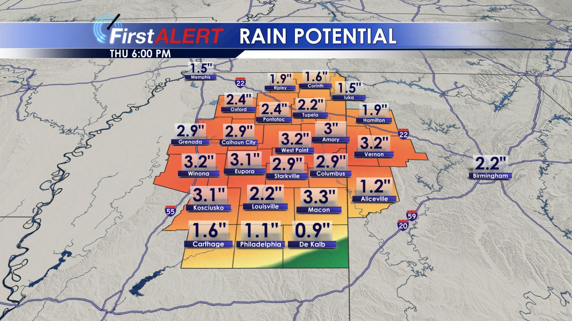
Rain Potential Through Thursday
sty winds and hail. Additional heavy rain is also possible. Lows are going to be around 60.
THURSDAY: Cool and showery conditions linger. Highs stay in the low to mid 60s. Total rainfall this week may range from 1″ to over 3″ in places. Additional flooding is possible due to all the recent rainfall.
FRIDAY – SUNDAY: High pressure returns and that means widespread sunshine. A few additional clouds are possible on Sunday but we’re keeping the forecast dry for now. We’ll be around 60 Friday, 65 Saturday, and 70 on Sunday. Lows are going to be in the 30s.
Follow @WCBIWEATHER on Facebook, Twitter, Instagram, and Snapchat


Leave a Reply