Wet & Stormy Next 2 Days, Sunny Weekend
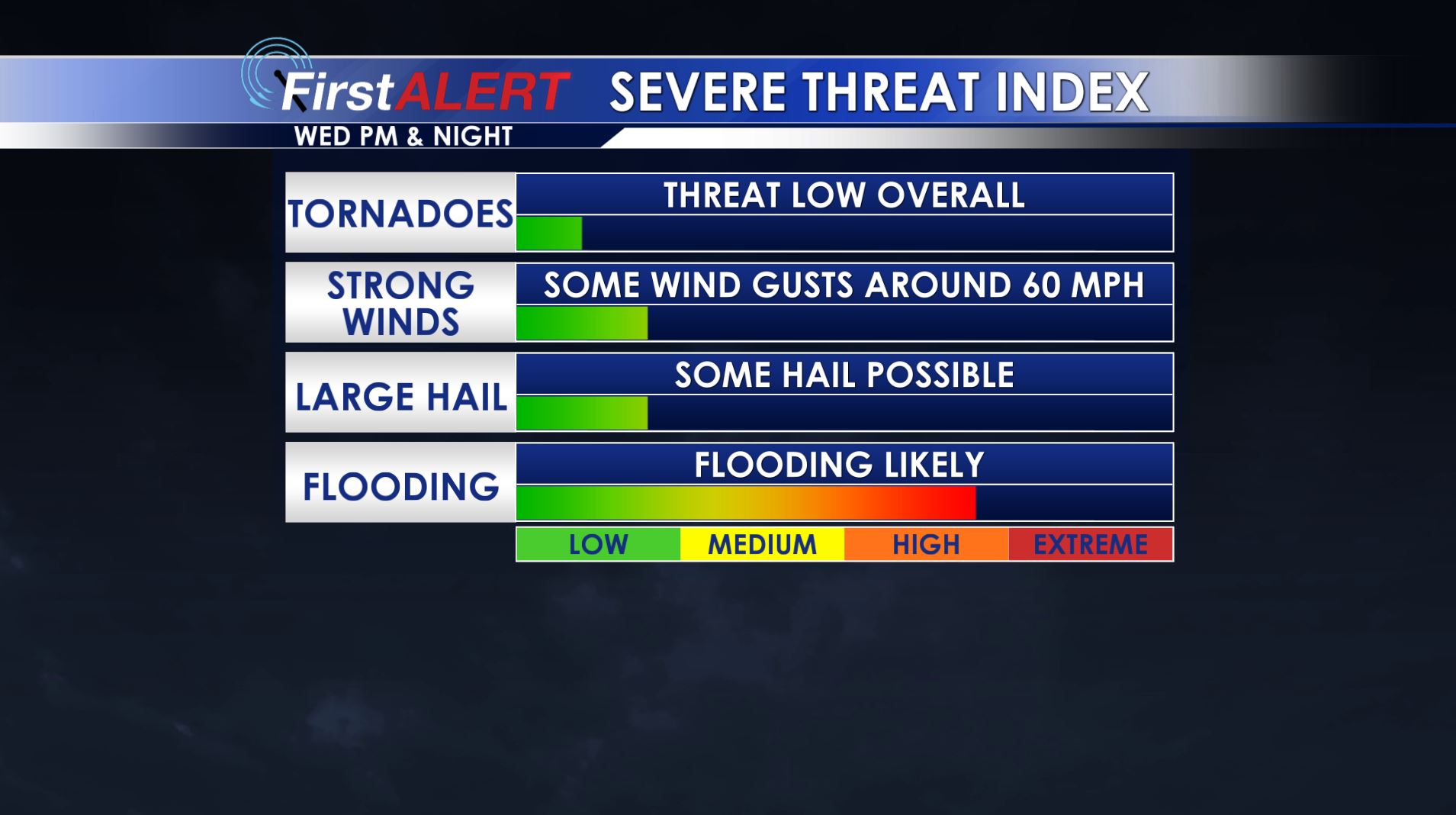
Severe Threat Wednesday
TONIGHT: Areas of rain and storms will push across the area. Locally heavy rain is possible. Lows should be only in the upper 50s.
WEDNESDAY: Rain and storms are likely. Some locally strong storms are possible as well during the afternoon and evening. Several inches of rain may fall along and north of US 278 so additional flooding is possible. Highs are going to range from the upper 60s near the Tennessee border to the mid and upper 70s south of Columbus.
WEDNESDAY NIGHT: Rain and storms will continue. Additional heavy rain is possible. Lows are going to be around 60.
THURSDAY: Lingering showers and clouds are going to make for a damp and cool day. Highs top out only in the lower 60s.
FRIDAY: Widespread sunshine returns! Highs around 60 can be expected.
WEEKEND: Mostly sunny weather is on track for both Saturday and Sunday. Highs will be in the 60s while cool overnight lows in the 30s return.
Follow @WCBIWEATHER on Facebook, Twitter, Instagram, and Snapchat


Leave a Reply