Rainy Thursday, Picture Perfect Weekend Coming
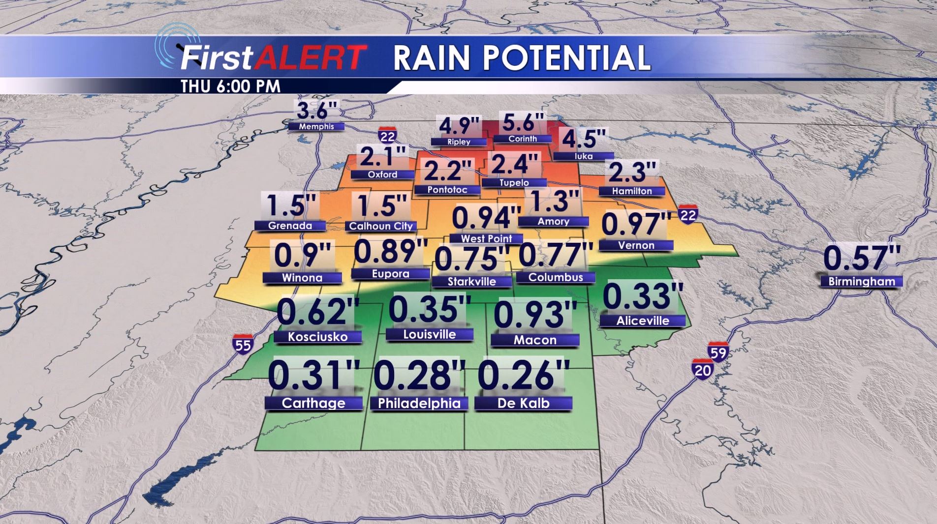
Rain Potential Through Thursday
TONIGHT: A few showers will continue during the evening mainly across the northern half of the area but another round of rain and storms will come in after midnight. The overall severe threat is low but we continue to monitor for some gusty winds. The big story overall is going to be the potential for more heavy rain. Several inches may fall across the northern half of the WCBI coverage area tonight and Thursday morning. Lows will be in the 60s.
THURSDAY: Widespread, heavy rain is likely during the morning with more in the way of showers during the afternoon. Fairly steady temperatures in the 60s are expected all day long. Breezy NW winds will develop during the morning hours.
THURSDAY NIGHT: Clearing skies will commence and temperatures will cool. Look for lows in the upper 30s to lower 40s.
FRIDAY: Sunny skies return! Highs are going to be around 60. Lows Friday night may get down into the mid to low 30s.
WEEKEND: Abundant sunshine is on tap for both Saturday and Sunday. Highs will be in the 60s while lows stay in the 30s.
Follow @WCBIWEATHER on Facebook, Twitter, Instagram, and Snapchat


Leave a Reply