A Few Showers Possible On Christmas Day
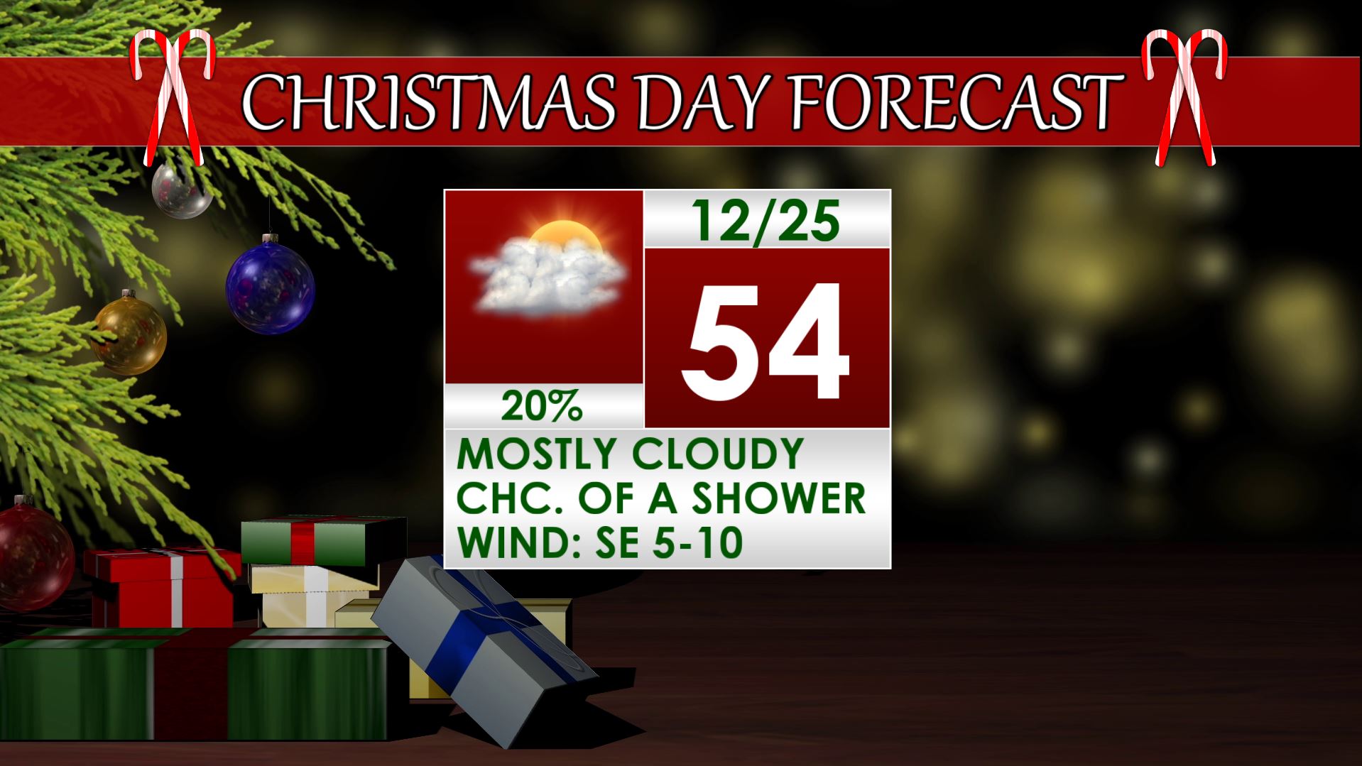
CHRISTMAS DAY: Look for a mostly cloudy day overall with a 20% chance of light showers. We’re going to average things out and forecast a high around 54 but a wide range of temperatures (40s, 50s, 60s) will exist across the region. Southeasterly winds continue between 5 and 10 mph.
TUESDAY NIGHT: Not as cold with lows in the mid 40s. Mostly cloudy skies hang around.
WEDNESDAY: While a stray shower can’t be ruled out most locations will experience a dry dry under partly to mostly cloudy skies. Temperatures should rebound back into the low 60s in most spots by the afternoon.
THURSDAY: A good chance of rain and storms exists with a system moving through the region. Highs should be in the 60s. We continue to monitor the potential for a few strong storms and locally heavy rainfall. Expect more details to emerge later in the week.
FRIDAY: Some rain may hold on during the morning but odds favor a drying trend from NW to SE during the day. Another day in the looks looks pretty reasonable at this point.
SATURDAY-MONDAY: We’re going to keep a daily 30% chance of rain around here but data is really all over the map regarding rain chances and rain timing. Things may end up wetter or drier depending on how the flow sets up late this week. Seasonable temperature for late December appear to be a good bet at this point.
Follow @WCBIWEATHER on Facebook, Twitter, Instagram, and Snapchat


Leave a Reply