A.M. Showers Sunday, Then Drying Out
COLUMBUS, Mississippi (WCBI) – Storms end tonight, then we dry out next week.
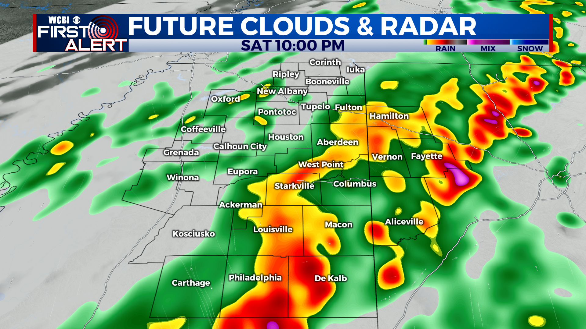
TONIGHT: Strong to severe storms are possible Saturday evening. A broken line of storms is moving through north Mississippi and could produce isolated damaging wind gusts and maybe a brief tornado or two. The threat should end by midnight. Once the storms pass and the cold front moves through, temperatures will drop and winds will pick up. Lows in the low 40s.
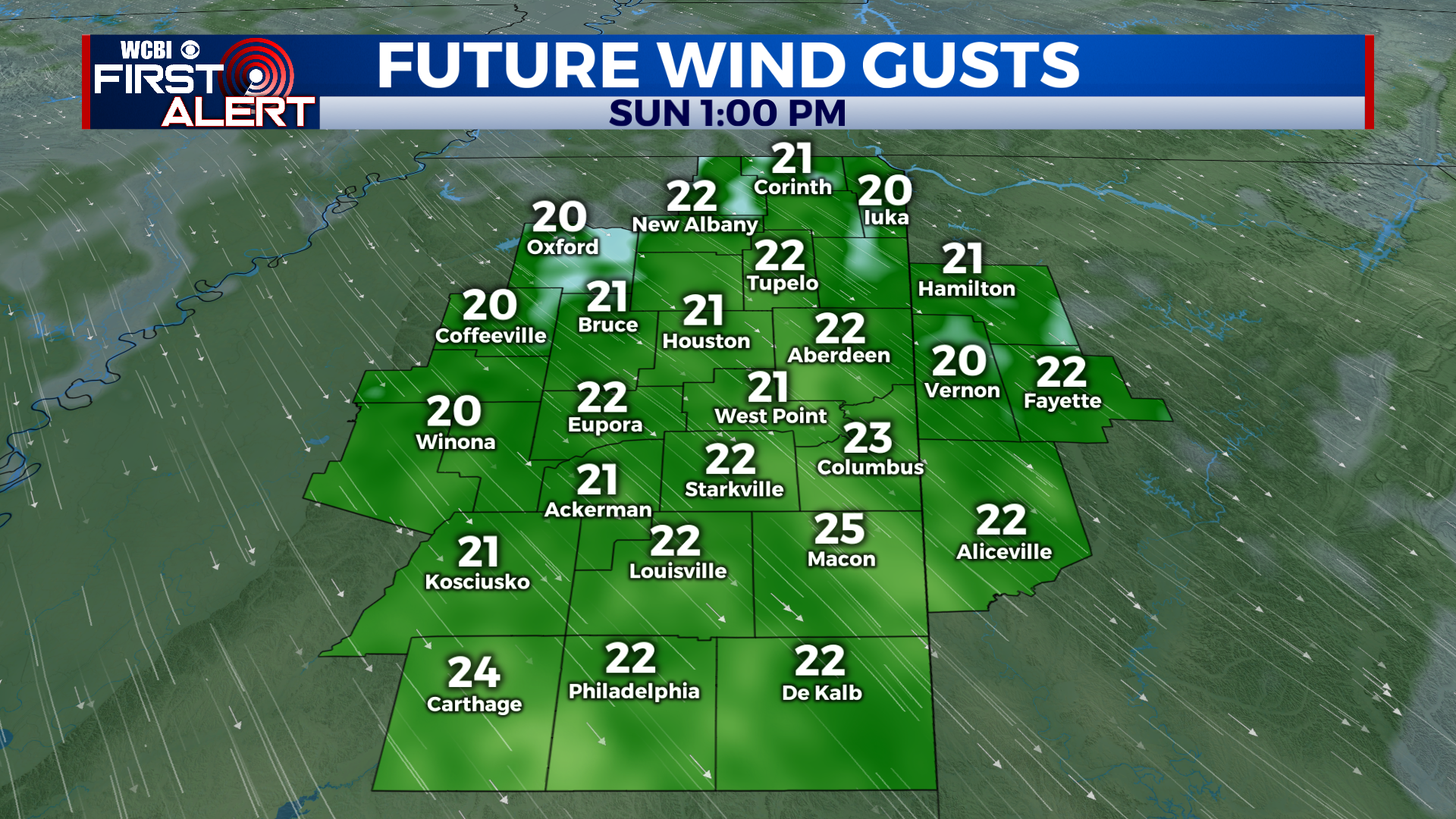
SUNDAY: A few lingering showers are likely on Sunday morning, likely ending by 10 AM. Clouds will stick around for most of the morning, but some clearing is expected during the afternoon. It’ll be a cool and windy day. Temperatures struggle to reach 50 degrees with northwest winds gusting to 20 mph!
NEXT WEEK: Cooler air arrives on Sunday and sticks with us for a few days. Upper 20s and low 30s in the mornings, mid- and upper 50s in the afternoons. Milder air returns late in the week ahead of our next system, which will bring a chance for rain over the weekend.


