A quiet, sunny and comfortable next few days
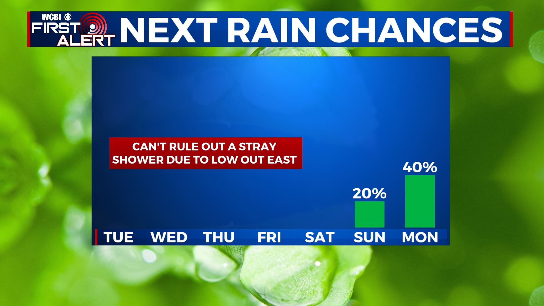
SUMMARY: The rest of the workweek looks to remain dry with a mix of sun & clouds. Still can’t rule out a stray shower thanks to a low pressure system off the East Coast, but not expecting much. Temperatures in the mid to upper 80s with pleasant, less humid conditions. Summer officially begins Saturday afternoon. It will certainly feel like it with heat and the humidity returning this weekend along with better rain chances for Father’s Day Sunday into Monday.
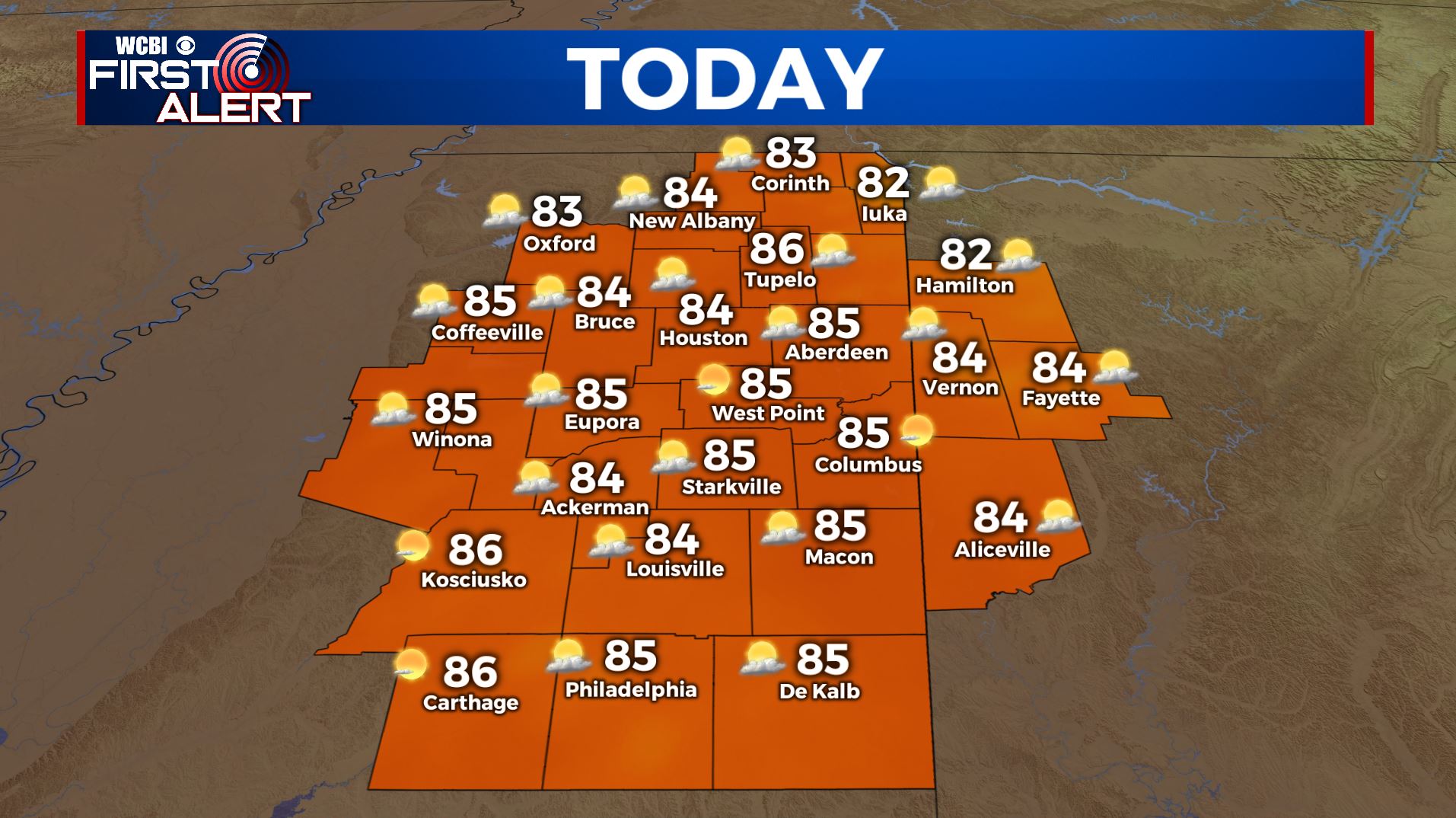
TUESDAY: It’s a cool and comfortable start out there with temperatures in the upper 50s to lower 60s. A pretty decent day is ahead for us. Mostly sunny to partly sunny skies for your Tuesday as we could see a few clouds move in this afternoon. Highs in the mid 80s with less humid conditions. Winds NNE 5-10 mph.
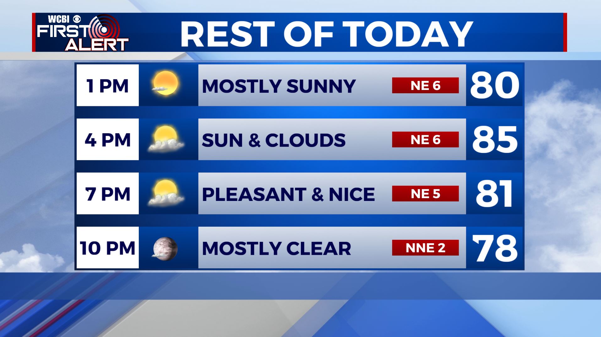
TUESDAY NIGHT: Mostly clear, calm and quiet. Overnight lows in the low 60s.
WEDNESDAY: Mostly sunny. Highs mainly in the mid 80s.
WEDNESDAY NIGHT: Another clear, calm and quiet night. Overnight lows in the low 60s.
THURSDAY & FRIDAY: Mostly sunny and warmer. Highs in the upper 80s to lower 90s. Lows in the mid to upper 60s.
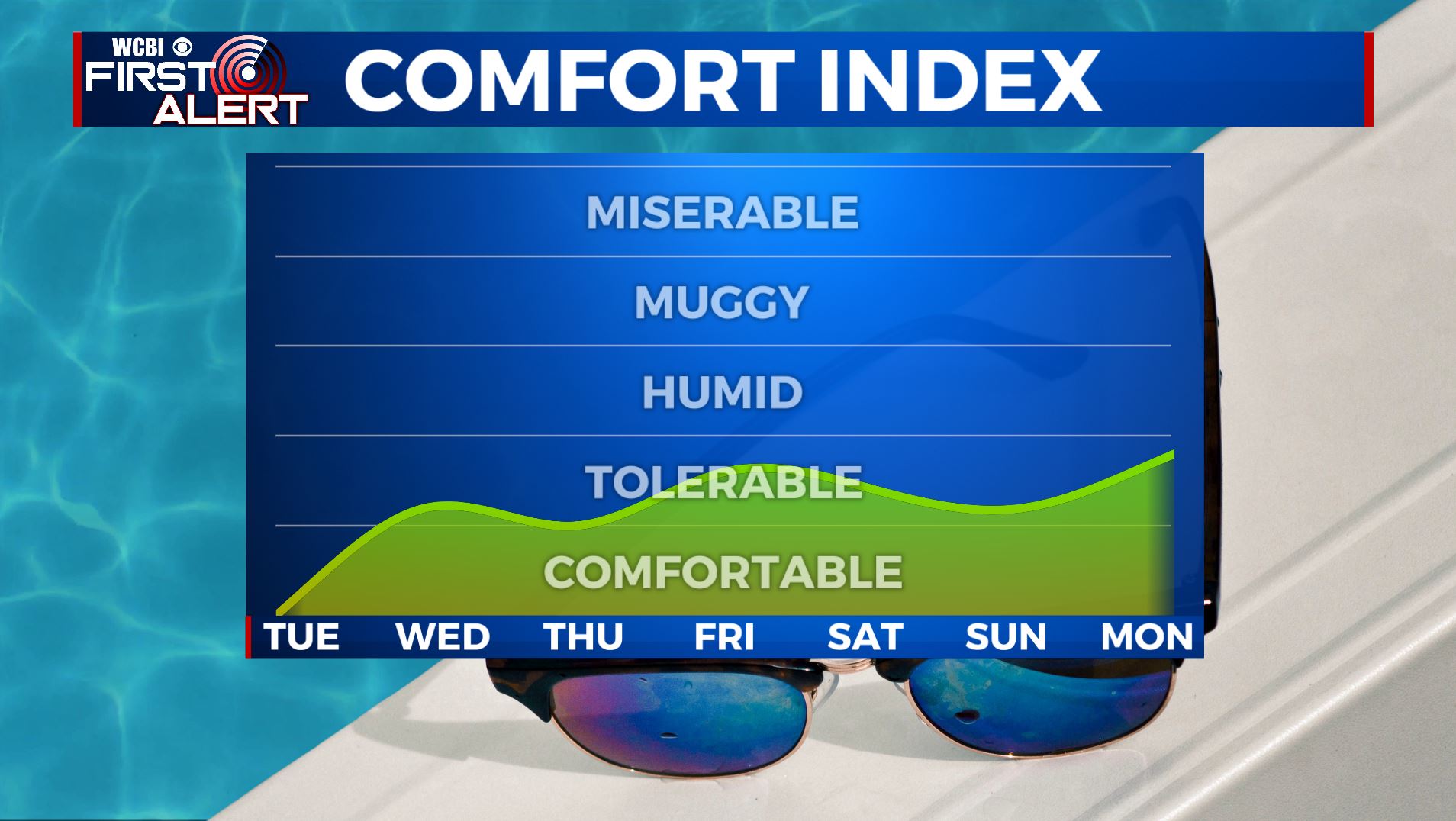
SATURDAY & SUNDAY: The summer heat and humidity makes a comeback with highs in the low to mid 90s. We’ll have a mix of sun & clouds overall, but a spotty storm is possible on Sunday.
MONDAY: We’ll have better chances of scattered showers & storms as we begin a new week with partly sunny skies. Highs near 90.
Stay connected with @WCBIWEATHER on Facebook, Twitter, Instagram, and the WCBI News App


Leave a Reply