A quieter weather pattern returns as a gradual warming trend begins
COLUMBUS, Mississippi (WCBI) – SUMMARY: We had a mix of sun and clouds today, but we were at least somewhat warmer than yesterday afternoon.

TONIGHT: Partly cloudy and colder with lows in the upper-30s. Scattered frost possible north. North wind 3-5 mph.
FRIDAY: Partly cloudy with highs in the low-60s. Northeast wind 5-10 mph.
FRIDAY NIGHT: Partly cloudy with lows in the upper-30s. Areas of frost possible. Northeast wind 3-5 mph.
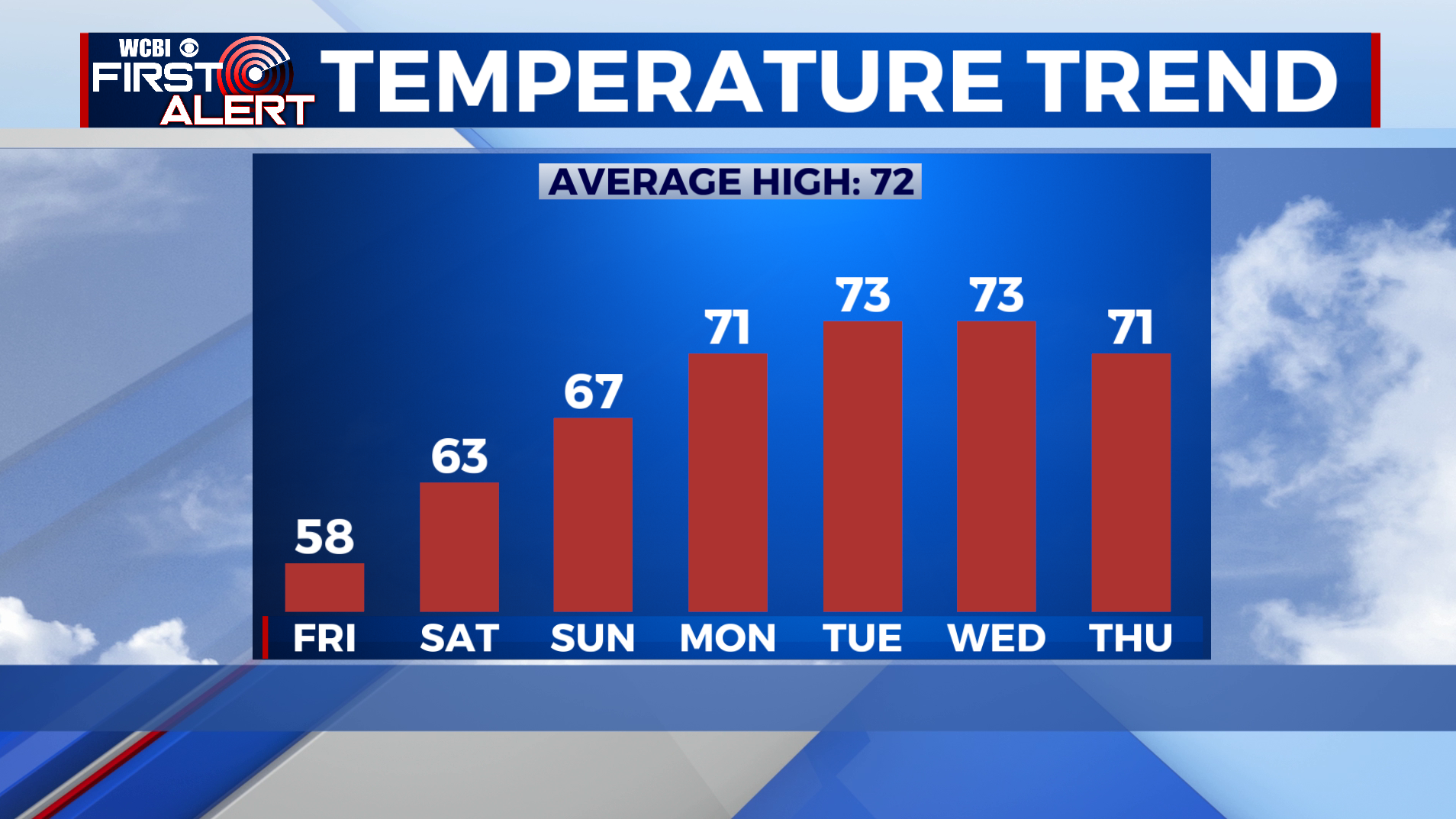
EXTENDED FORECAST: This weekend is looking great with afternoon highs in the mid-to-upper 60s Saturday and Sunday under a sunny sky each day. Next week will start off sunny and warmer with highs in the low-70s Monday. Clouds will increase ahead of our next chance of rain by Thursday and Friday. Enjoy the warmer weather
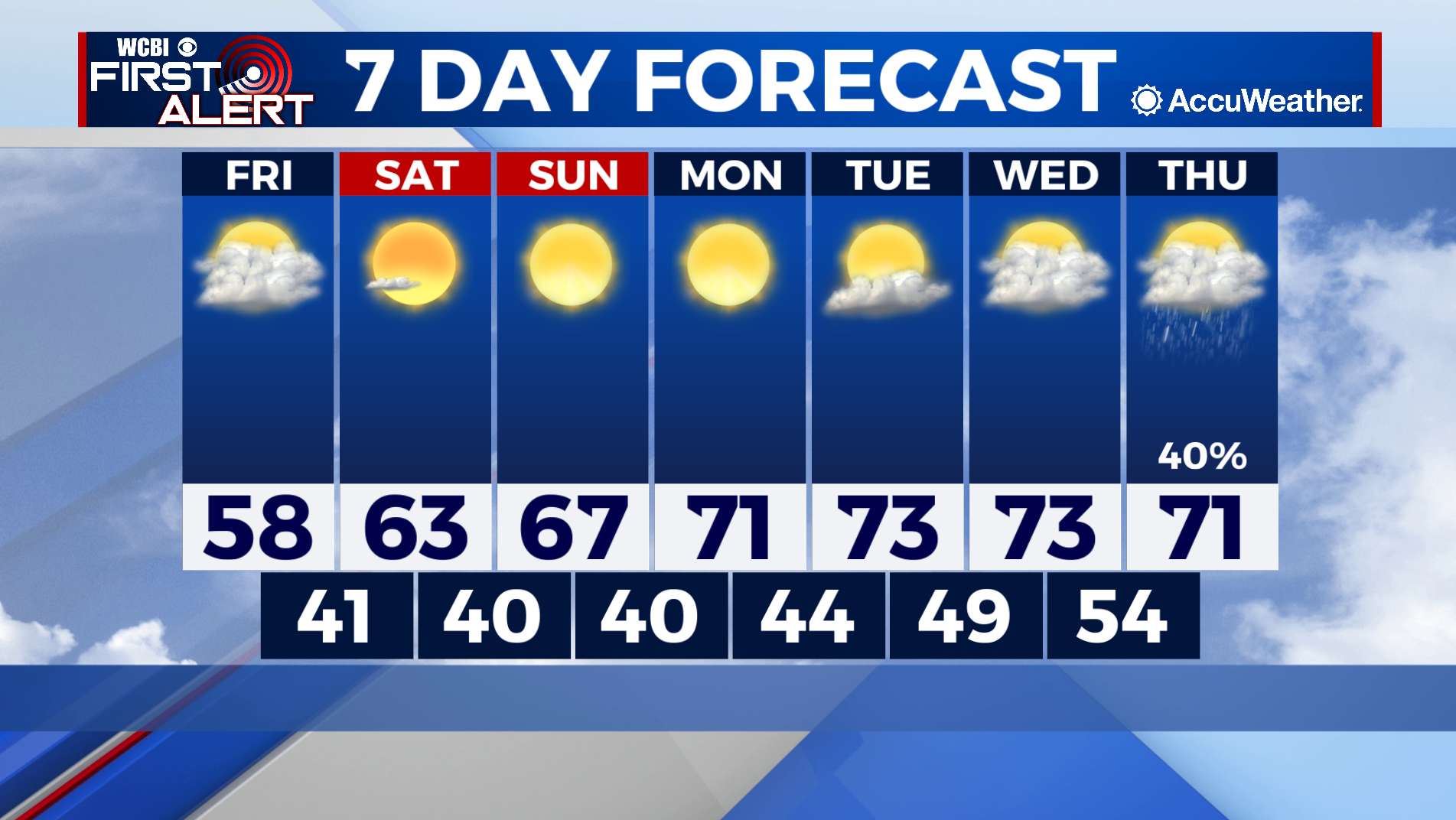
HIGH SCHOOL FOOTBALL: Friday night’s games will be dry with no chance of rain, but still colder than normal. Expect temperatures to be in the low-50s around 7pm then low-to-mid 40s after the game. Bundle up!
TROPICS: Tropical Storm Wanda continues in the North Atlantic, but is expected to dissipate soon. Elsewhere across the Atlantic and Gulf of Mexico, all is quiet and tropical storm formation is not expected through this weekend.