A rain & stormy Friday ahead then drier weather into next week
SUMMARY: We’ll continue having some unsettled weather the next two days ahead of a cold front that will push through Saturday afternoon. Any storm may produce lots of lightning, gusty winds, and torrential rainfall. Some flooding is possible along with downed trees in the strongest cells. We’ll have drier weather and lower rain chances by Sunday into early next week.


FRIDAY: A warm and humid Friday is ahead for us with a 60-80% chance of showers and storms. A Level 1 to 2 risk for severe weather exists across the area. We’ll be keeping an eye on it! Some stronger storms may produce gusty winds and torrential rainfall. Highs in the mid to upper 80s, but a few low 90s are possible if there is enough sunshine. Keep the rain gear handy! Winds SW 5-10 mph.
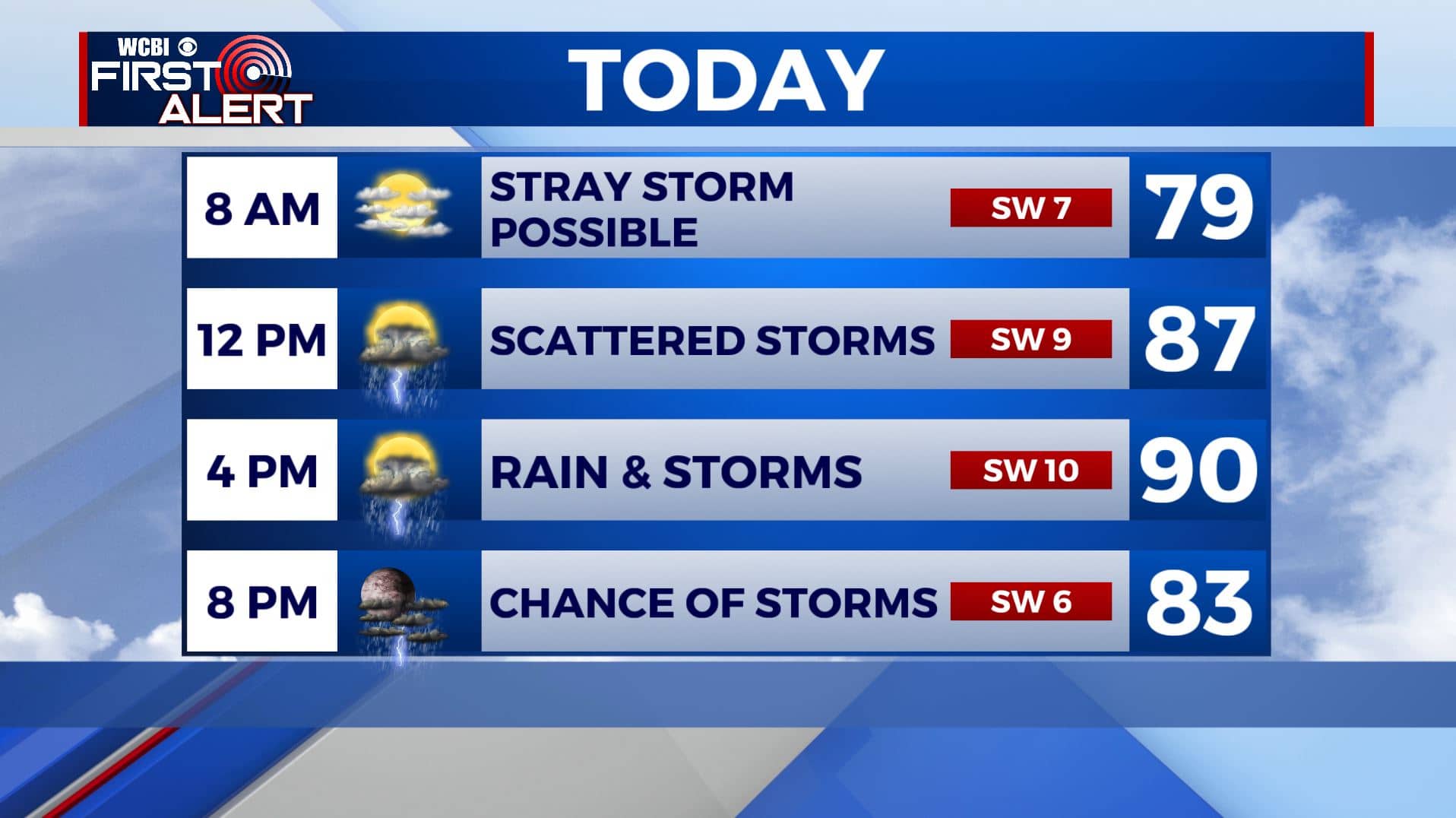

FRIDAY NIGHT: A continuing chance of showers and storms. Some storms may produce gusty winds and torrential rainfall. Muggy overnight lows in the 70s.

SATURDAY: Cold front will push through Saturday afternoon so keeping in the likely chances for showers & storms. Highs in the mid to upper 80s.
SUNDAY THROUGH NEXT WEEK: Rain chances lower but some spotty storms can’t be ruled out during the heating of the day. Highs will be in the upper 80s to lower 90s. Slightly cooler lows in the upper 60s to around 70.
TROPICS: Isaias became a Category 1 Hurricane late Thursday night with winds at 80 mph and moving toward the Bahamas. It will be getting very close to the Florida coastline over the weekend before heading north up the U.S. Eastern seaboard. It will have no bearing on our area or the northern Gulf Coast.
Stay connected with @WCBIWEATHER on Facebook, Twitter, Instagram, and the WCBI News App


Leave a Reply