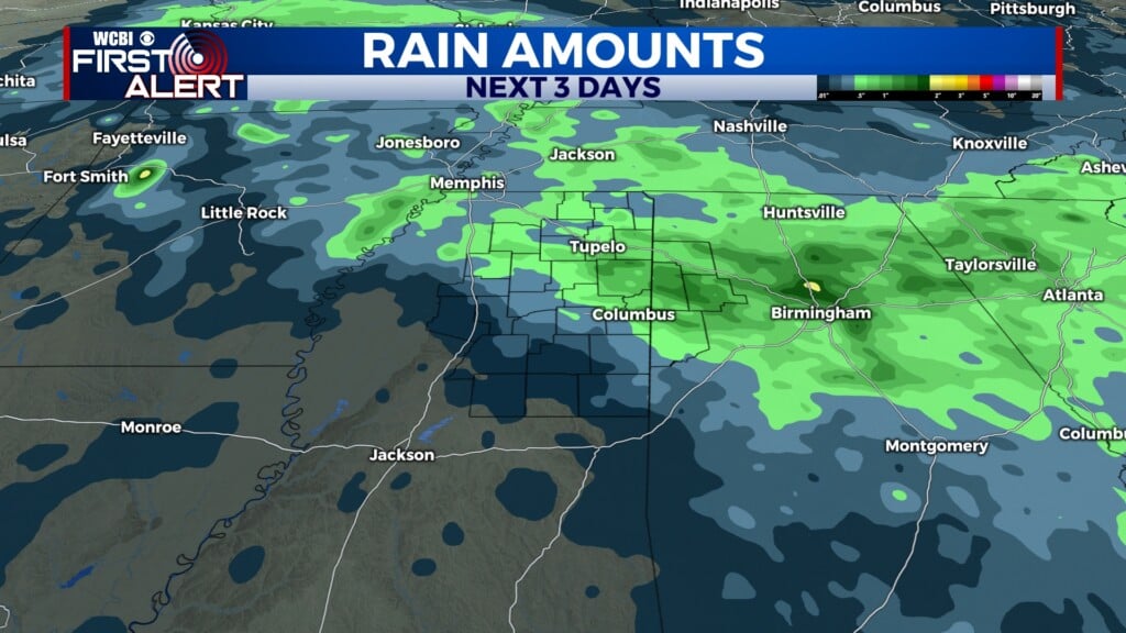
A soggy Valentine’s week
COLUMBUS, Mississippi (WCBI)- More rain is on the horizon, as another week in February begins. Showers and storms could become severe for the middle of the week.
MONDAY NIGHT: Monday had a great start to the week! There was a lot of sun today and mild temperatures that made it comfortable outside. Tonight will continue the trend for mild overnight temperatures, in the low to middle 40s. Sky conditions are going to be mostly clear through tomorrow morning.
VALENTINE’S DAY: Cloud coverage will begin working its way back into northern Mississippi. High temperatures are going to be warm and mild again tomorrow, in the middle to upper 60s. There is a chance of seeing some scattered showers throughout the evening hours, with a passing front. While these showers will not be widespread, a romantic picnic on the Riverwalk may not the be best plan for your Valentine’s Day dinners. Regardless of plans, be prepared with rain gear. Overnight low temperatures will be in the upper 50s.
WEDNESDAY: A warm front Wednesday will be bringing in even more warmth and moisture. High temperatures will be in the lower 70s. While spotty rain is possible through the day, scattered storms could form in the evening hours. These storms could become strong at times, with gusty winds & small hail as the main hazards. Showers and storms will continue through the night. The overnight temperatures will be very mild for evening temperatures, in the low to middle 60s.
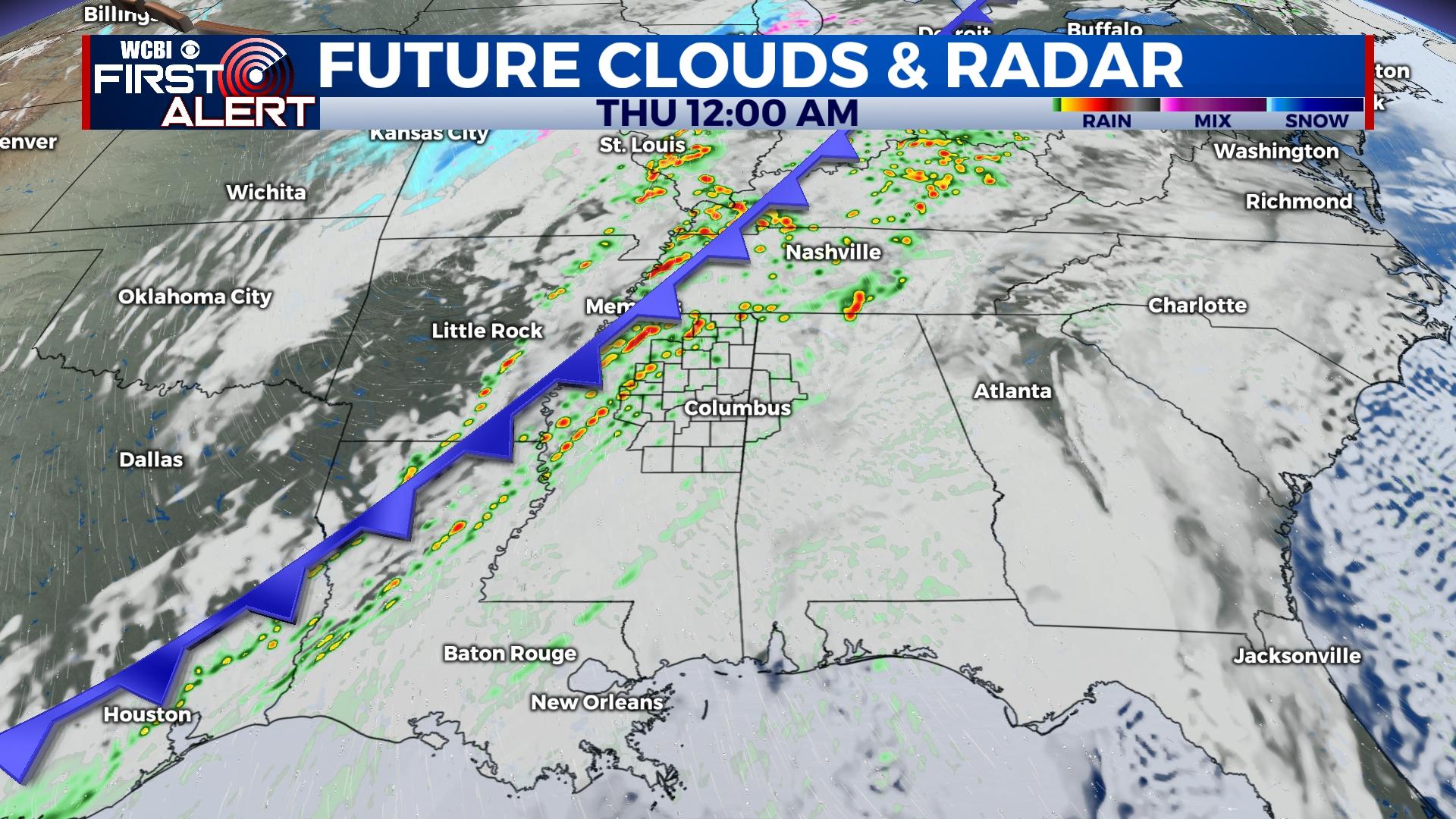
THURSDAY: The severe threat mainly shows up on Thursday. Showers and storms appear most likely during the day. Specific timing is uncertain with this system still being a few days away. The ingredients for the storms will be in place for any cell to enhance enough to become severe. High temperatures will be in the upper 60s, with overnight low temperatures dropping into the middle 30s.