A warming trend arrives this weekend with record heat possible next week
COLUMBUS, Mississippi (WCBI) – SUMMARY: Scattered showers and thunderstorms moved across the region today, but we’ll dry out and warm up through the extended forecast.
TONIGHT: A few isolated showers possible, otherwise mostly cloudy overnight. Lows in the upper-60s. Chance of rain: 20%. Calm wind.
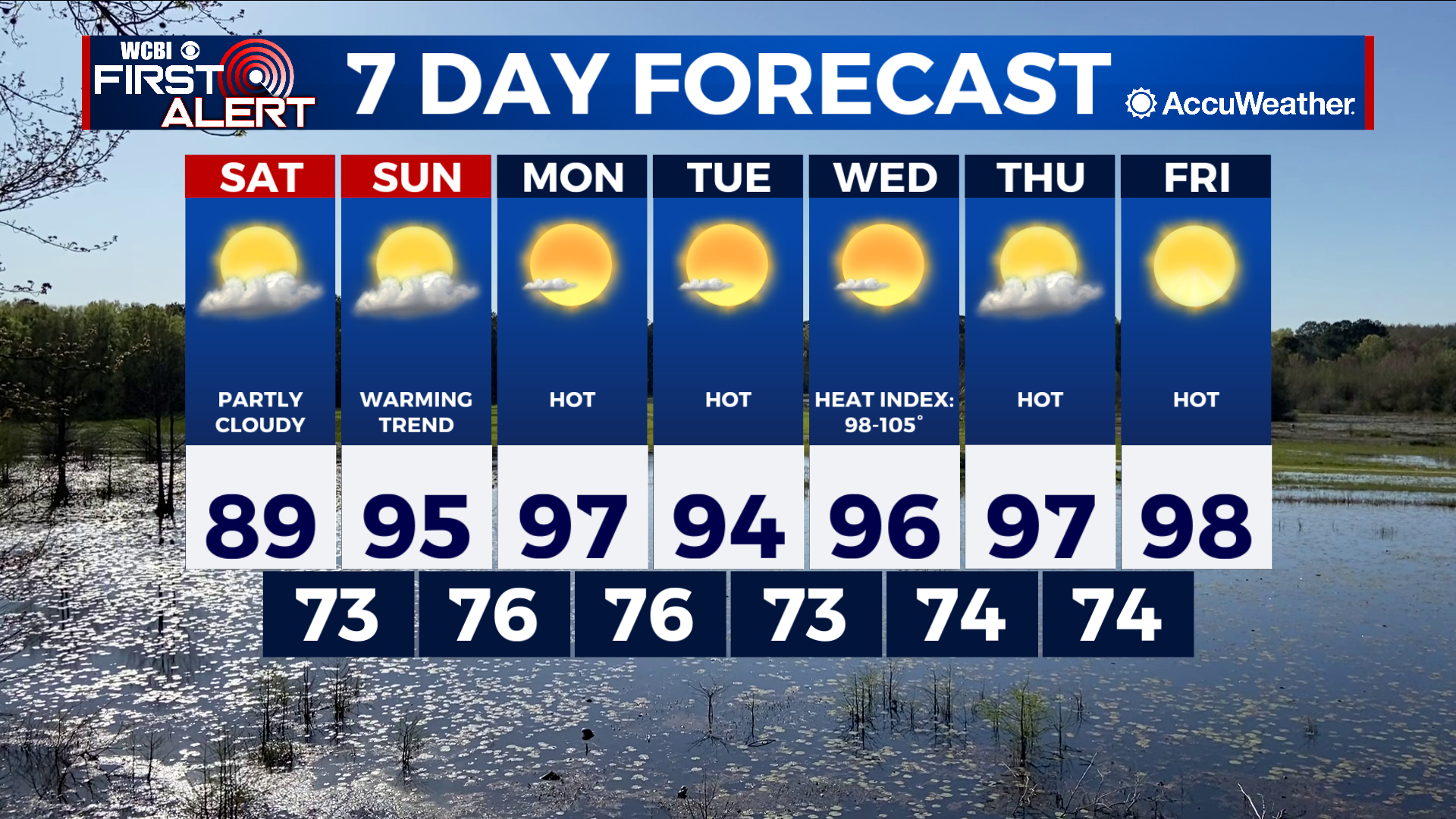
SATURDAY: Partly cloudy with highs in the upper-80s. Calm wind.
SATURDAY NIGHT: Partly cloudy with lows in the low-70s. Calm wind.
SUNDAY: Partly cloudy and warmer with highs in the mid-90s. Calm wind becoming southwest 3-5 mph in the afternoon
SUNDAY NIGHT: Mostly clear with lows in the mid-70s. Calm wind.
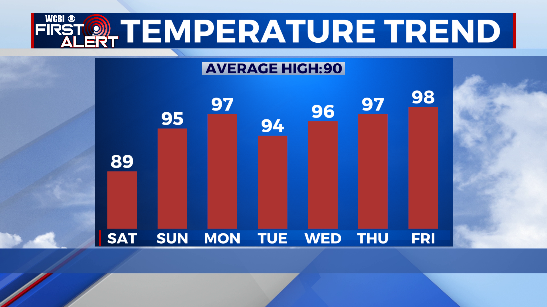
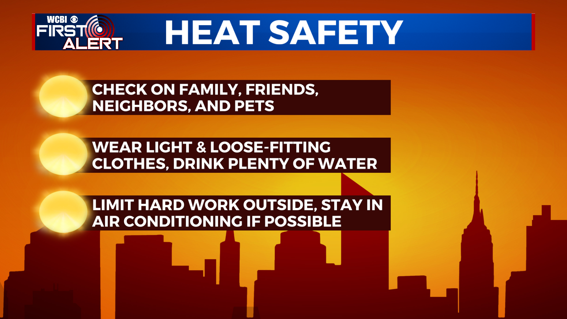
EXTENDED FORECAST: High pressure will prevail over the next week or so and keep us rain-free through the extended forecast period. Daily high temperatures will max out in the upper-90s, with heat index values ranging from 98-105°.