A wet week ahead
COLUMBUS, Mississippi (WCBI)- While the past couple of days were nice with drier conditions, Friday has seen some isolated moments of rain. This will not be the last of the rain for several days.
FRIDAY NIGHT: There is an approaching cold front moving in from the NW. While it is not expected to pass through tonight, there are still several impacts moving in ahead of it. Cloud coverage will continue building throughout the night. Rain showers are also expected to stall across NE MS and NW AL tonight and into tomorrow morning. Overnight low temperatures tonight are falling only into the upper 50s.
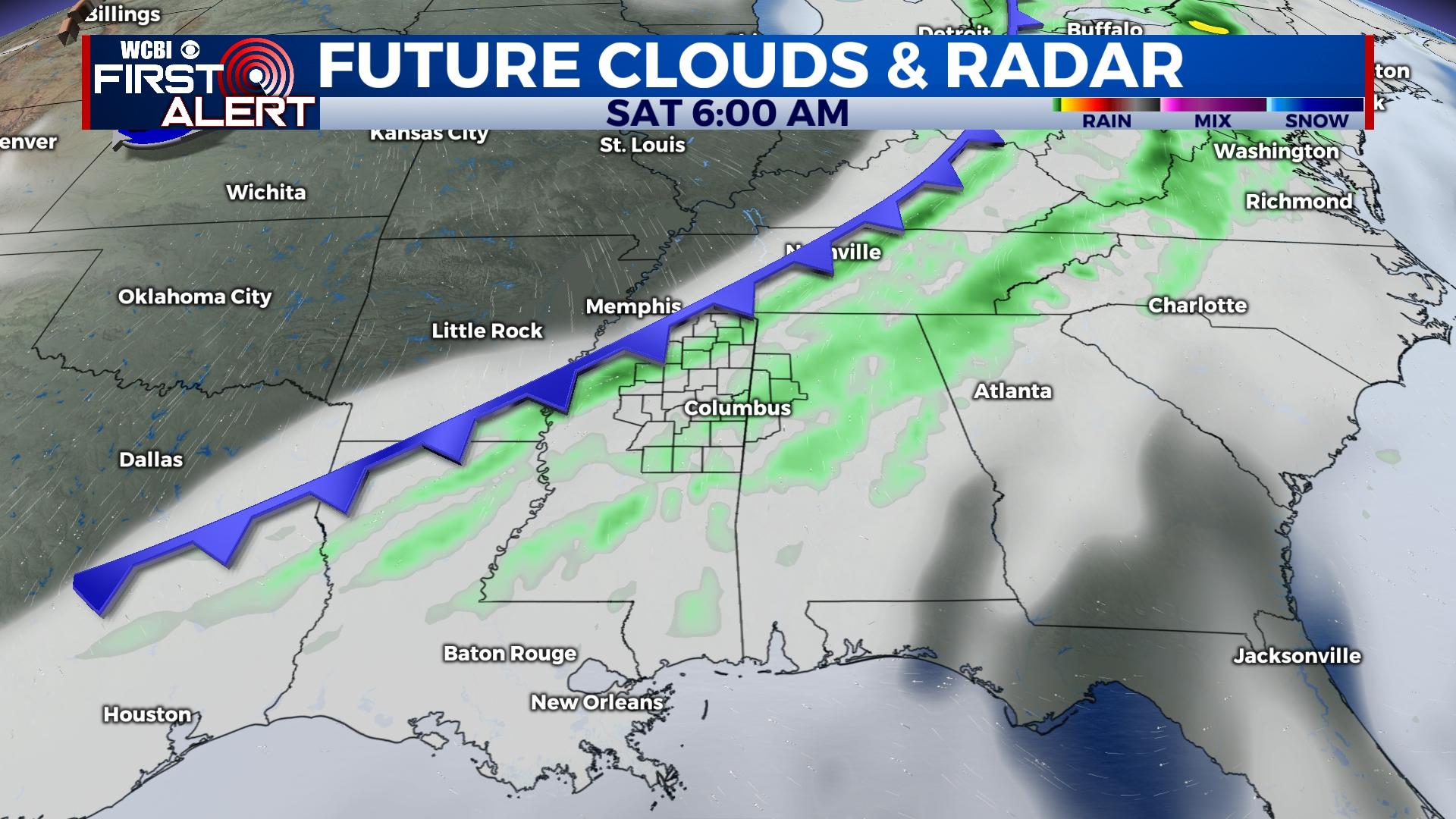
SATURDAY: There is a 60% chance for rain showers to continue through the morning and into the early afternoon hours. As the front pushes to the SE, rain chances should clear out into the evening. High temperatures will reach into the middle 60s. Cooler air behind the front will have overnight low temperatures falling into the upper 30s.
SUNDAY: Colder air will continue into Sunday from the passing cold front. High temperatures will be in the upper 40s to lower 50s. There is a chance of seeing some scattered showers, currently at 30%. If you heading to any Christmas parades, bundle up and be prepared for rain. Overnight low temperatures will drop into the low to middle 40s.
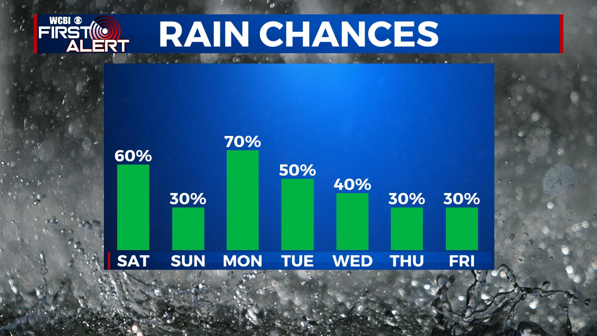
NEXT WEEK: Rain chances continue throughout the week. Temperatures will range in the 60s Monday and Friday, 70s for the middle of the week.


