A winter-like start to November
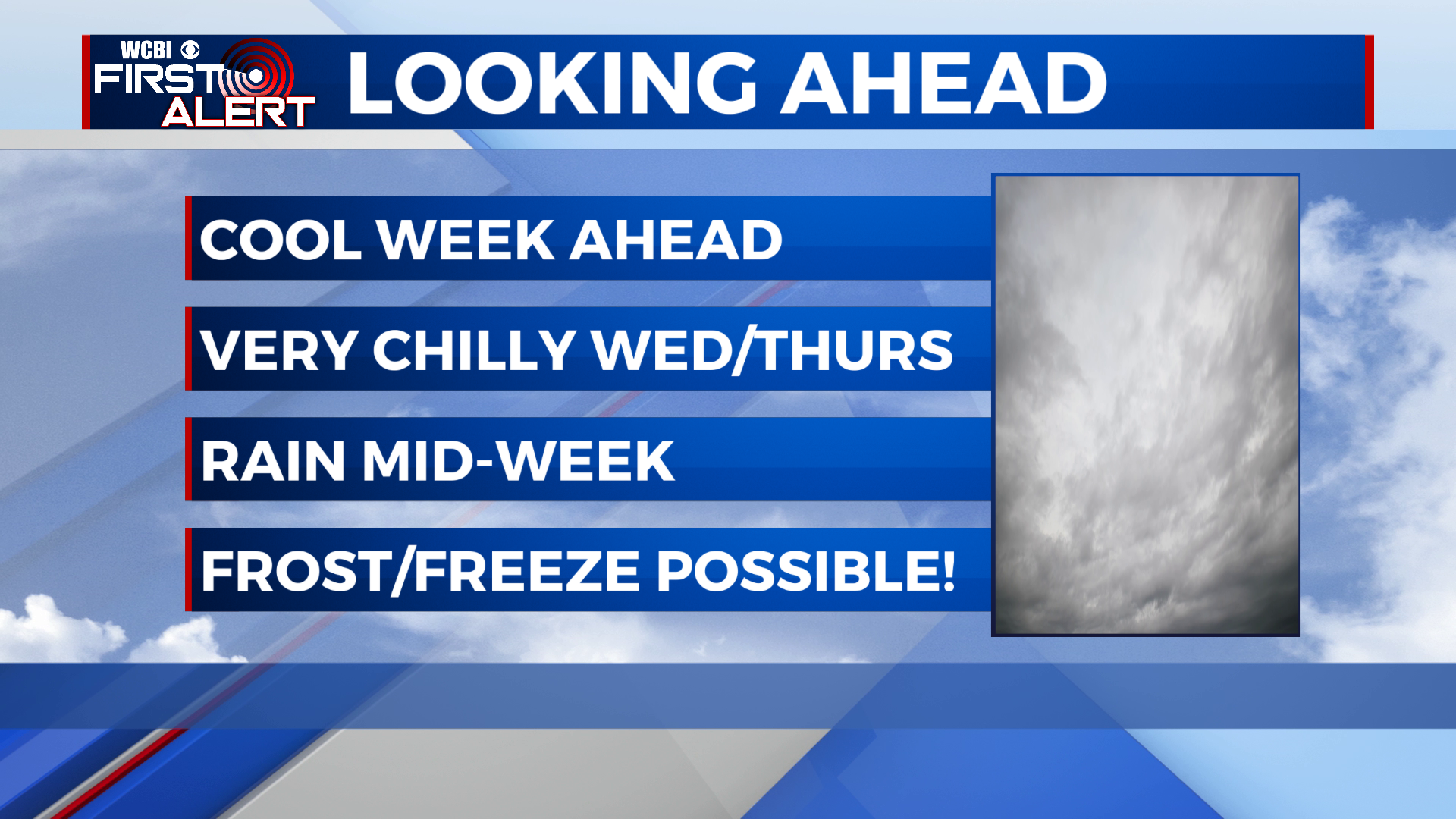
SUMMARY: Below average temperatures are going to be the theme for the upcoming week. After a warm and nice Monday, clouds begin to move in for Tuesday, dropping highs into the low 60s. Wednesday and Thursday look very chilly, with highs more typical of the dead of winter! It will be cloudy and rainy both days as well. Lows also tumble into the 30s, with a frost or freeze possible on several nights this week! Some moderation occurs by Friday, with sunshine returning but we’ll stay chilly and dry through the weekend.
SUNDAY NIGHT: Halloween night is looking chilly and clear, with a low in the mid 40s.
MONDAY: Monday will be the warmest day of the week ahead, with a high topping out near 70 in the afternoon with lots of sunshine.
MONDAY NIGHT: We’ll stay clear for Monday night, with lows in the mid 40s once again.
TUESDAY: A cold front approaches the area beginning Tuesday, with cloud cover increasing through the day. We’ll stay dry but highs look to be cooler in the low to mid 60s.
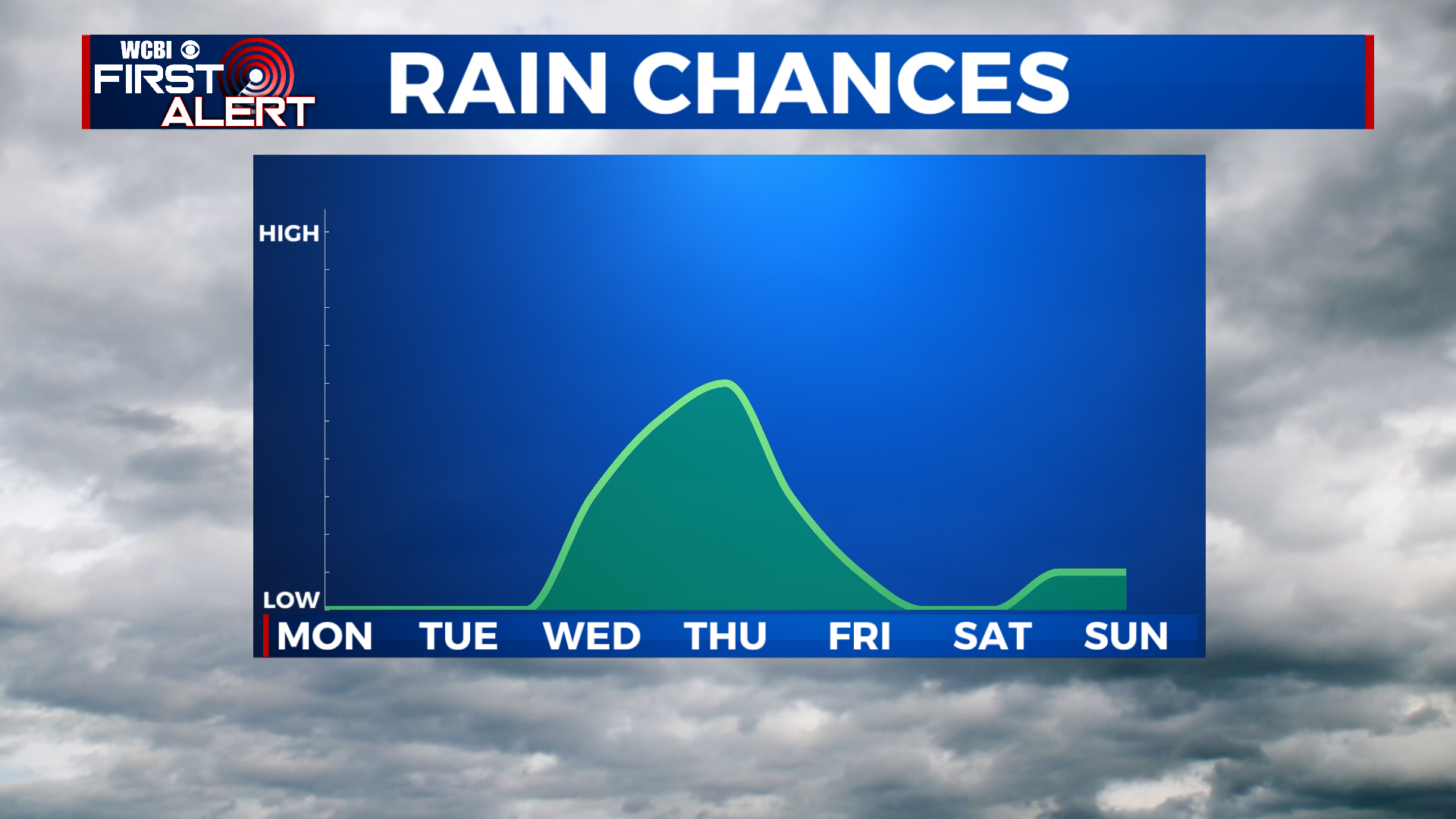
WEDNESDAY TO SUNDAY: There is a lot of disagreement in the weather models for the late week forecast, but plan on it being very chilly for early November. Wednesday, highs will struggle to get to the 50s with cloudy skies and showers. Lows drop to the mid 40s Wednesday night and we look to stay in the 40s for the entirety of Thursday! Rain showers and cloudy skies will continue. As things clear out Thursday night, temps will fall into the 30s, with some sheltered locations waking up to frost on Friday! Friday to Sunday is looking dry and cool, with highs staying in the mid to upper 50s. Friday night looks to be the coolest in the forecast, and some places may drop below freezing. Lows remain in the 30s for the weekend.
CONNECT WITH @WCBIWEATHER ON TWITTER, FACEBOOK AND INSTAGRAM