Above average temperatures ahead as warming trend ensues
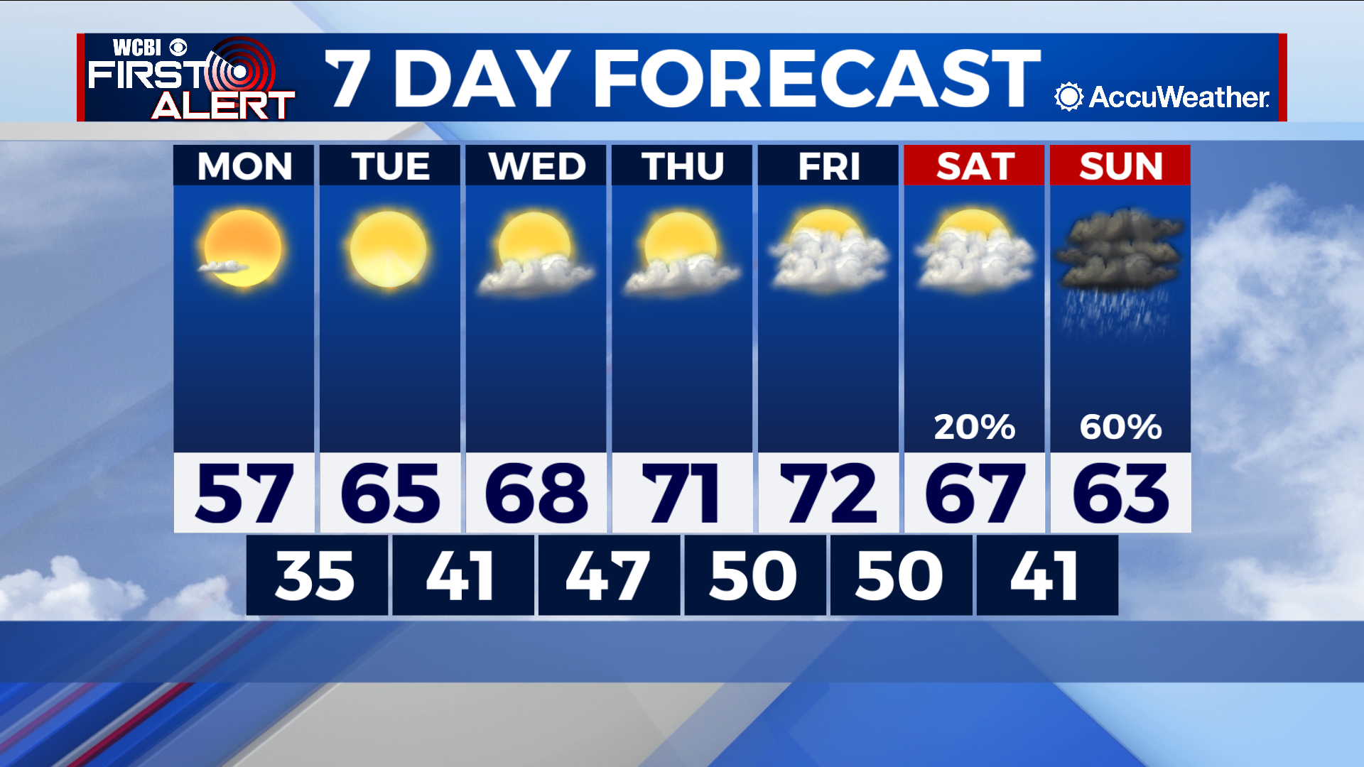
COLUMBUS – SUMMARY: Temperatures become much more comfortable this coming week, climbing into the low 70s by Thursday. Our week remains mostly dry until the weekend, when rain chances return to the forecast. Skies will start clear this week, with widespread cloud cover making an appearance by Friday.
MONDAY: Cool temperatures remain in the area with highs topping out in the mid 50s. A dry pattern and mostly clear skies accompany and otherwise cool day. Lows drop into the low 40s overnight.
TUESDAY: A significant jump in temperatures into the 60s is expected Tuesday. Not a cloud in the sky is expected as the dry pattern continues its course. Overnight lows also improve into the high 40s.
WEDNESDAY: The warming trend slows a bit, but continues to bring afternoon highs closer to the 70s. Look for the afternoon maximum to reach the high 60s Wednesday. Lows also improve into the low 50s. Some clouds return but the dry pattern maintains its stranglehold on the week.
NEXT WEEK: Highs will peak in the low 70s Friday before a gradual cooling trend sets in. Lows will slowly increase into the high 50s by Saturday night. Cloud cover will become increasingly dense as rain chances return for the weekend. A cold front overnight Sunday looks to aid in the drop in temperatures the following week.