Active weather pattern remains in place through the weekend
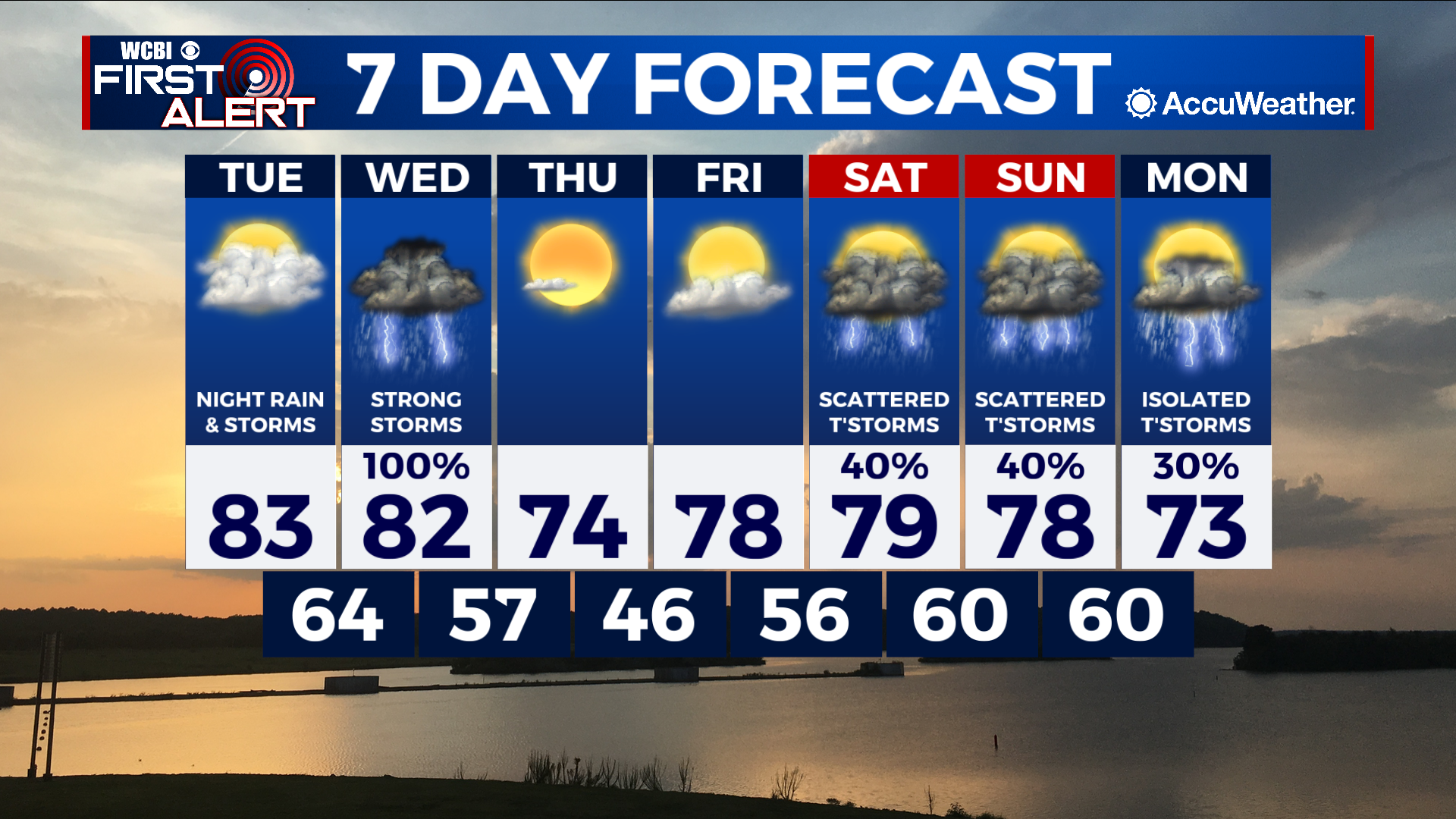
COLUMBUS, Mississippi (WCBI) – SUMMARY: Showers and thunderstorms moved through the region today, but cleared the area this afternoon. More storms are expected this week with severe weather likely Wednesday.
TONIGHT: A stray shower or thunderstorm is possible before midnight, then partly cloudy overnight. Lows in the low-60s. South wind: 5-10 mph with gusts up to 20 mph. Chance of rain: 20%.
TUESDAY: Mostly sunny and warmer with highs in the low-80s. Breezy South winds 5-10 mph with gusts up to 20 mph.
TUESDAY NIGHT: Showers and thunderstorms likely. Some storms may be severe. South winds 5-10 mph with gusts up to 20 mph. Chance of rain: 60%.
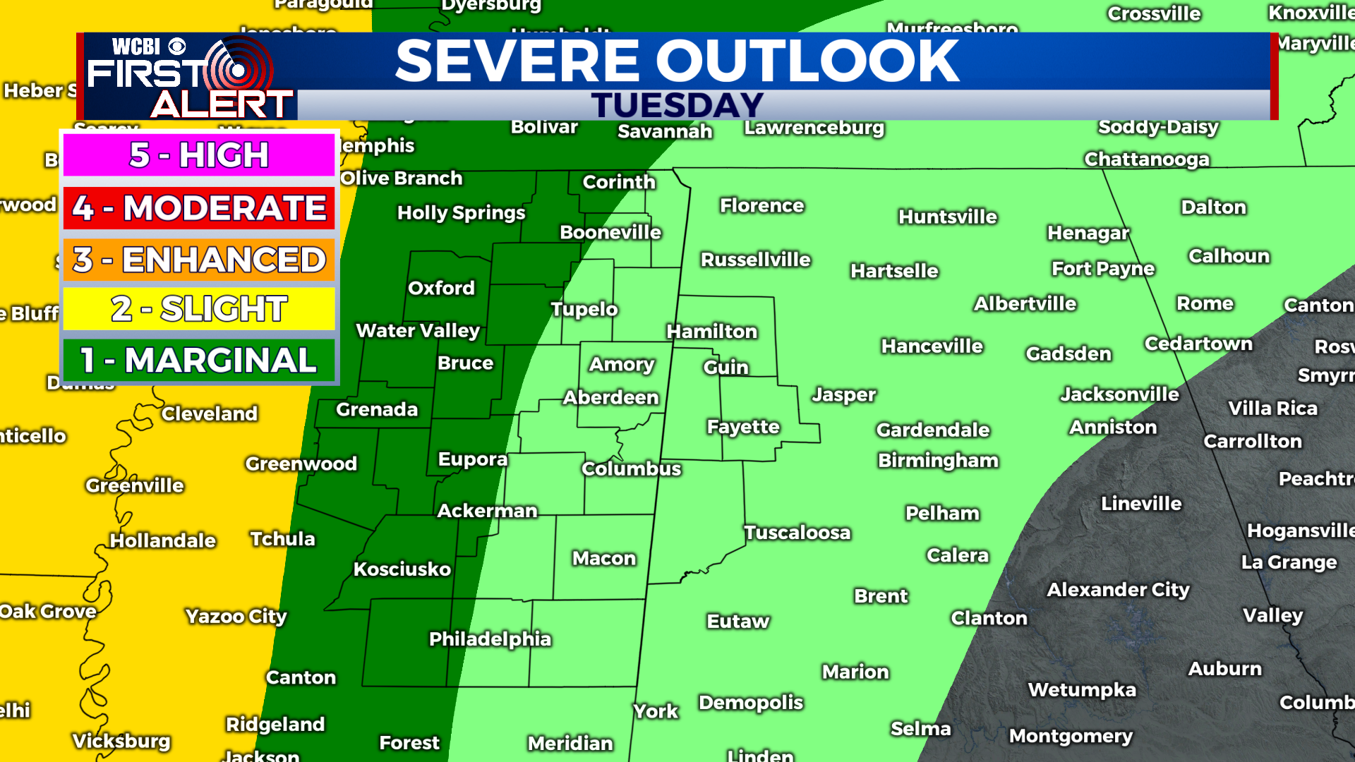
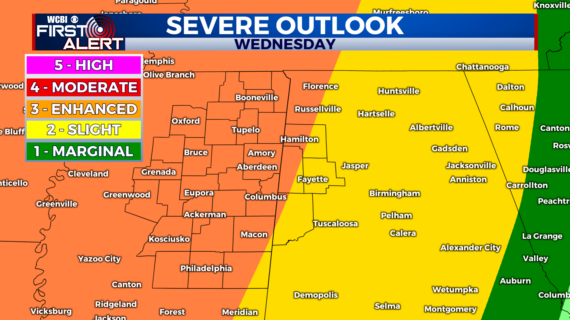
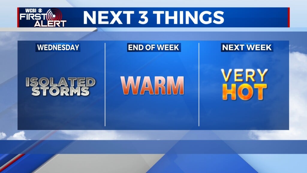
EXTENDED FORECAST: The focus of this week’s weather will be the threat of severe thunderstorms Wednesday. As of now, the primary threat of severe weather will arrive during the afternoon and evening, but a few isolated strong thunderstorms will also be possible Wednesday morning. All forms of severe weather will be possible including tornadoes, damaging wind gusts, and large hail. A few tornadoes may be particularly intense… and I do not use those words very often.
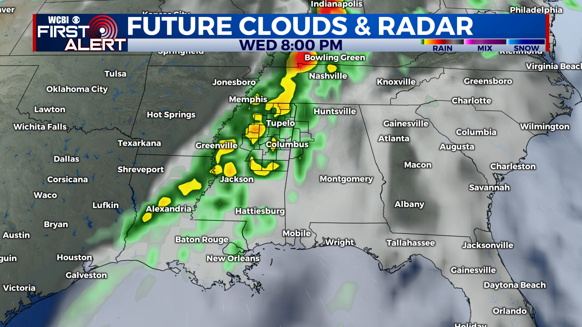
Therefore, it is important to remain weather aware Wednesday and have multiple ways to receive severe weather warnings. In addition, now is the time to consider your severe weather action plan. If you live in a mobile home, you will need to be prepared to relocate to a site-built structure or storm shelters in advance of severe weather. This means consider the amount of time to collect your belongings and family, then include travel time to the safe location. Then add an extra 10 minutes. I realize this is asking a lot, but this is the time of year we need to place safety above anything else. Just be safe.
Of course we will be live streaming on our Facebook Page, WCBI.com, and on local TV should tornado warnings be issued within our viewing area.