Afternoon storm chances next few days
COLUMBUS, Mississippi (WCBI) – As tropical moisture returns, afternoon storm chances become the norm for the next few days.
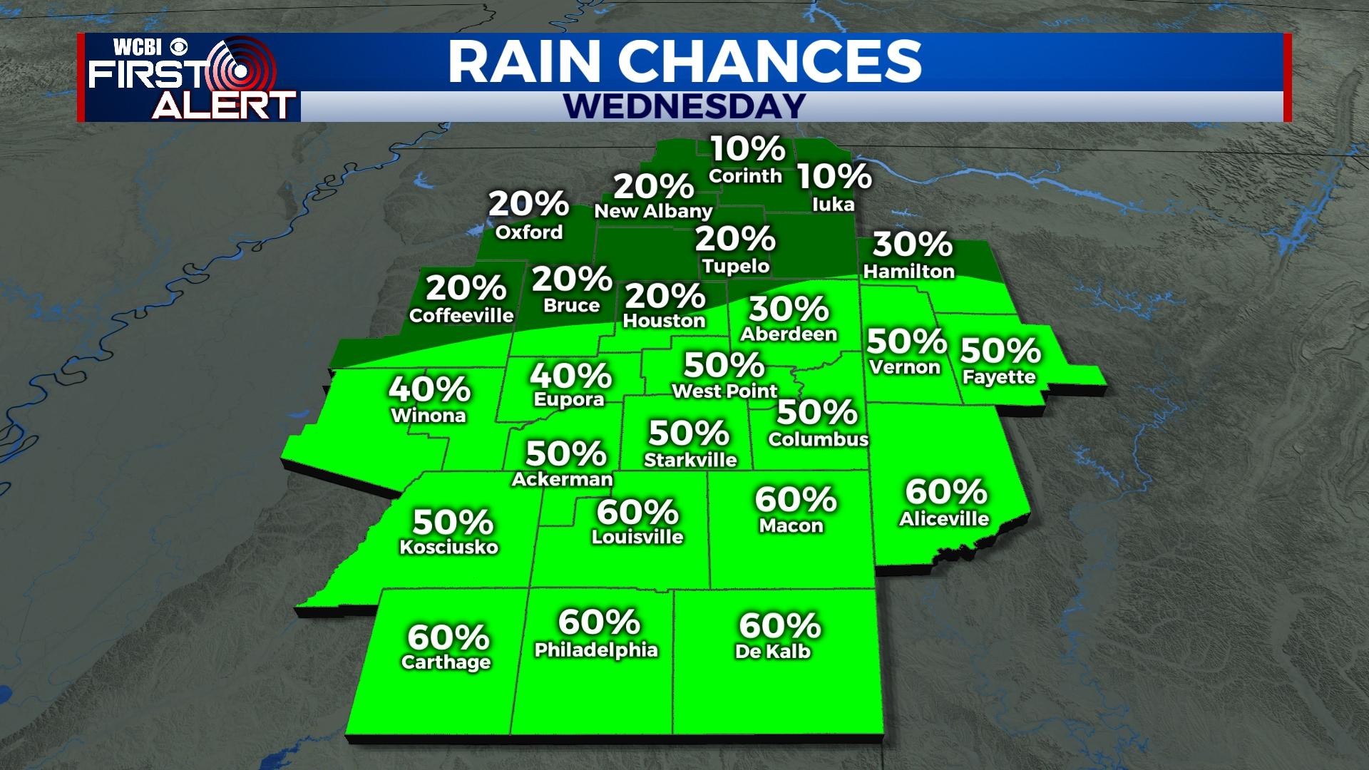
WEDNESDAY: Warm and increasingly humid weather leads to building afternoon storm chances, starting today. Before any storms move in from the south, highs reach the 90-93 degree range with hotter readings in the north. Scattered downpours and embedded storms are most likely from 3-9p.
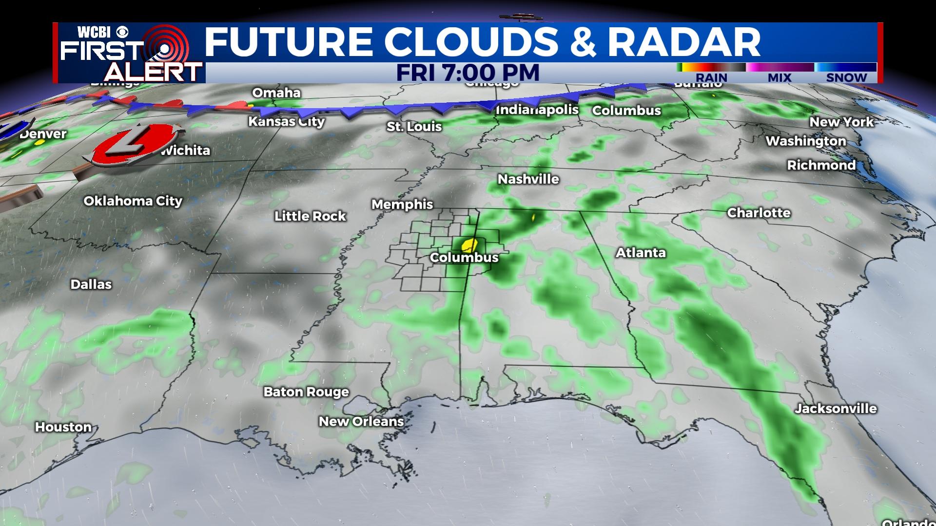
REST OF WEEK: Scattered, mainly afternoon storms continue Thursday and Friday as highs stay in the upper 80s. An important reminder – coverage will be seemingly random and rain distribution will be uneven.
WEEKEND: Looking ahead to the long holiday weekend, scattered storms stay likely Saturday ahead of a potentially drier Sunday. Forecast models remain a bit inconsistent as to potential rain coverage, so stay tuned for updates!
NEXT WEEK: Mid-level ridging could build back in across the Southeast, and this could mean another period of hotter and drier weather is in store. However, models in the mid-range are still split on the pattern evolution. We still expect at least a handful of afternoon storms on Monday and Tuesday with highs at least in the low 90s.


