An amazing Friday & weekend ahead
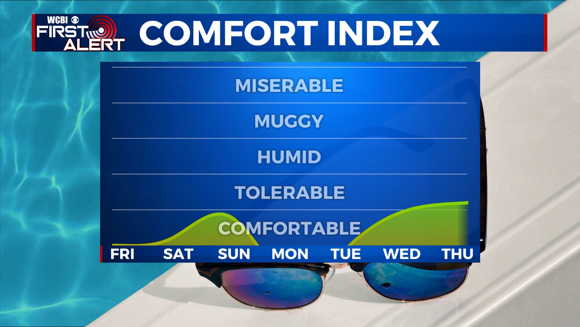
SUMMARY: A series of high pressure systems will keep our region mainly sunny through next week. A weak disturbance will push through the region late Saturday night into early Sunday that will provide us with a second shot of cooler, drier air Sunday into Monday. The 90s and the humidity will make a comeback midweek next week.
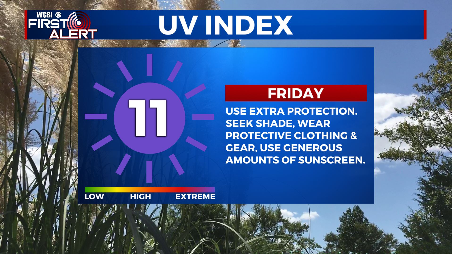
FRIDAY: Sunny and warm as high pressure remains in control. Highs in the mid to upper 80s. Winds NE 10-20 mph. Gusts up to 25.
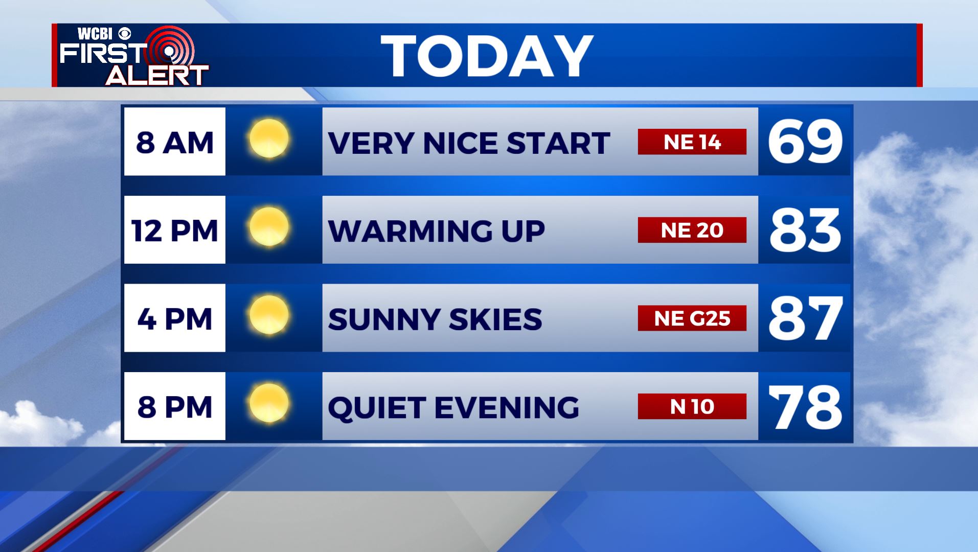
FRIDAY NIGHT: Clear skies and quiet. Still comfortable and refreshing overnight lows in the lower 60s.
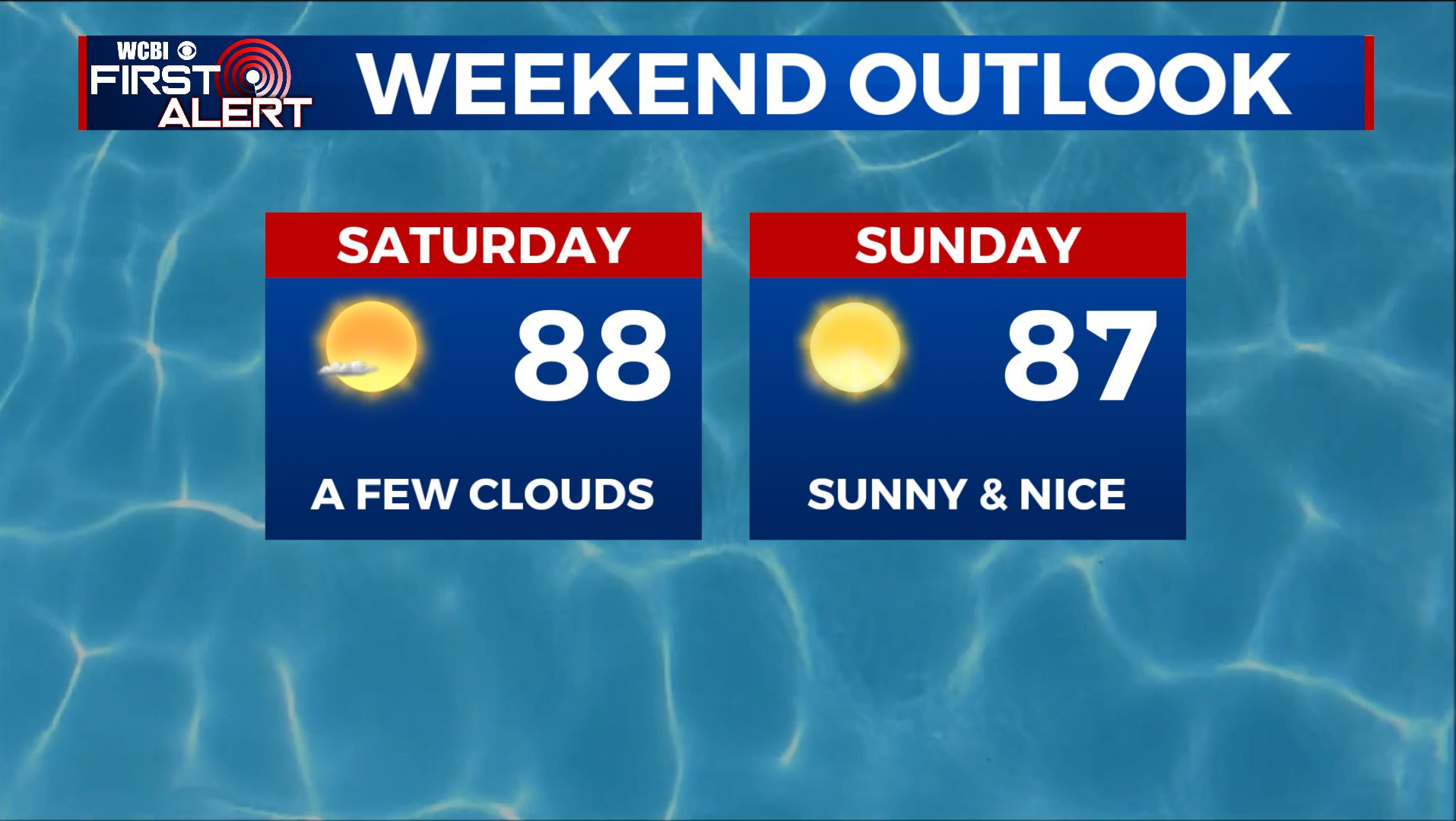
SATURDAY: A few clouds but mainly sunny as a weak disturbance pushes through the Mid-South. Highs in the upper 80s.
SATURDAY NIGHT: Staying clear and quiet. Overnight lows near 60.
SUNDAY: Lots of sunshine, dry and staying pleasant for June as the front brings in another shot of cooler, less humid air. Highs near average in the mid to upper 80s. Clear skies during the overnight hours with lows in the upper 50s to lower 60s.
MONDAY: The sunshine continues and staying dry to start the new workweek. High temperatures remain the the mid 80s. Overnight lows in the upper 50s to lower 60s with mostly clear skies.
TUESDAY-THURSDAY: Still sunny overall. Highs warming back up a bit to the lower 90s with the humidity making a comeback.
Stay connected with @WCBIWEATHER on Facebook, Twitter, Instagram, and the WCBI News App


Leave a Reply