An Unsettled Weather Pattern
Conditions will be dry Monday but then rain and storms return
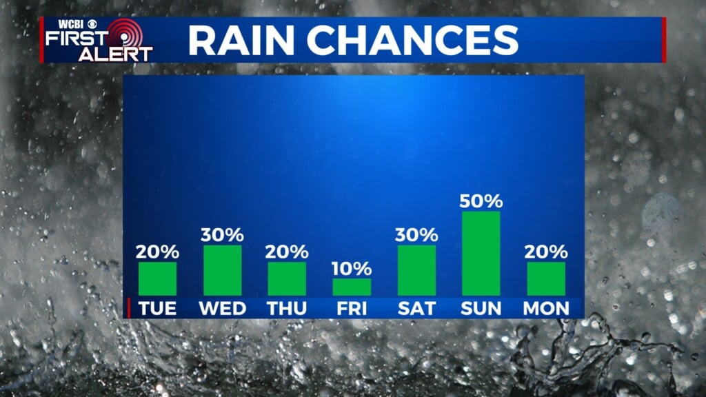
COLUMBUS, Mississippi (WCBI) – Rain and storm chances remain in the forecast along with above and below average temperatures
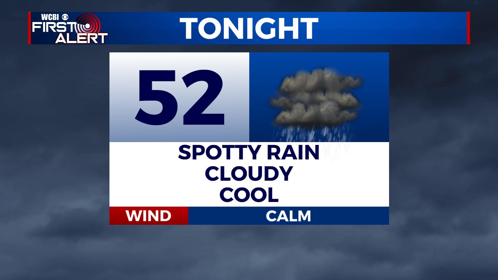
TONIGHT: A saturated atmosphere will carry us through the overnight allowing for fog development in some places. Thick cloud cover will remain overhead with temperatures falling into the low 50s.
MONDAY: Although conditions will be dry, skies will be mostly cloudy. Temperatures will peak in the low to mid 60s.
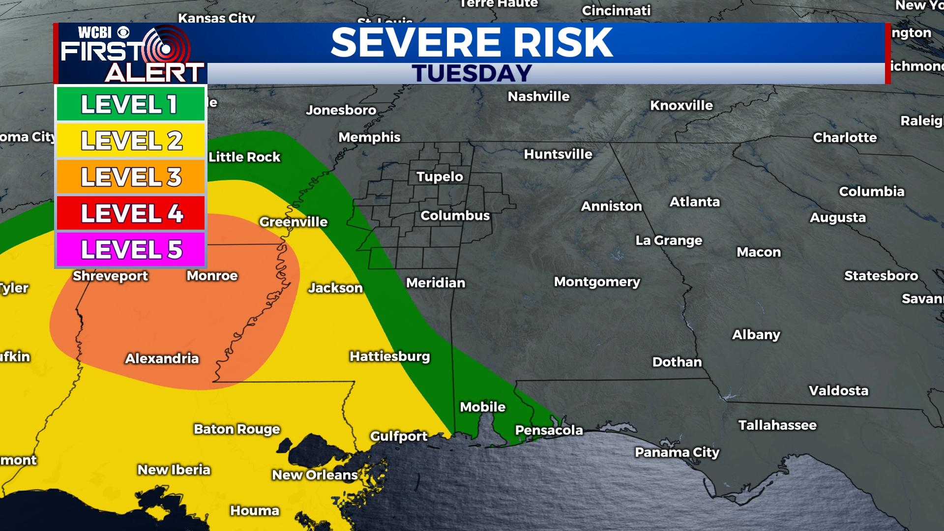
TUESDAY/WEDNESDAY: Rain and storm chances return Tuesday afternoon. An anticipated cold front is expected to sweep across the Southeast associated with a low-pressure system. The timing of the projected system appears to allow the bulk of storms in our area late Tuesday night into Wednesday morning. Some of the storms could be severe. It’s too early to state specific timing/impacts as the forecast is subject to change. The WCBI Weather Team will keep you informed!
REST OF THE WEEK: Following this system, northerly flow is expected to rush cold, dry air to the South. Temperatures will drop to the 50s then 40s as we say hello to a new weekend!