Another chance of rain & storms likely for Wednesday
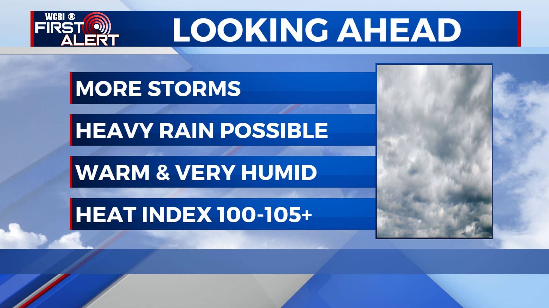
SUMMARY: A stationary front across the Deep South will help keep our weather a bit unsettled as we head into the middle part of the workweek. We’ll still have those daily chances of afternoon showers & storms. We’ll have better chances Wednesday through Friday. It will remain hot & humid with highs in the upper 80s to lower 90s. Rain & storm chances though will start to scale back this weekend into early next week.
WEDNESDAY: We’re waking up to a few clouds with temperatures in the 70s. We do have a few light showers/sprinkles moving in from the west. We’ll have likely chances of rain and storms by the afternoon. Some spots may see some locally heavy downpours, gusty winds and lightning in stronger storms. The rain & cloud cover will help high temperatures be a bit cooler in the mid 80s.
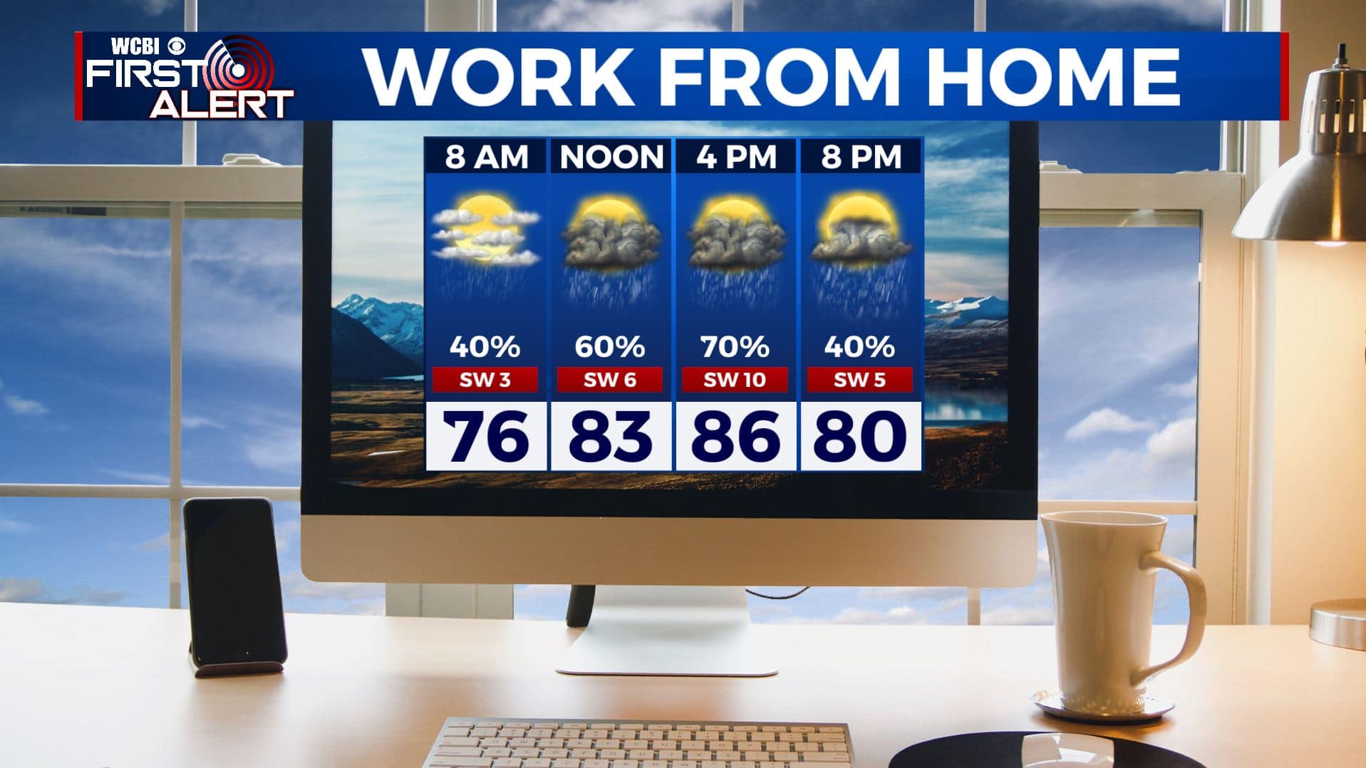
WEDNESDAY NIGHT: We’ll have partly cloudy skies after showers and storms end early in the evening. Overnight lows in the low 70s.
THURSDAY: Still likely chances for showers and storms. Remaining warm & humid. High temperatures in the upper 80s to lower 90s with overnight lows in the 70s.
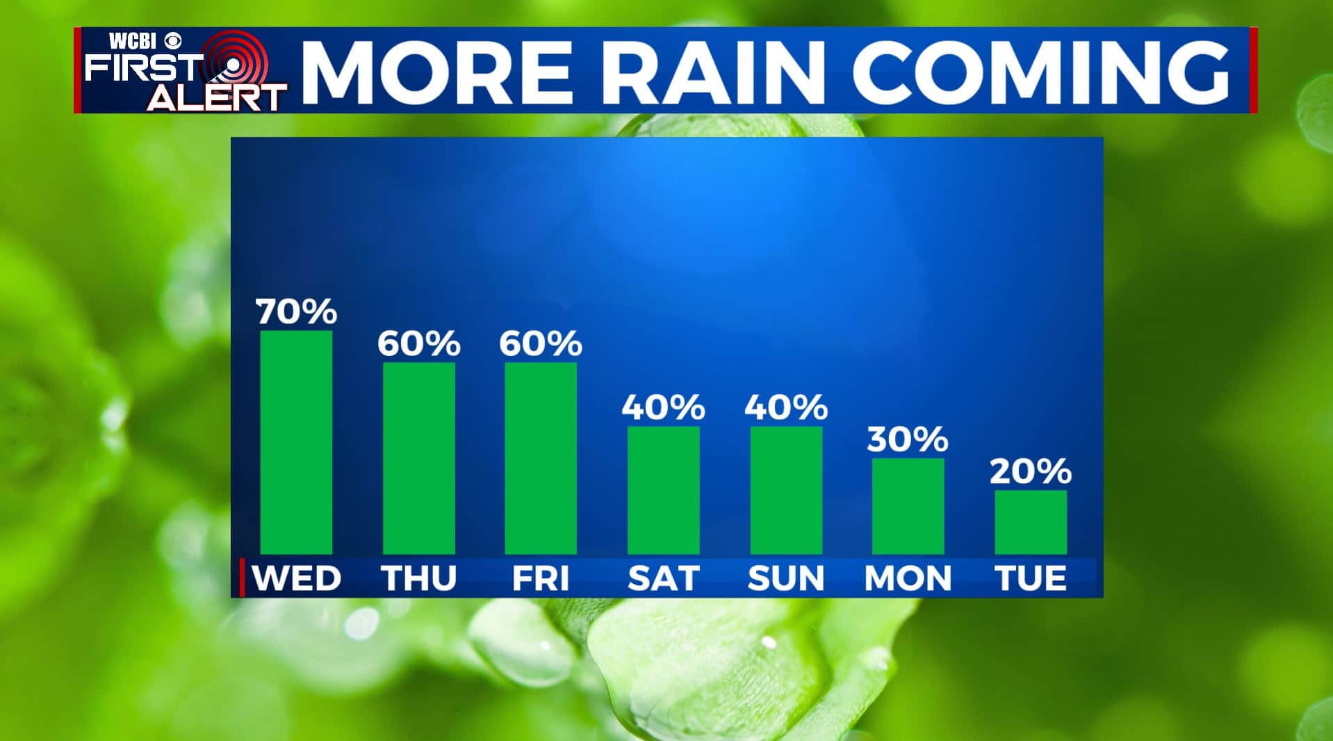
FRIDAY-MONDAY: Warm and steamy with highs in the lower to mid 90s and heat indices in the 100-105° range so you will need to stay cool & hydrated. We could have a few storm complexes that roll down from the Plains from time to time. Those could be wind and rain producers if they do pan out. It’s sometime we’ll be watching.
TUESDAY: We’ll finally start drying out with more of a mix of sun & clouds with a very isolated chance of a shower or storm. Highs in the upper 80s to lower 90s.
Stay connected with @WCBIWEATHER on Facebook, Twitter, Instagram, and the WCBI News App


Leave a Reply