Another day, another storm chance
COLUMBUS, Mississippi (WCBI): Here we go again folks! Today and tomorrow have back-to-back severe storm chances, with sweltering conditions.

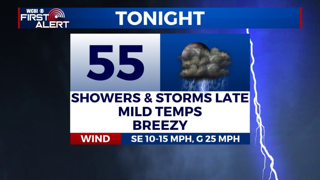
TODAY/TONIGHT: Temperatures will increase fast, with the heat index approaching the upper 90s to 100 degrees by 10am-12pm. High temperatures will be in the low 90s. Once we hit peak heating around 12pm-3pm, storms will develop and have a chance to become severe posing a damaging wind and hail threat. Storm activity should dwindle with time tonight, yet they should persist later into the evening than last night.


SATURDAY: The most widespread of the storminess will happen mid-day to mid-afternoon Saturday. The entire coverage area is under a level 2/5 severe risk, mainly for straight line winds and some 1.00″ hail. Luckily, the tornado threat is very minimal, but we will watch the radar like hawks in any case. Another hot, hot, hot day with the heat index rising to near 100 degrees.
SUNDAY: There may be residual storminess from Saturday’s storms Sunday morning before more develops Sunday afternoon. High temps take a step back into the mid 80s, so an improvement, but it will be far from comfortable with the humidity. We may not have as much storm coverage in the afternoon than the past few days, but they will be around.
BEYOND: Storm chances and rain chances will persist for the remaining days on the 7-Day. For the most part, they should be garden variety summer thunderstorms, but of course we will keep an eye out for anything more worrisome.