Another week, another severe weather risk
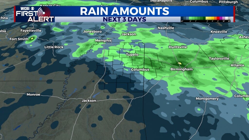
COLUMBUS, Mississippi (WCBI)- The rain this morning cleared out and allowed for major clearing to take place. This brought in sunshine and warm temperatures. Round 2 of the rain chance for this week will move in tomorrow afternoon, with a potential severe risk.
TUESDAY NIGHT: Patchy fog is going to be moving in overnight and into Wednesday morning. Cloud coverage will also be filling back in ahead of the system moving into the Deep South on Wednesday. Overnight low temperatures will fall into the middle 50s.
WEDNESDAY: The morning will begin with patchy fog across NE Mississippi. Heavy cloud coverage and scattered rain showers will be seen throughout the morning and afternoon. High temperatures are expected to make it into the middle 70s, ahead of the front. Into the evening, the warmer temperatures are going to help enhance the strength of the showers and storms. Between 7 PM and midnight is when our storms are looking to be the strongest, give or take a few hours.

Meaning once the sun starts to set, the plans may need to head indoors. There is a Level 2 – Slight Risk already issued ahead of this event. Heavy rain and gusty winds are likely. With this system, hail, damaging winds, or even a few embedded tornadoes cannot be ruled out. Temperatures into the night will be in the middle 50s.
THURSDAY: The temperatures are going to be in the middle 60s. A few left over showers may be possible within the morning hours. The cloud coverage will lighten up some, meaning the sun is going to be returning. Temperatures Thursday night will fall into the middle 30s.