April cool-down on the way, some frost possible
A late-season cold snap could put your plants in jeopardy on Thursday morning as temperatures fall to the mid 30s across the area. After a round of rain late Friday night and Saturday, temperatures will climb back above normal by early next week.
TUESDAY NIGHT: A cold front will pass through the area this evening, bringing much cooler air in, and perhaps a shower or two north of I-22. Any rain will be gone by sunrise Wednesday. Lows will be near 40 with a breezy northwesterly wind.
WEDNESDAY: After a few morning clouds, sunshine will develop through the day with temperatures remaining cool. Highs will only be in the low 60s with a breezy northwesterly wind continuing.
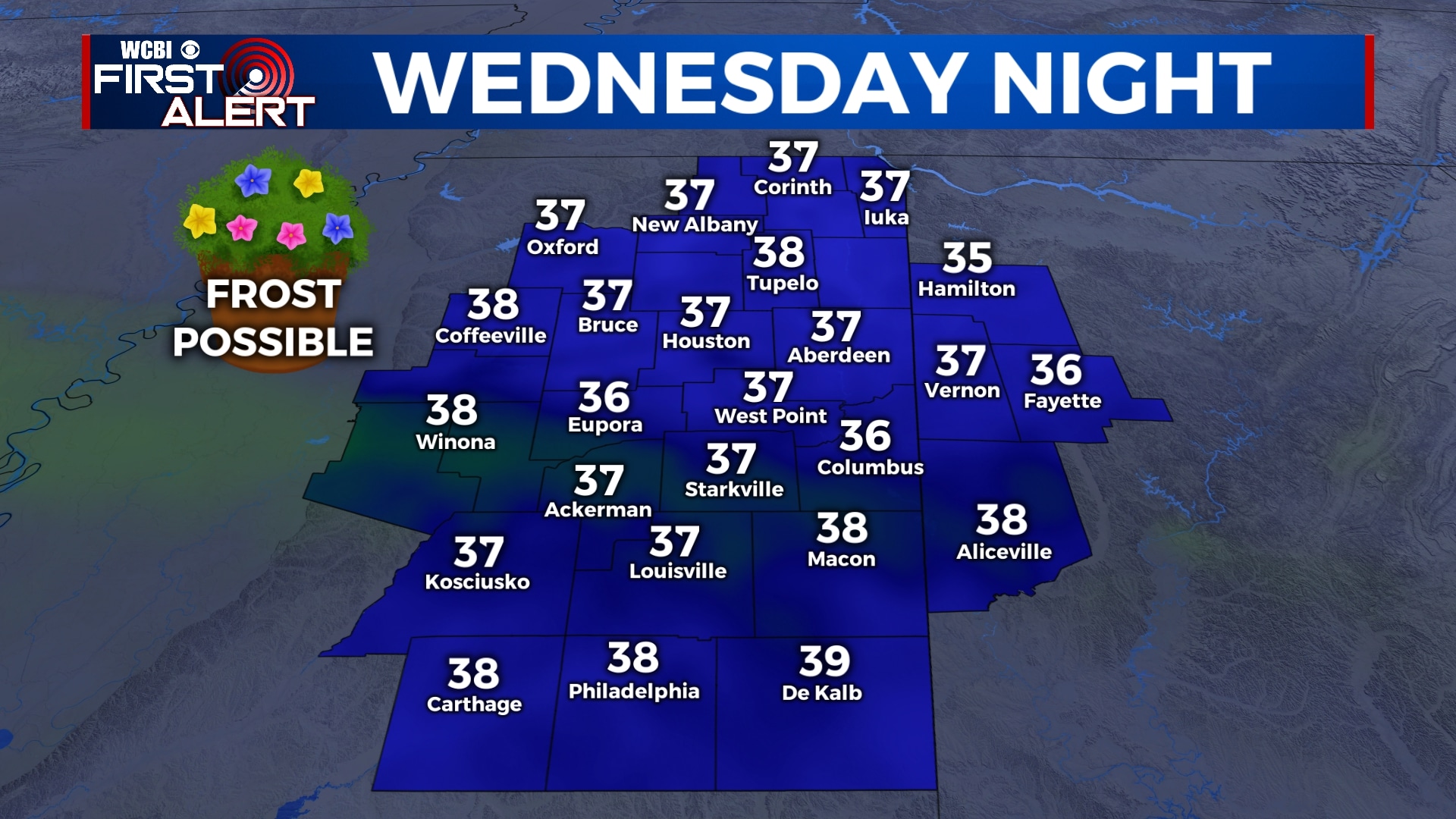
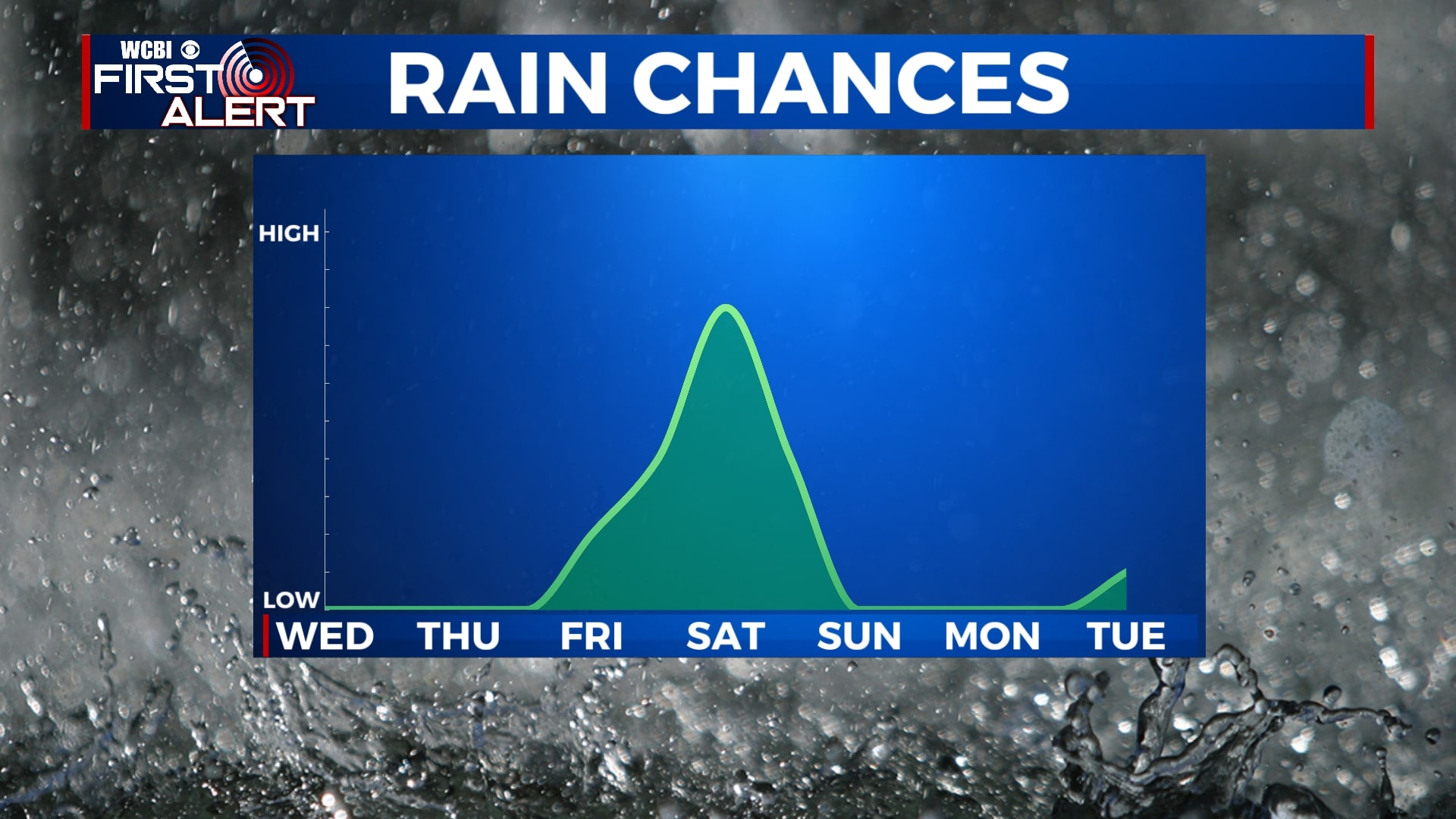
THURSDAY-FRIDAY: Temperatures will remain cool for the second half of the week with lows in the 30s and 40s and highs in the 60s. Some patchy frost is possible Thursday morning, so bring in or cover your plants Wednesday night. Skies will remain mostly sunny to partly cloudy, but rain will develop across the area Friday night after sunset.
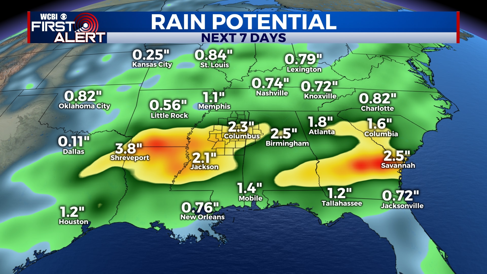
SATURDAY: Rain showers are likely through the day on Saturday, but fortunately, it appears the severe weather threat will remain to our south. However, we could see some heavy rain at times with totals between 1 and 2 inches. Rain could start to slack off later in the day on Saturday, so fingers crossed for that. Highs will be in the mid 70s.
SUNDAY-TUESDAY: Rain will exit by Sunday morning, leaving us dry for Sunday, Monday, and Tuesday. Temperatures will be warming back up with highs back in the low 80s for early next week. Overnight lows will remain in the upper 40s and 50s.
Follow WCBI Weather on Facebook, Twitter, and Instagram
Follow Meteorologist Trevor Birchett on Facebook and Twitter


Leave a Reply