A beautiful fall-like weekend is ahead
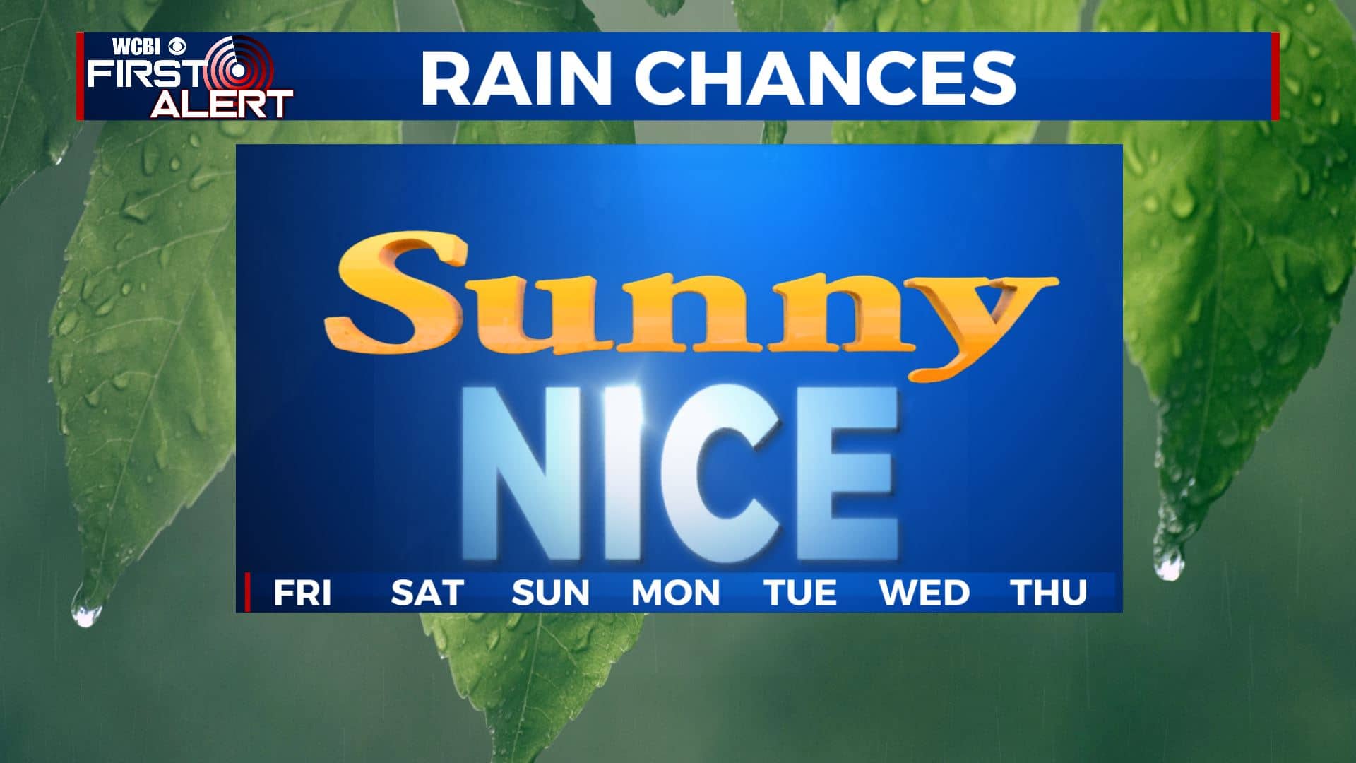
SUMMARY: Drier and less humid air is filtering in for our Friday as a cold front pushed through overnight, giving us some awesome and pleasant weather. We’ll have a mix of sun & clouds with highs in the upper 70s to lower 80s. It will continue this weekend into early next week as high pressure takes control. Enjoy!
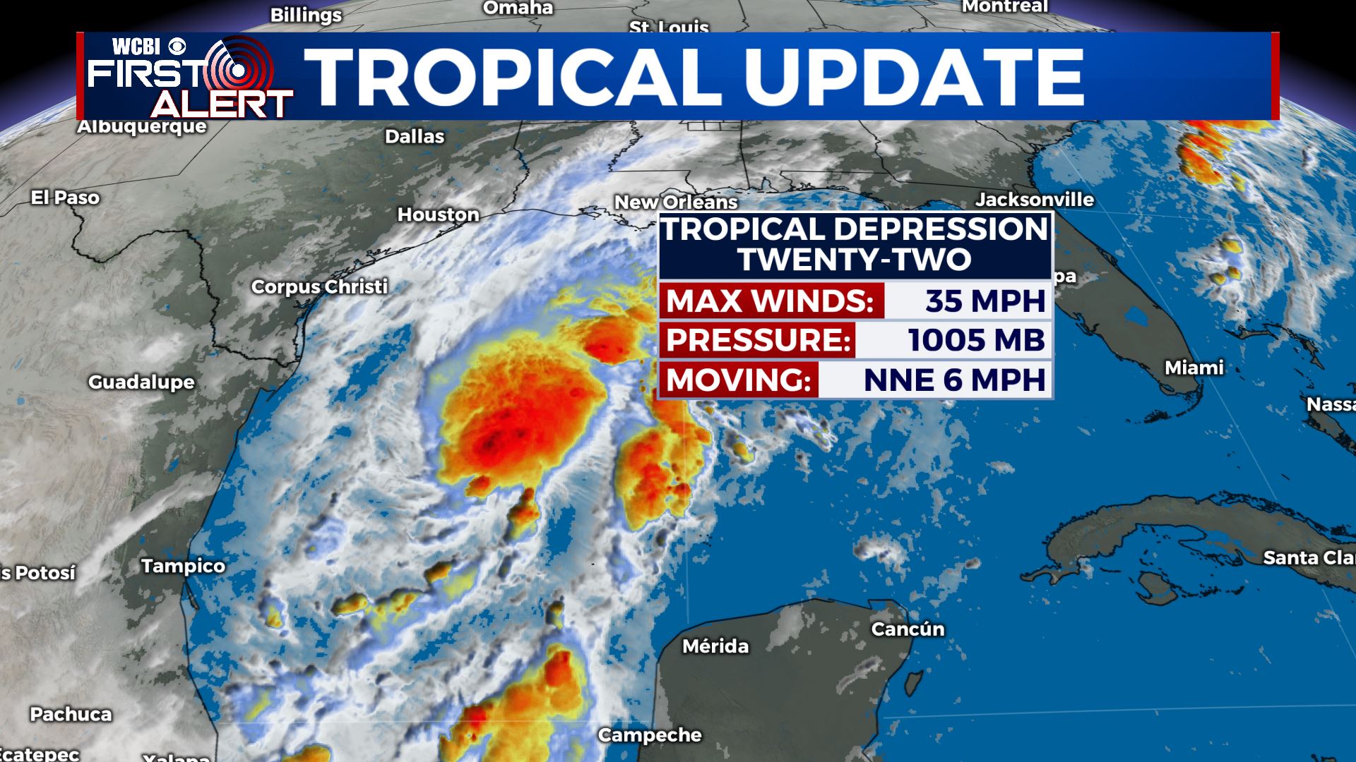
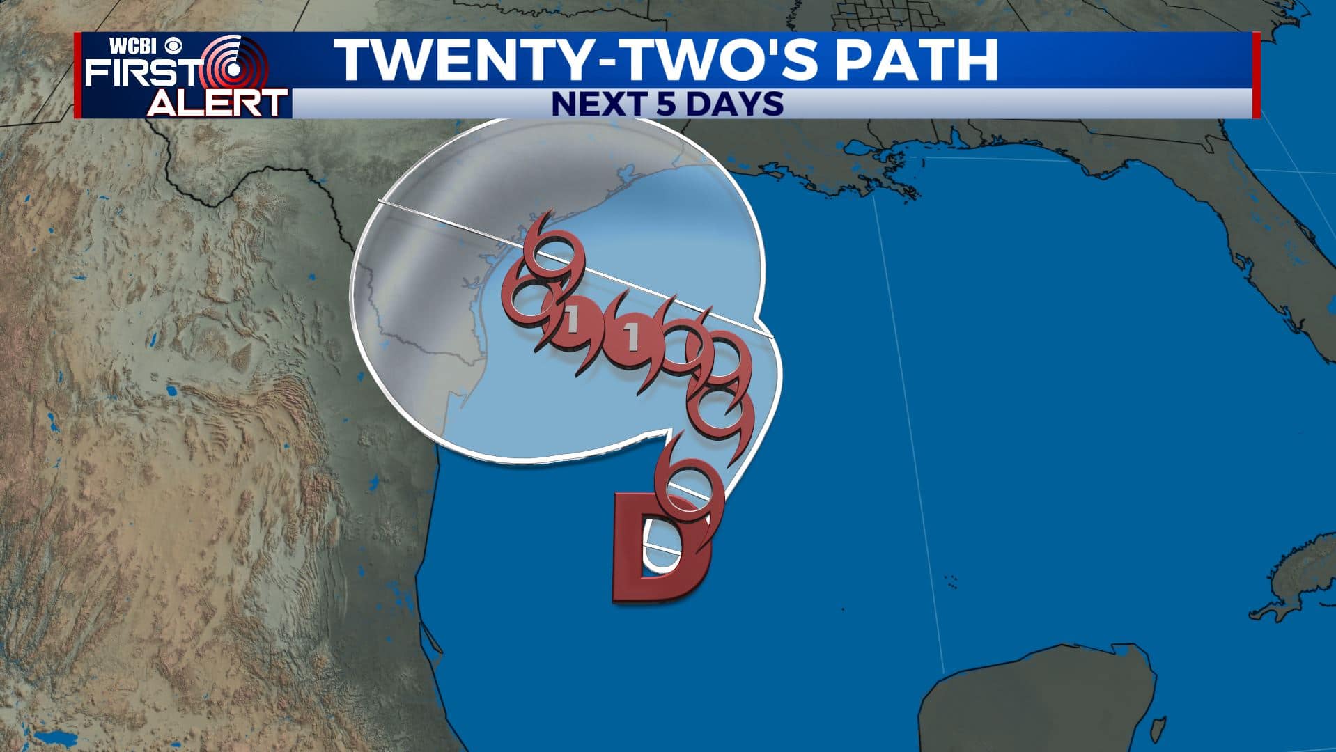
TROPICS: Tropical Depression #22 has formed in the southwestern Gulf of Mexico and most likely will become Wilfred over the next day or so. It is likely to meander around the western Gulf through the weekend but it’s still not out of the question that it could move towards the northern Gulf by the middle of next week. Stay tuned for updates!
FRIDAY: Fall-like weather is moving in for our Friday as a cold front pushed through. We’ll have a mix of sun & clouds with highs in the upper 70s to lower 80s.
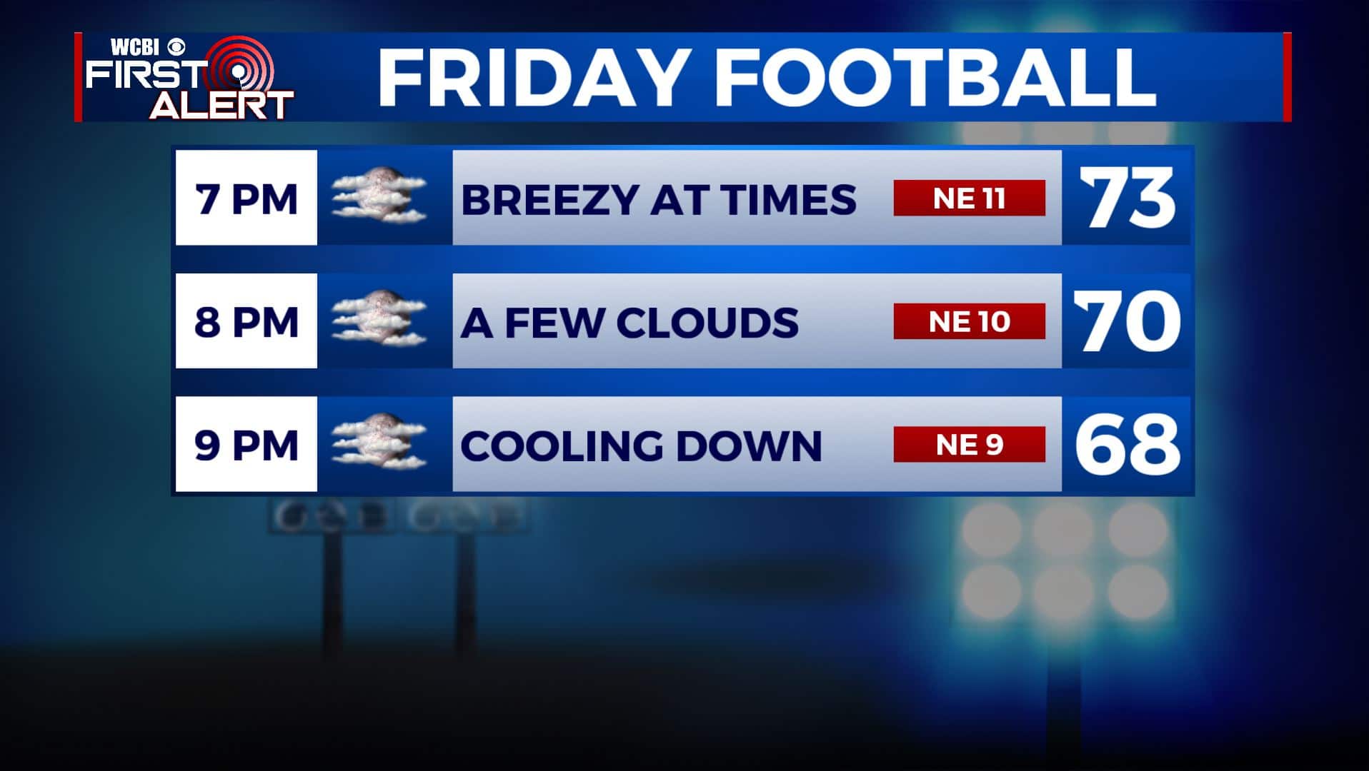
FRIDAY NIGHT: It’ll be amazing weather for high school football Friday evening. Have that sweater handy as temperatures will be in the 70s and 60s with partly cloudy skies. Overnight lows in the upper 50s.

SATURDAY: Clouds & sunshine. Refreshing as highs mainly stay in the upper 70s.
SATURDAY NIGHT: A few clouds and quiet. Overnight lows in the upper 50s.
SUNDAY-WEDNESDAY: A big area of high pressure centered to our north should keep dry air flowing our way. Lots of sunshine and pretty nice fall-like weather. Lower humidity levels will make it feel amazing to be outside with highs in the upper 70s to near 80 and comfortable overnight lows in the upper 50s.
Stay connected with @WCBIWEATHER on Facebook, Twitter, Instagram, and the WCBI News App


Leave a Reply