Beautiful Sunday and Monday, warmer air and humidity returns
While we’re enjoying some more comfortable air this weekend, warm and muggy weather will return through the week along with some rain chances. A second cold front could bring us another shot of comfortable air by next weekend.
SATURDAY NIGHT: Besides a few clouds passing by, we’ll be generally clear tonight and a touch cooler. Temperatures will fall to near 60 with a calm wind. Some spots could dip into the upper 50s by early Sunday morning.
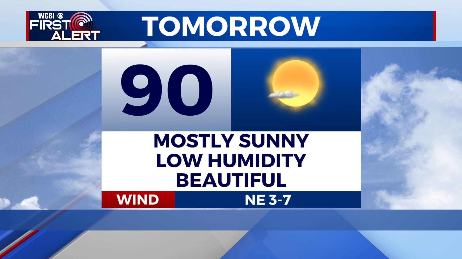
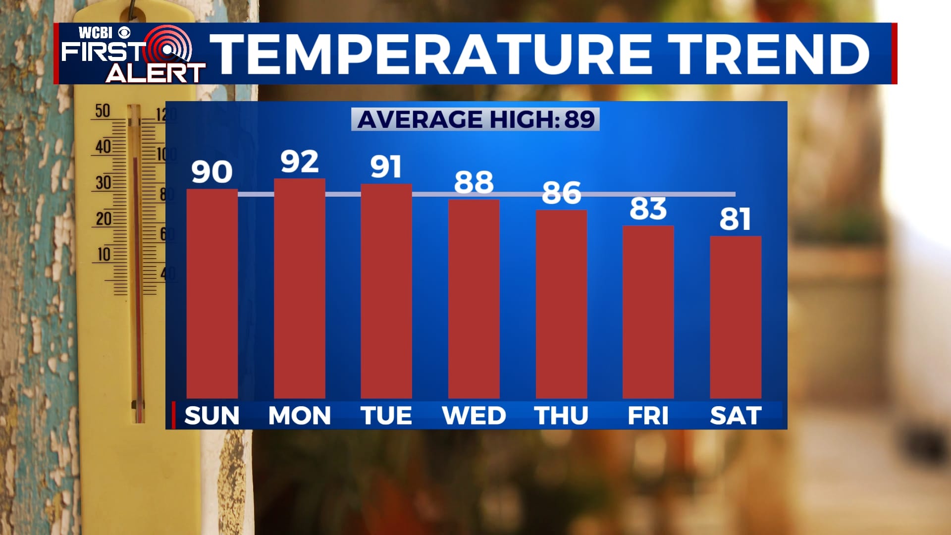
SUNDAY-TUESDAY: Temperatures and humidity will continue to increase by Labor Day with our typical humid air returning completely by the middle of the week. Fortunately, we will remain free of any rain through at least Tuesday and skies will remain mostly sunny. Highs will be in the low 90s with morning lows in the mid 60s.
WEDNESDAY-THURSDAY: A cold front will ever-so-slowly approach the area through the middle of the week, which will increase our chances for some showers and storms for Wednesday and Thursday. Temperatures will still be reaching the mid to upper 80s each afternoon with lows near 70.
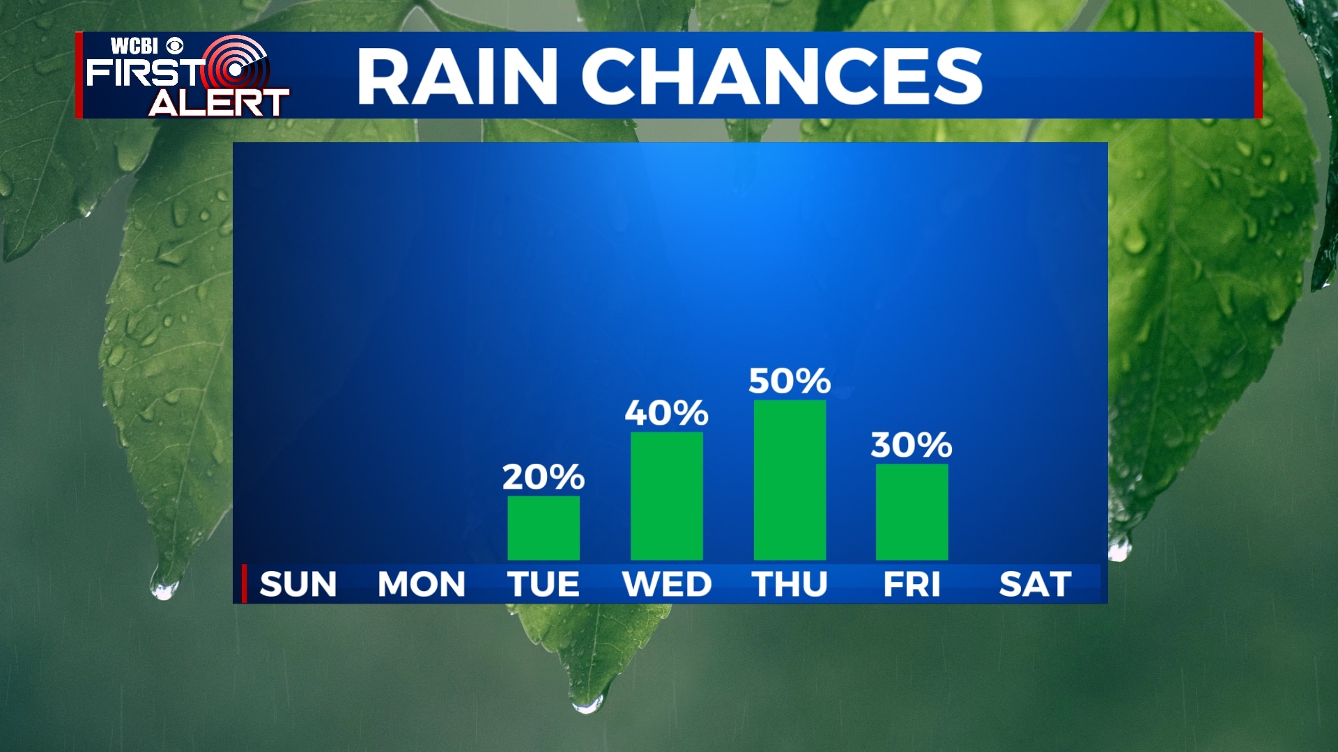
FRIDAY-SATURDAY: To be transparent, there is still some of uncertainty in the forecast for the end of the week and the weekend, so this could change. As of now, we expect the cold front to move through on Friday, decreasing our rain chances to 0% for Friday afternoon and next weekend. This front will likely drop our temperatures for next weekend with highs near 80 and overnight lows as low as the upper 50s. Depending on how far south the front can dig, we could even see highs in the 70s in some spots next weekend. Again, this can change, but this is the way things look for right now.


Leave a Reply