Beautiful on Sunday, Strong Storms Possible by Midweek
TONIGHT: Look for a clearing sky and falling temperatures. Winds shift out of the south and west 2-6 mph by morning with a clear sky. Lows drop into the 30s.
SUNDAY: We’ve got a beautiful day on tap! Highs climb into the upper 60s with some spots making it into the low 70s a real possibility! Look for winds out of the south and west 5-10 mph with abundant sunshine! Sunday Night lows drop into the 40s with a mostly clear sky.
MONDAY: We’re back into the upper 60s and low 70s with increasing clouds. A few showers are possible as early as Monday evening, particularly west of the Natchez Trace. Monday Night, scattered showers are anticipated with lows only in the middle 50s.
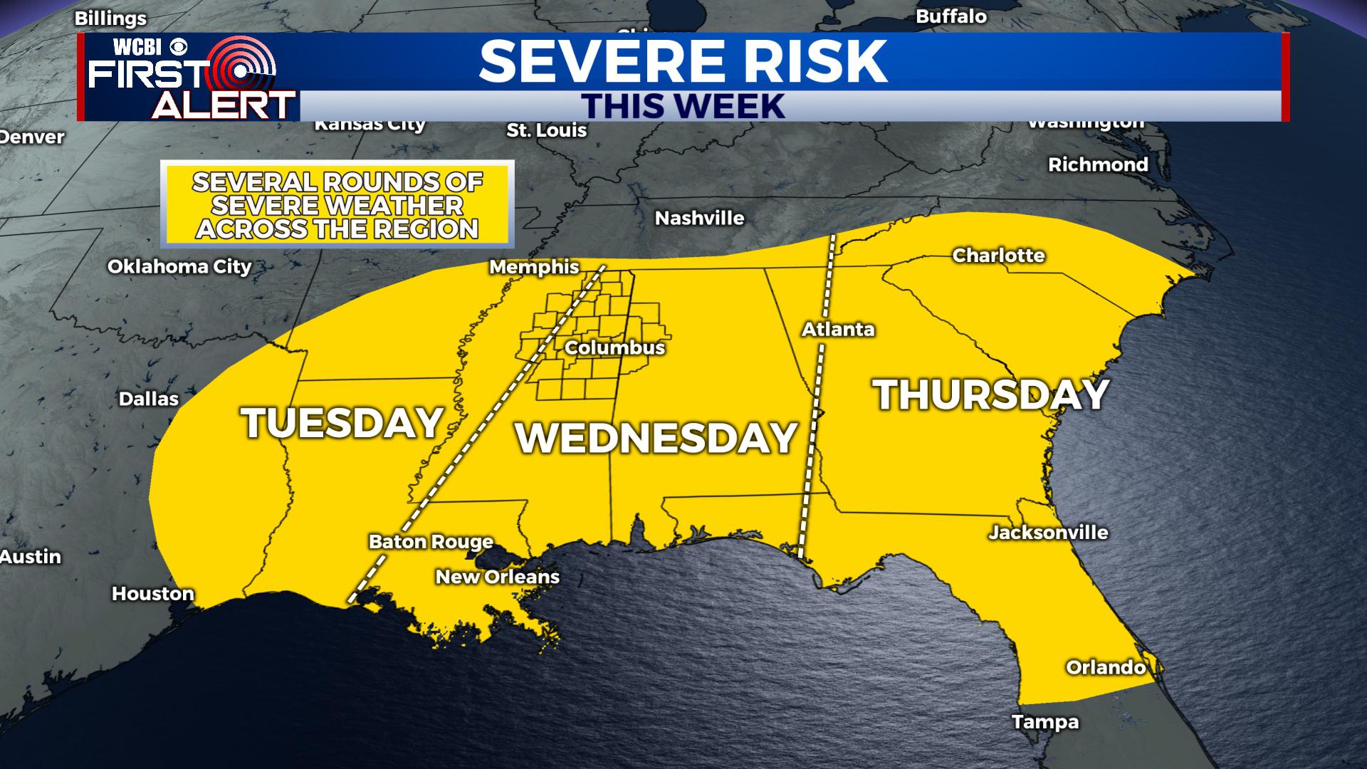
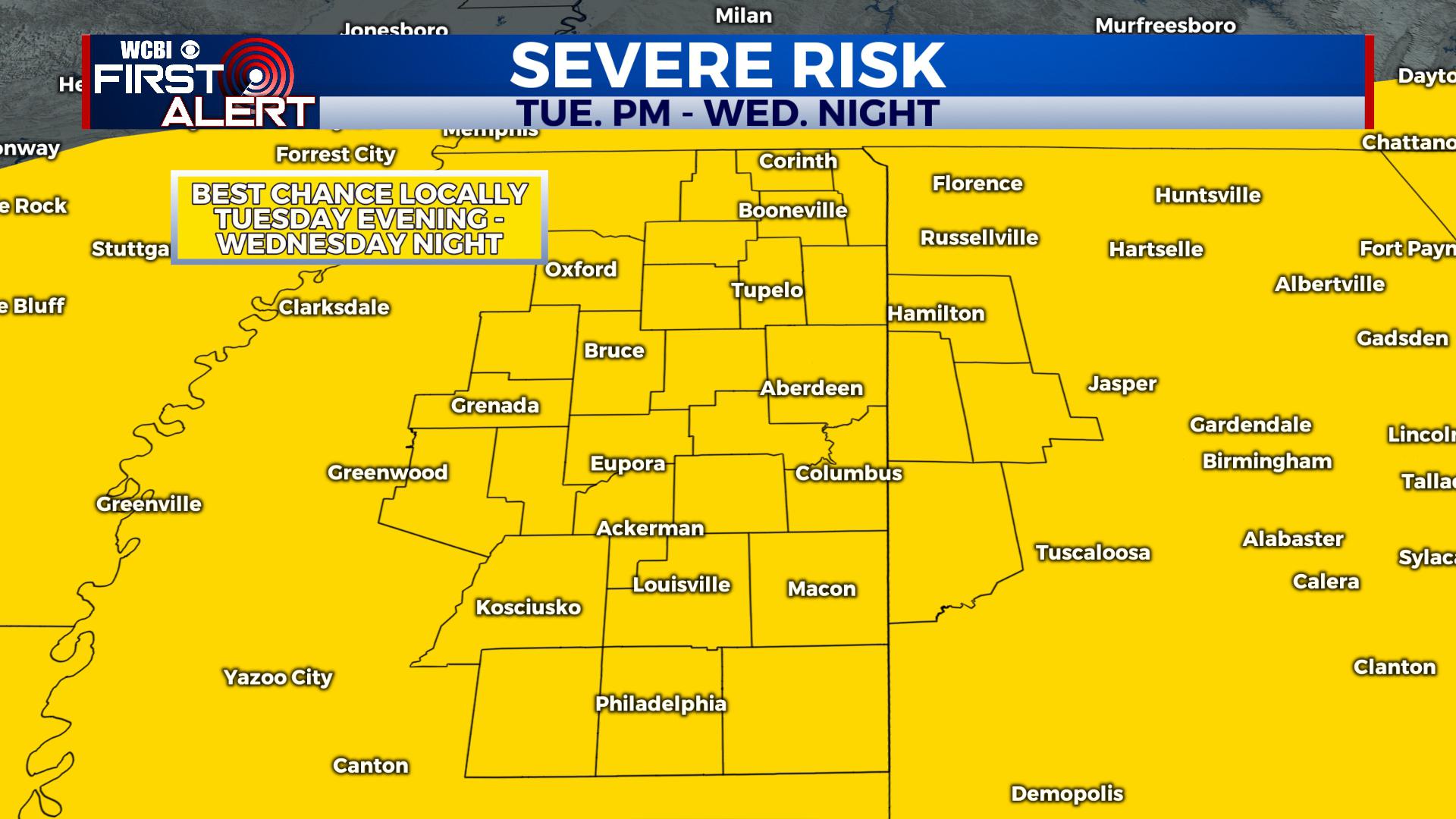
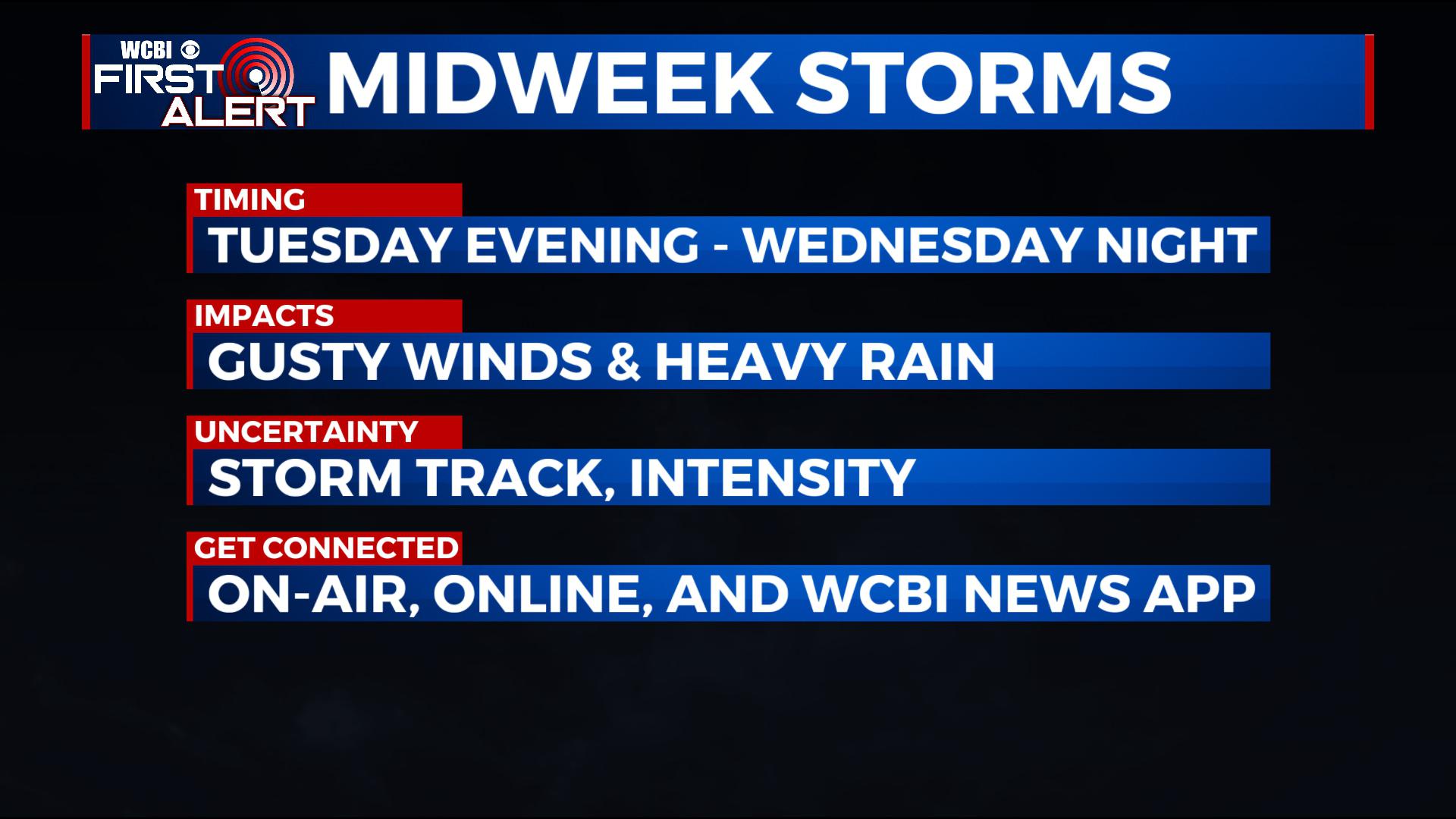
TUESDAY – WEDNESDAY: We’ll advertise a mostly cloudy day, but some sunshine is possible. Look for showers and thunderstorms to build to the west and approach our area. We think it could come as several rounds through the area, and a few strong storms are possible, particularly along the cold front. Still, some uncertainty remains, including the track of the storm system and the intensity. As of now, we’ll advertise the main threats as gusty winds and heavy rain. Once the cold front passes Wednesday into Wednesday Night, the threat for severe weather will end.
THURSDAY: Currently, we anticipate the front to clear through at the latest by Wednesday Night or early Thursday Morning before sunrise. That would end the chance for strong storms, but some lingering showers are anticipated behind the front. Thursday will bring falling temperatures and breezy north and west winds. By the afternoon, temperatures will be in the low 50s with lows Thursday Night dropping into the low 30s.
FRIDAY: Cooler air filters on in, with more seasonal highs in the 50s and lows in the 30s. Look for a mix of sun and clouds.
NEXT WEEKEND: There are some signals for more showery weather, but we don’t have a lot of confidence now. As such, we’ll advertise a mix of sun and clouds with some isolated showers possible and seasonal highs in the 50s.
STAY CONNECTED WITH @WCBIWEATHER ON FACEBOOK, INSTAGRAM AND TWITTER AND THROUGH THE WCBI MOBILE APP.


Leave a Reply