Beautiful Thursday, severe storms possible Friday evening
COLUMBUS, Mississippi (WCBI) – Beautiful spring weather continues Thursday ahead of Friday evening’s severe storm potential.
THURSDAY: As high pressure moves east today, slight southerly breezes develop by afternoon under a sunny sky. Highs will top out in the middle 70s – just like spring should be!
THURSDAY NIGHT: Clouds will fill in after midnight, and a few showers or rumbles are possible through daybreak. Lows will only drop to near 60 degrees.
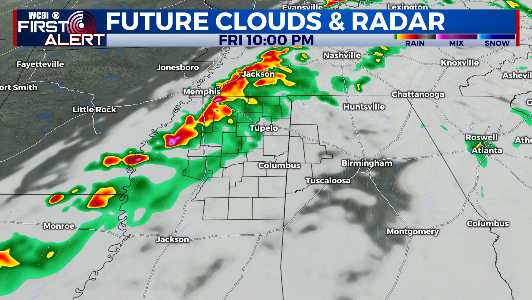
FRIDAY: Showers early in the day eventually dissipate, leaving a partially clearing sky by afternoon as breezy southerly winds bring in increased heat & humidity. Most of the day should be dry, but showers and storms will develop into northern and central MS after sunset. Damaging winds and tornadoes are possible as a broken line of storms moves through the region between 7p-2a.
WEEKEND: Friday night’s storms will be out before daybreak Saturday, leaving much of the day mostly sunny and warm. Highs will reach the 80s Saturday afternoon. Sunday starts chilly back in the 40s, but sunshine through the day will warm the afternoon back to the 70s. Clouds arrive quickly Sunday evening, and a few showers and storms are possible late Sunday night into Monday. These could contain a hail risk, but no major severe concerns are noted at this time.
NEXT WEEK: Increasingly warm & humid weather will continue Monday – Wednesday. In fact, middle 80s are likely Tuesday into Wednesday. A slow-moving frontal system could ultimately trigger a severe threat in the region by Wednesday, so stay tuned!


