Below average temperatures grip region while midweek rain chances make appearance
COLUMBUS, Mississippi (WCBI)- Highs don’t get much higher than the mid 70s as a relatively cooler pattern sets in. A few rain chances mid-week bring storms back to the region.
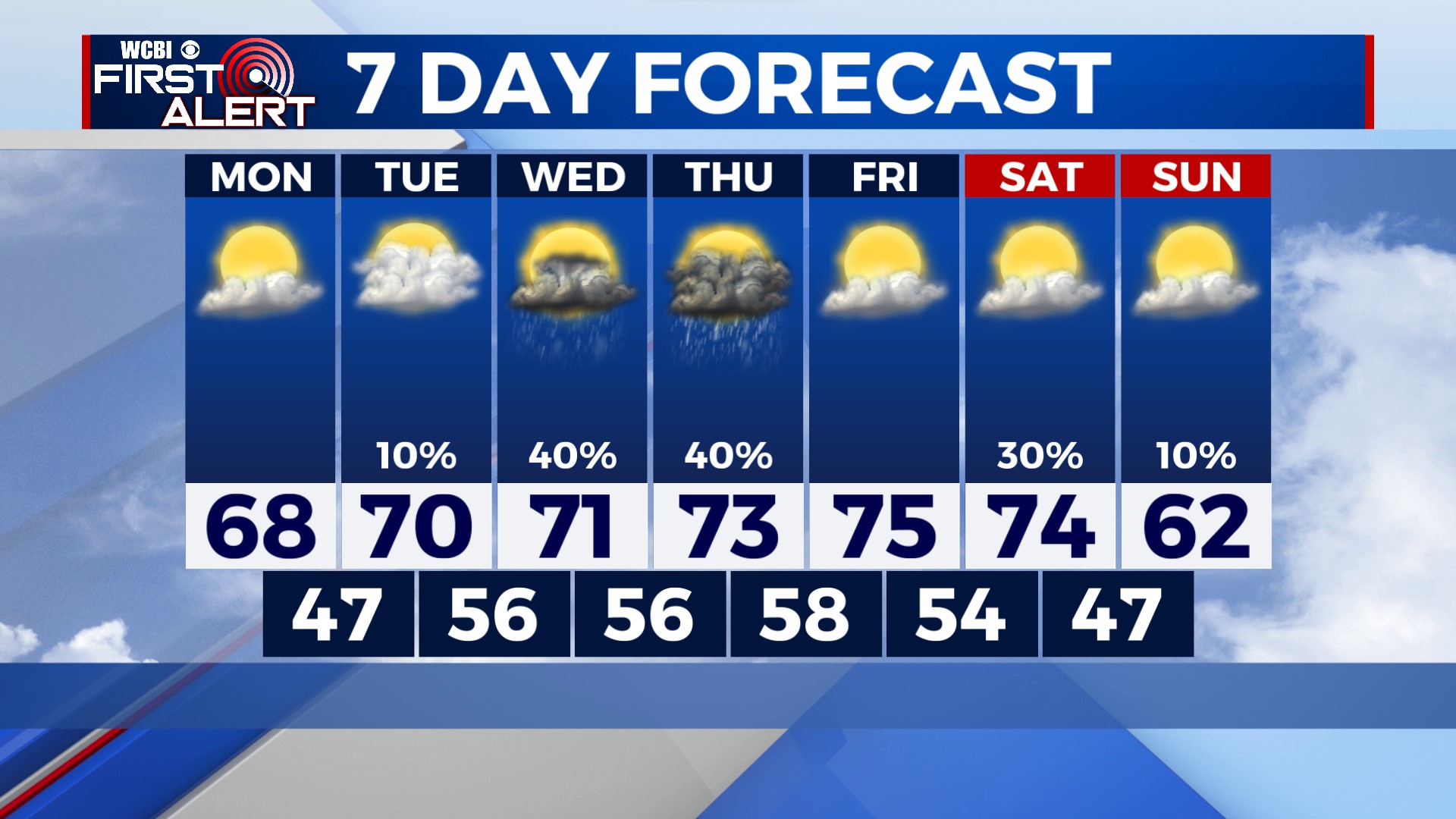
MONDAY: Afternoon temperatures hit the upper 60s as more sunshine reigns Monday. Lows drop into the upper 40s overnight. No rain is expected Monday.
TUESDAY: Highs climb to around 70 in the afternoon, even as cloud cover increases somewhat. The rogue shower is possible but most remain dry otherwise. Lows warm significantly into the mid to upper 50s overnight.
REST OF THE WEEK: The highest we’ll get in the afternoon this week is the mid 70s coming up on Friday. Otherwise, temperatures remain cooler compared to the average for this time of year. A few chances for scattered showers and storms arrive midweek, making up the bulk of rain chances for the next 7 days. Lows gradually warm into the upper 50s by overnight Thursday before a late Saturday cold front brings lows back into the 40s.