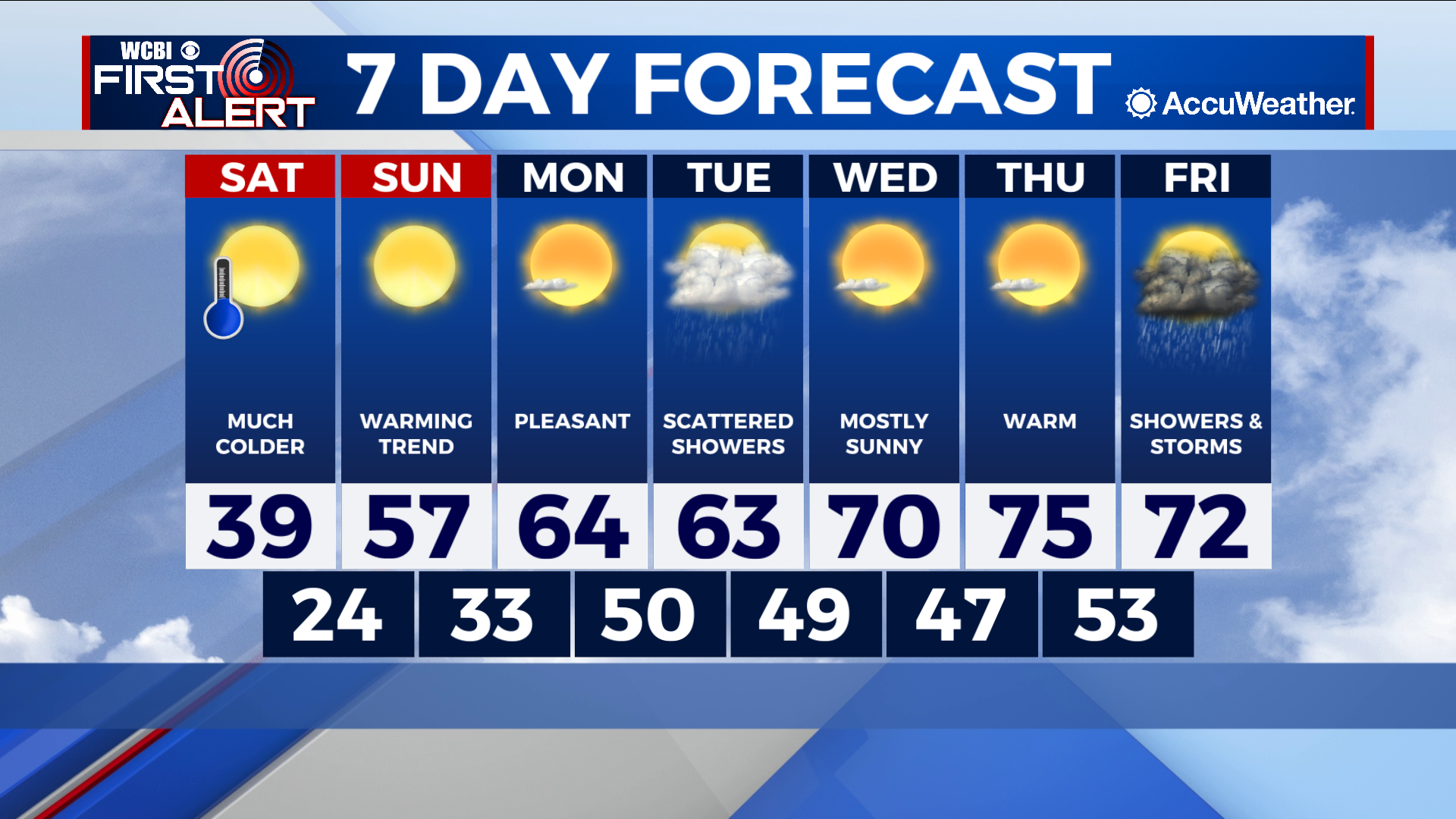
Bitterly cold Saturday, but another warming trend starts Sunday
COLUMBUS, Mississippi (WCBI) – SUMMARY: Keep the winter coat and chap-stick handy today! Saturday will be bitterly cold and breezy, but milder weather returns on Sunday.
TODAY: The snow is over and out of here in a hurry! We’ll see a mix of sun and clouds during the morning, and then all sun during the afternoon. Temperatures won’t climb much, only reaching a high near 39 degrees. Winds will be breezy, but they should calm down this evening. Dress warm if you’re heading out!
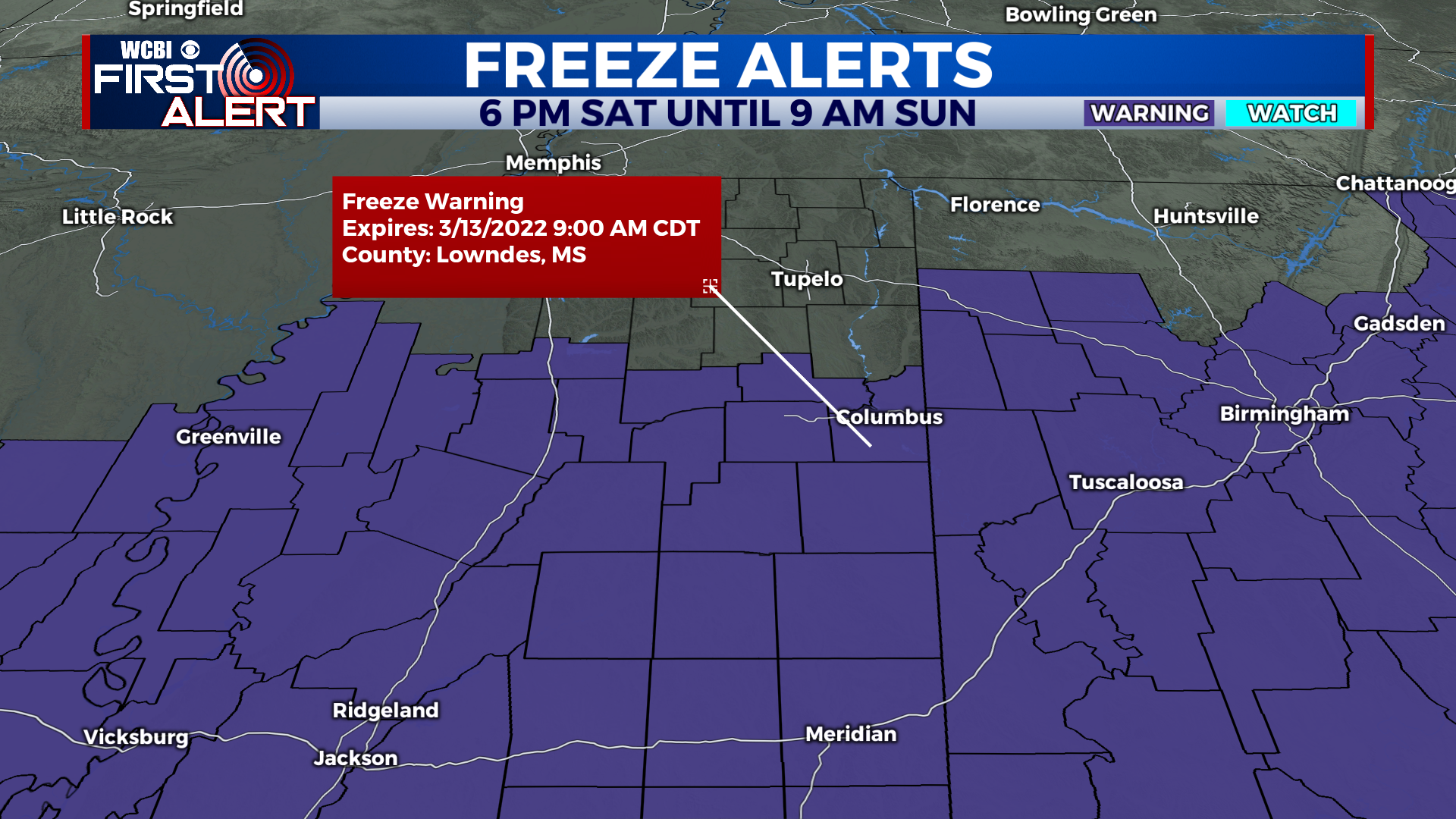
TONIGHT: It will be COLD! A freeze warning is in effect for the Golden Triangle and points south. Expect calming winds and clear skies. Low near 24 degrees.
TOMORROW: Sunday marks the start of our next warming trend. It’ll be a pleasant relief from the brutal cold we have experienced Saturday and Saturday night! Sunny skies and a high near 57 degrees. It might feel chilly in the shade, but the sunshine will help warm you up!
TOMORROW NIGHT: Temperatures will dip down into the low 30s with mostly clear skies.
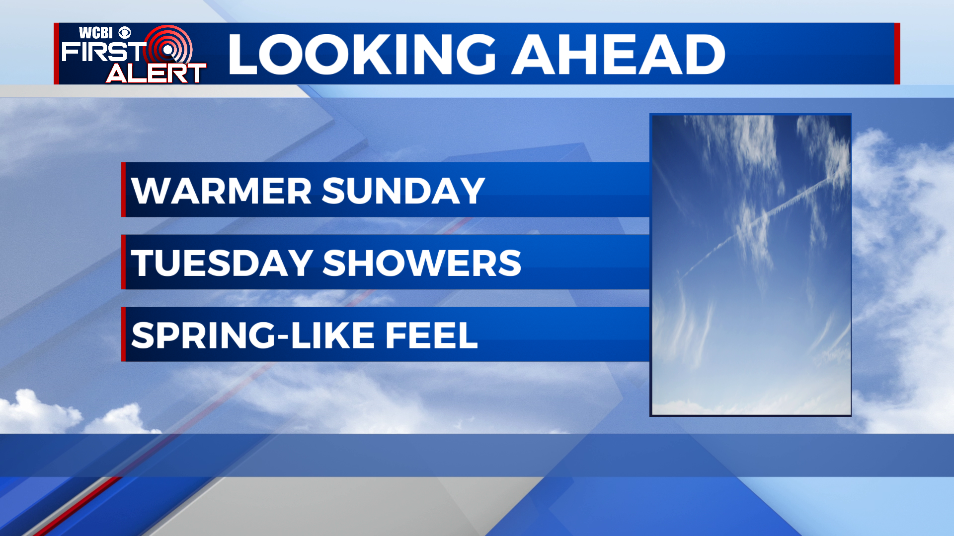
EXTENDED FORECAST: Each day this week looks to build warmer and warmer than the last. Our next chance for rain comes on Tuesday as our next system moves through the region. Scattered showers look likely across much of the region throughout the day, so we’ll put rain chances at 60%. Wednesday and Thursday will be beautiful, featuring sunshine and highs in the 70s! A more dynamic storm system will move through sometime around Friday, bringing showers and storms to the region. Details on timing and storm intensity will become more clear over the next few days. With that being said, stay warm and have a wonderful weekend! Hang in there, spring-like weather is on the way!