Blustery Friday, Milder By Christmas
THURSDAY NIGHT: Areas of showers will continue. Temperatures by daybreak Friday should range from the upper 30s to lower 40s. Winds pick up from the NW between 10 and 25 mph.
FRIDAY: Blustery conditions are expected all day long with NW winds between 10 and 25. Shower activity is expected to wind down during the morning but cloud cover is going to be persistent into the afternoon. Highs in the low to mid 40s may be about the best we can do. Wind chill values may stay in the 30s all day long.
FRIDAY NIGHT: Clear, quiet, and colder. Lows down to around 30 with much lighter winds.
SATURDAY: We’ll enjoy lots of sunshine along with highs in the middle 50s. It’ll be a great day for last second holiday shopping or decorating.
SUNDAY: A weak cold front may spark a few showers in our region. We’re going to keep the chance of rain around 30%. Daytime highs should peak in the mid to upper 50s.
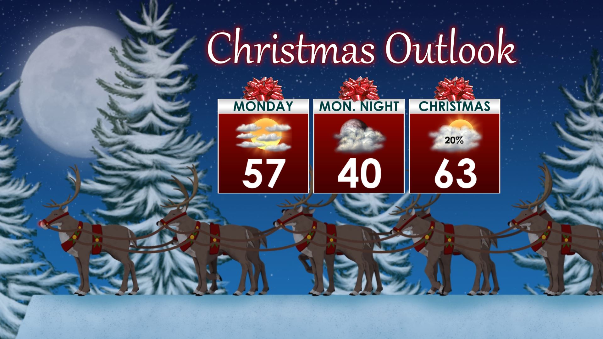
MONDAY: Variably cloudy and quiet conditions settle in for Christmas Eve Day. Highs stay in the 50s. Lows Monday night look to be in the upper 30s to around 40.
CHRISTMAS DAY: Partly to mostly cloudy skies are expected. A few showers can’t be ruled out but the rain chance is just 20%. New data suggest a warmer day with highs in the low to mid 60s.
Follow @WCBIWEATHER on Facebook, Twitter, Instagram, and Snapchat


Leave a Reply