Calm before bringing back active weather
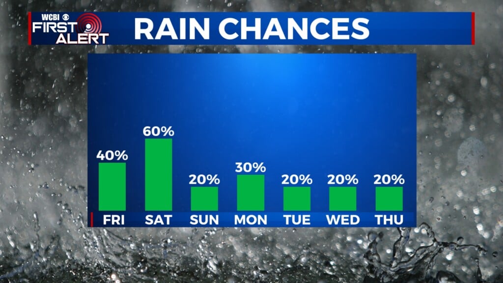
COLUMBUS, Mississippi (WCBI) – Staying mostly clear through Saturday. Clouds return Saturday night with a light rain chance Sunday afternoon. Sunday evening could bring a couple rumbles of thunder. Active weather continues throughout next week.
FRIDAY NIGHT: Another clear night tonight, allowing for temperatures to get chilly. Overnight low temperatures drop again into the upper 30s and lower 40s.
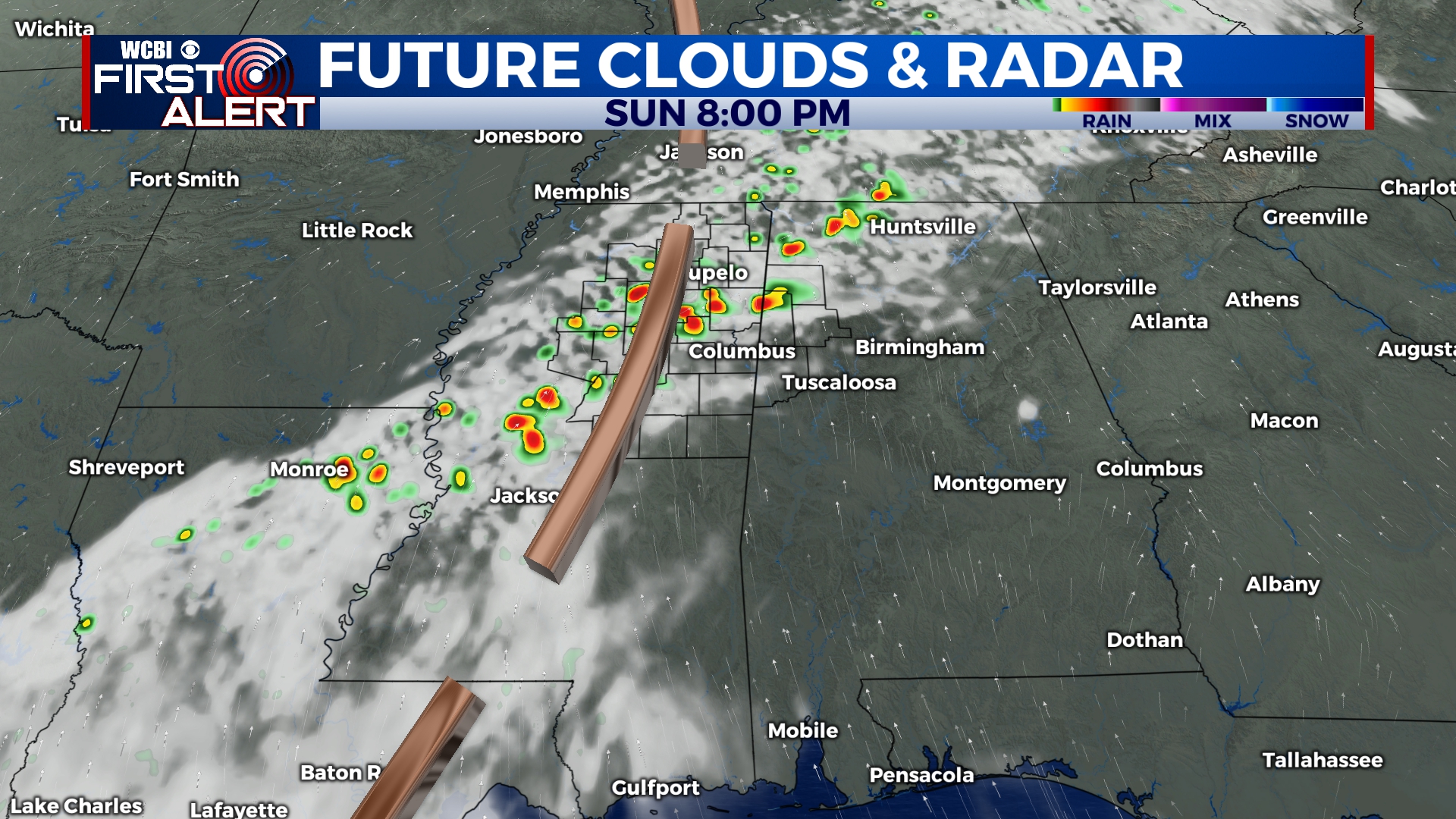
WEEKEND: Clear, sunny, and overall pleasant going into our weekend. Temperatures will reach into the lower 70s on Saturday. Throughout the evening, a few clouds will start to fill back in and across Mississippi. Sunday starts dry, but clouds will continue slowly filling in by the afternoon and evening. There is a possibility for a few scattered showers and storms Sunday evening. These are most likely NW of the Natchez Trace, and some could become locally strong with hail or gusty winds.
NEXT WEEK: Monday will be mostly cloudy, with the chance for scattered showers. Tuesday – Thursday looks quite active with continuous rain showers and thunderstorms. Potentially, we could face a dual threat of flooding and severe weather, as well. Stick with us through the weekend though, as details will start agreeing a bit more!